
Insights from recent episode analysis
Audience Interest
Podcast Focus
Publishing Consistency
Platform Reach
Insights are generated by CastFox AI using publicly available data, episode content, and proprietary models.
Most discussed topics
Brands & references
Total monthly reach
Estimated from 36 chart positions in 36 markets.
By chart position
- 🇨🇦CA · Earth Sciences#41M to 3M
- 🇺🇸US · Earth Sciences#51M to 3M
- 🇬🇧GB · Earth Sciences#51M to 3M
- 🇩🇪DE · Earth Sciences#11300K to 1M
- 🇦🇺AU · Earth Sciences#14300K to 1M
- Per-Episode Audience
Est. listeners per new episode within ~30 days
2.3M to 7.2M🎙 ~2x weekly·122 episodes·Last published 3w ago - Monthly Reach
Unique listeners across all episodes (30 days)
4.7M to 14M🇨🇦21%🇺🇸21%🇬🇧21%+33 more - Active Followers
Loyal subscribers who consistently listen
1.9M to 5.8M
Market Insights
Platform Distribution
Reach across major podcast platforms, updated hourly
Total Followers
—
Total Plays
—
Total Reviews
—
* Data sourced directly from platform APIs and aggregated hourly across all major podcast directories.
On the show
From 10 epsHost
Recent guests
Recent episodes
Steve Brusatte on the Dinosaurs That Survived the Asteroid
May 28, 2026
32m 41s
Alec Brenner on When Tectonic Plates First Moved
Apr 30, 2026
28m 55s
Materials in Extreme Environments
Apr 15, 2026
35m 41s
Esther Sumner on Turbidity Currents
Mar 26, 2026
31m 00s
Hal Levison on the Mission to Jupiter's Trojan Asteroids
Mar 6, 2026
37m 27s
Social Links & Contact
Official channels & resources
Official Website
Login
RSS Feed
Login
| Date | Episode | Topics | Guests | Brands | Places | Keywords | Sponsor | Length | |
|---|---|---|---|---|---|---|---|---|---|
| 5/28/26 | 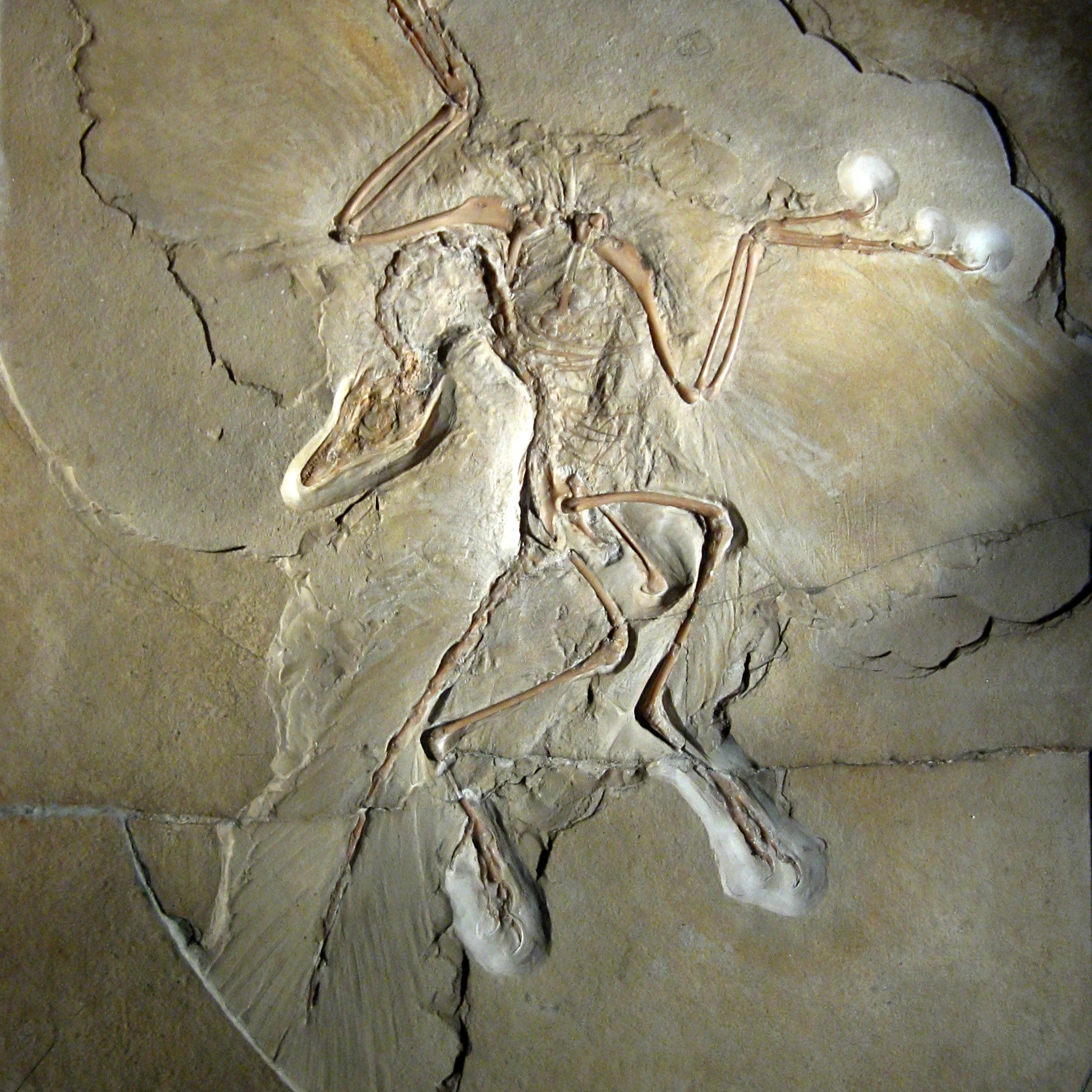 Steve Brusatte on the Dinosaurs That Survived the Asteroid✨ | dinosaursbirds+4 | Steve Brusatte | University of EdinburghThe Story of Birds | northeastern China | dinosaursbirds+5 | — | 32m 41s | |
| 4/30/26 | 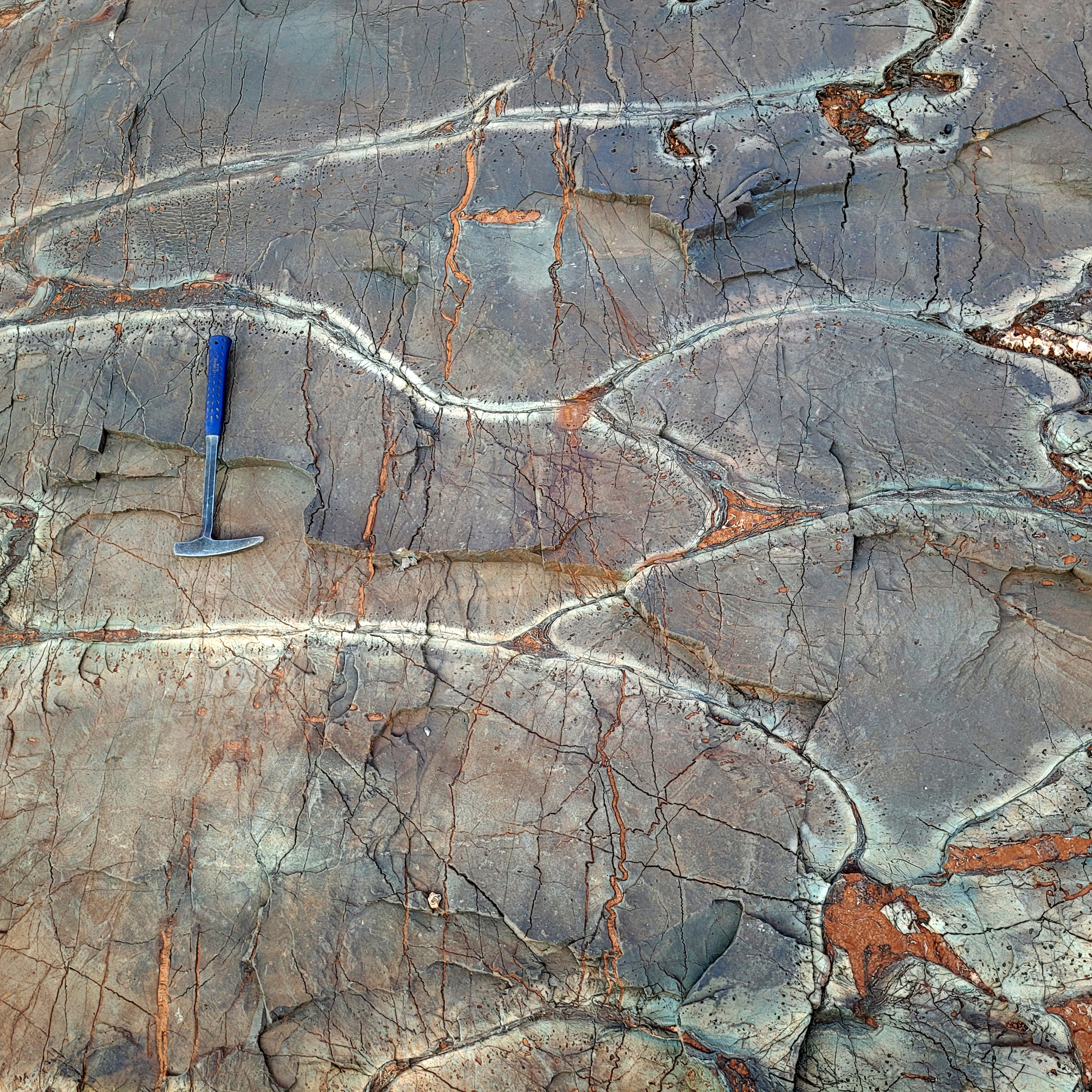 Alec Brenner on When Tectonic Plates First Moved✨ | tectonic platespaleomagnetism+3 | Alec Brenner | Yale University | East PilbaraKaapvaal | tectonic platespaleomagnetic methods+6 | — | 28m 55s | |
| 4/15/26 | 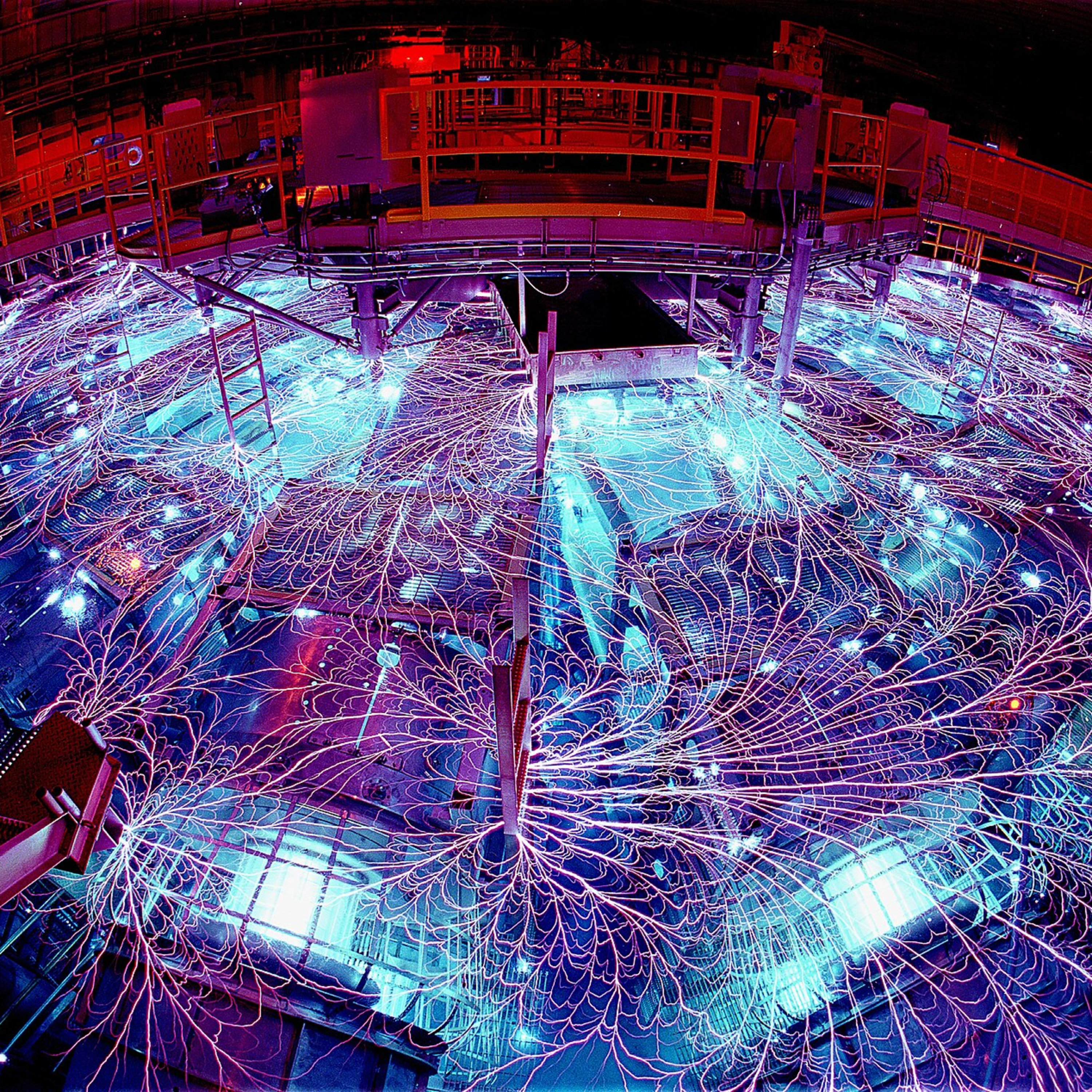 Materials in Extreme Environments✨ | mineral physicsextreme environments+3 | Steve Jacobsen | University of Colorado Boulder | — | materialspressure+4 | — | 35m 41s | |
| 3/26/26 | 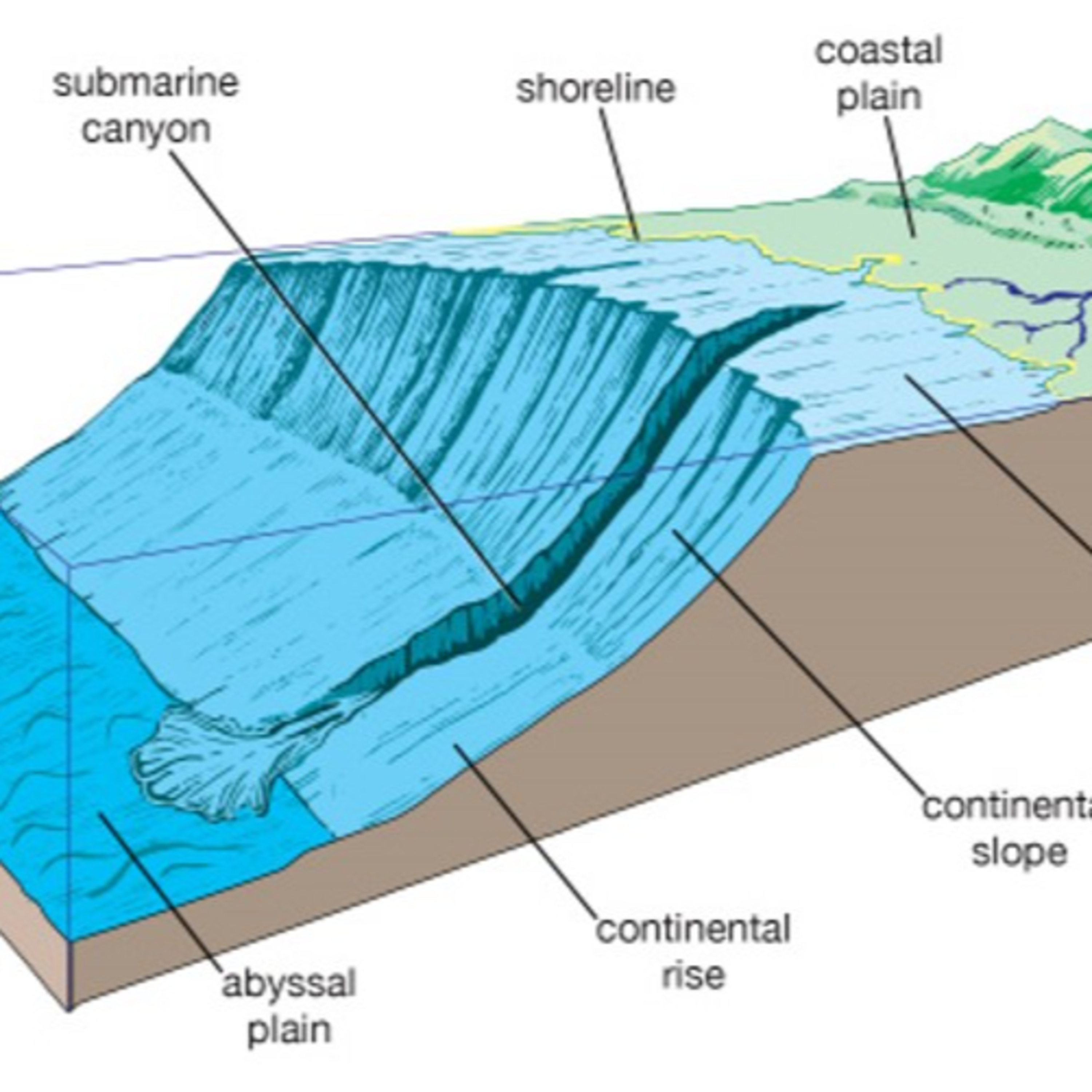 Esther Sumner on Turbidity Currents✨ | turbidity currentssubmarine canyons+3 | Esther Sumner | University of Southampton | Mendocino canyonCalifornia | turbidity currentssubmarine canyon+3 | — | 31m 00s | |
| 3/6/26 |  Hal Levison on the Mission to Jupiter's Trojan Asteroids✨ | Solar System evolutionTrojan asteroids+3 | Hal Levison | Southwest Research InstituteLucy | Boulder, ColoradoSolar System+2 | Trojan asteroidsLucy mission+5 | — | 37m 27s | |
| 2/11/26 |  Sara Pruss on the First Reef Builders✨ | reef buildersCambrian explosion+4 | Sara Pruss | Smith College | — | Cambrianarchaeocyaths+4 | — | 23m 21s | |
| 1/20/26 |  Michael Manga on Wet Eruptions✨ | wet eruptionsvolcanism+4 | Michael Manga | University of California, Berkeley | — | volcanic eruptionswater+5 | — | 40m 29s | |
| 12/24/25 |  Carina Hoorn on the Evolution of the Amazon Basin✨ | biodiversityAmazon Basin+4 | Carina Hoorn | Institute for Biodiversity and Ecosystem DynamicsUniversity of Amsterdam+2 | Amazon BasinAndes+1 | biodiversityAmazon Basin+7 | — | 23m 03s | |
| 12/2/25 | 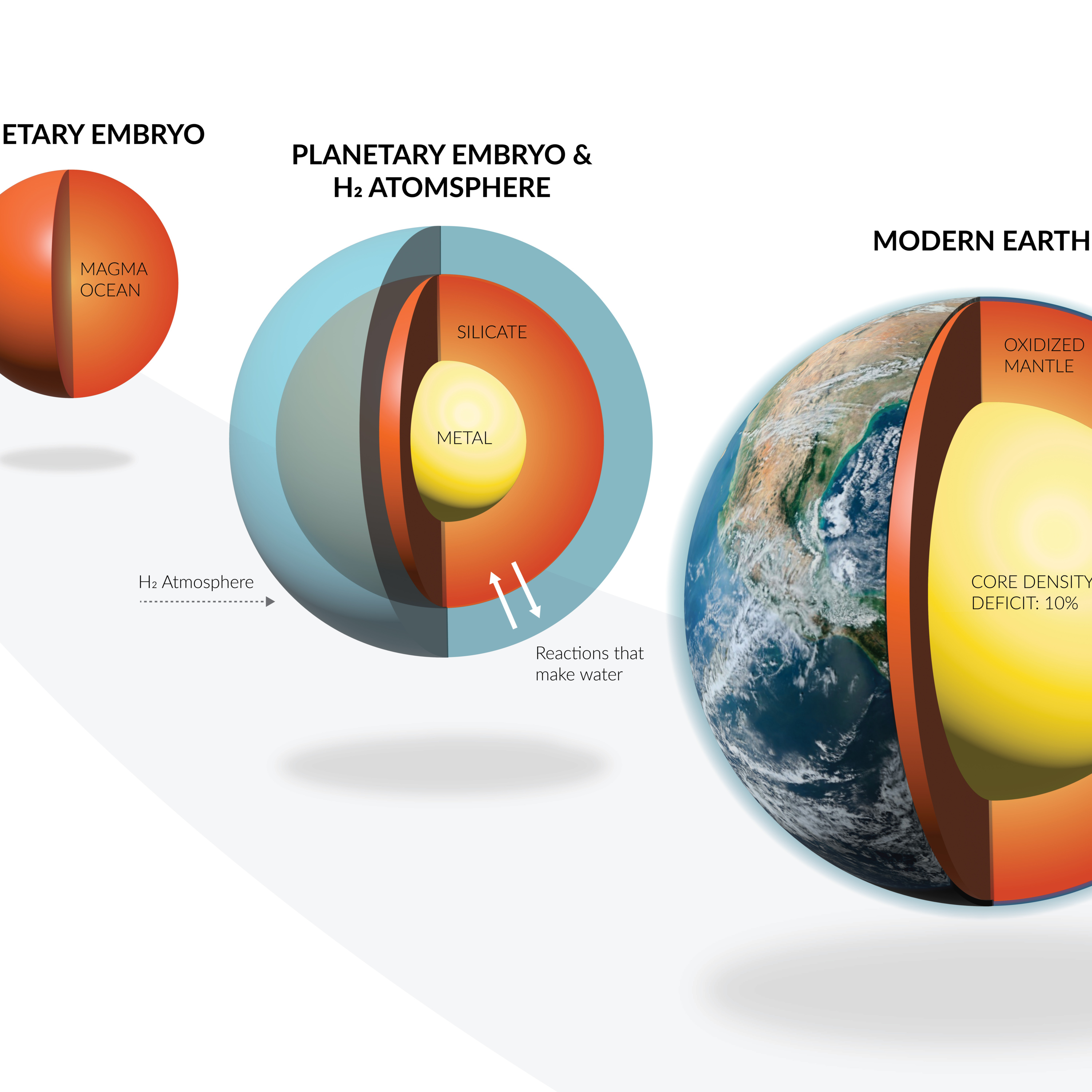 Anat Shahar on What Makes a Planet Habitable✨ | exoplanetshabitability+4 | Anat Shahar | Earth and Planets LaboratoryCarnegie Institution for Science | Washington, DC | exoplanetshabitable planets+5 | — | 26m 08s | |
| 11/12/25 | 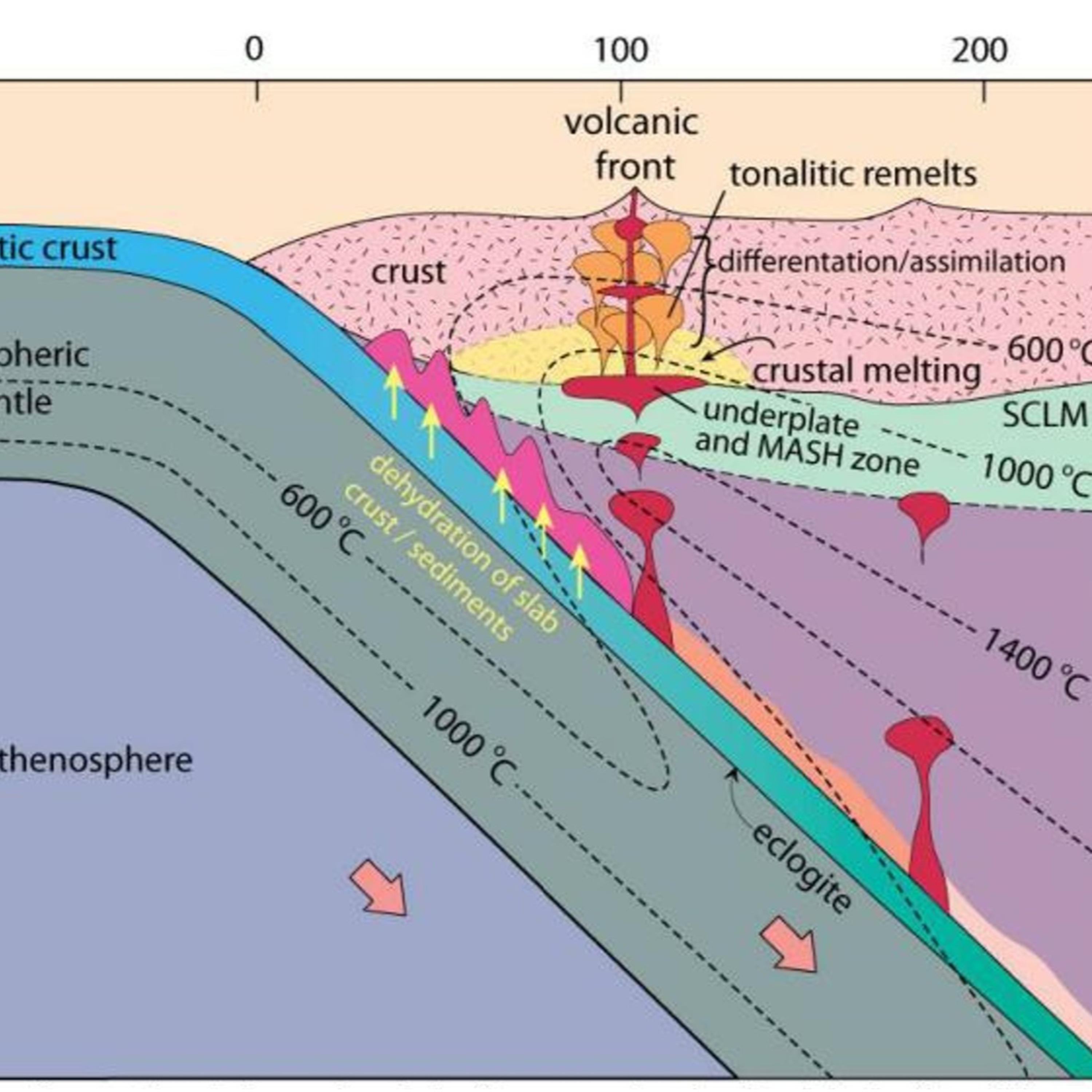 Keith Klepeis on How Plutons Form✨ | plutonsigneous rock+4 | Keith Klepeis | University of Vermont | Southern FiordlandNew Zealand+1 | plutonsigneous rock+5 | — | 26m 11s | |
Want analysis for the episodes below?Free for Pro Submit a request, we'll have your selected episodes analyzed within an hour. Free, at no cost to you, for Pro users. | |||||||||
| 10/21/25 | 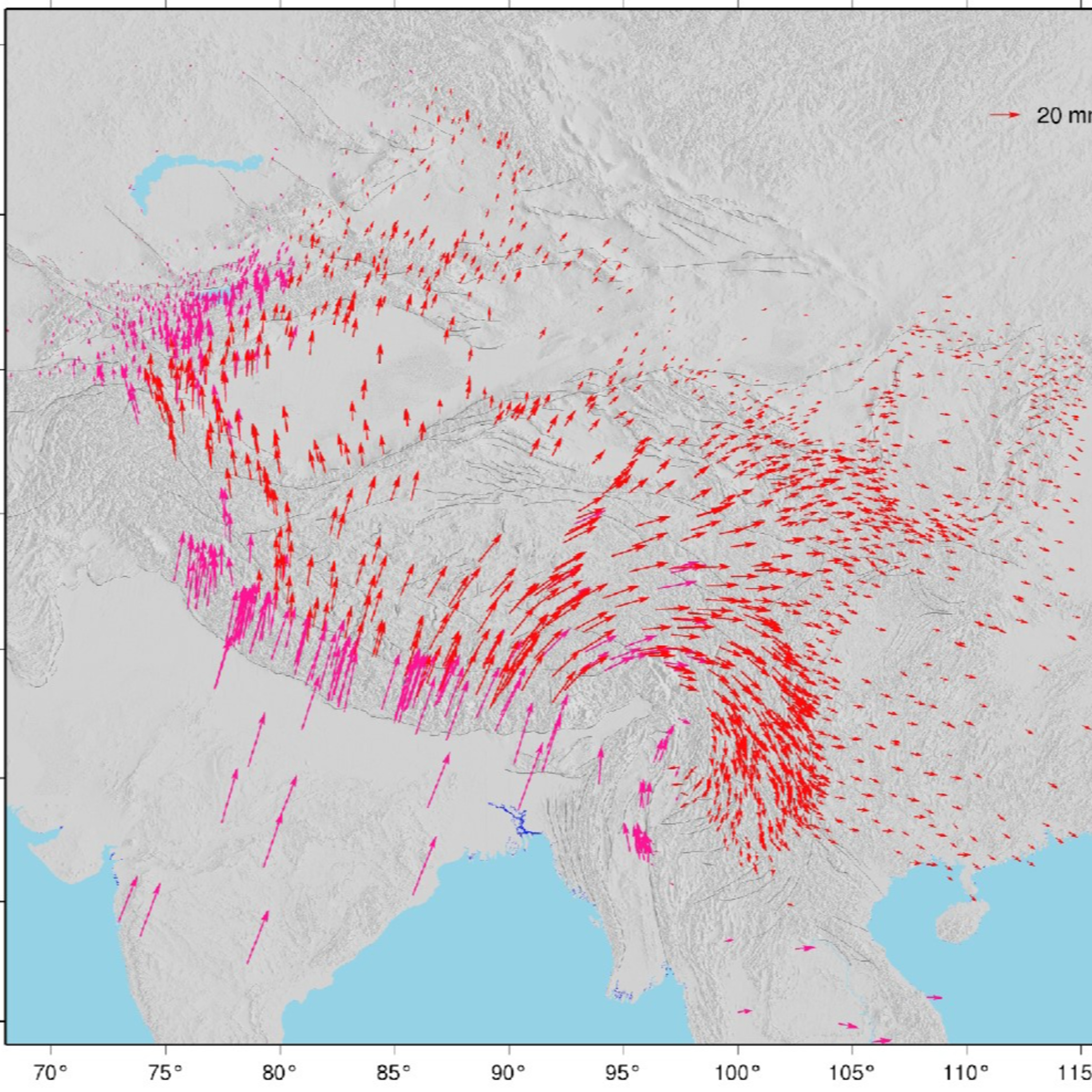 Tom Herring on High-Precision Geodesy | There are three main types of geodetic measurement systems — satellite-based systems such as GPS, very long baseline interferometry (VLBI), and interferometric synthetic-aperture radar (InSAR). While each type of systems has its particular strengths, the cost of satellite-based receivers has plummeted. Millimeter-level accuracy will soon be incorporated into phones. This has broadened the kinds of geological questions we can now address with such systems. In the podcast, Tom Herring describes how these systems are giving us new insight into plate motions, slow and fast deformation associated with faults and earthquakes, the Earth’s rotation, as well as applications in civil engineering, such as dams and tall buildings, and agriculture.Herring is a pioneer in high-precision geodetic analytical methods and applications for satellite-based navigation systems to study the Earth’s surface. He is a Professor in the Earth, Atmospheric, and Planetary Sciences department at the Massachusetts Institute of Technology. | — | ||||||
| 10/6/25 | 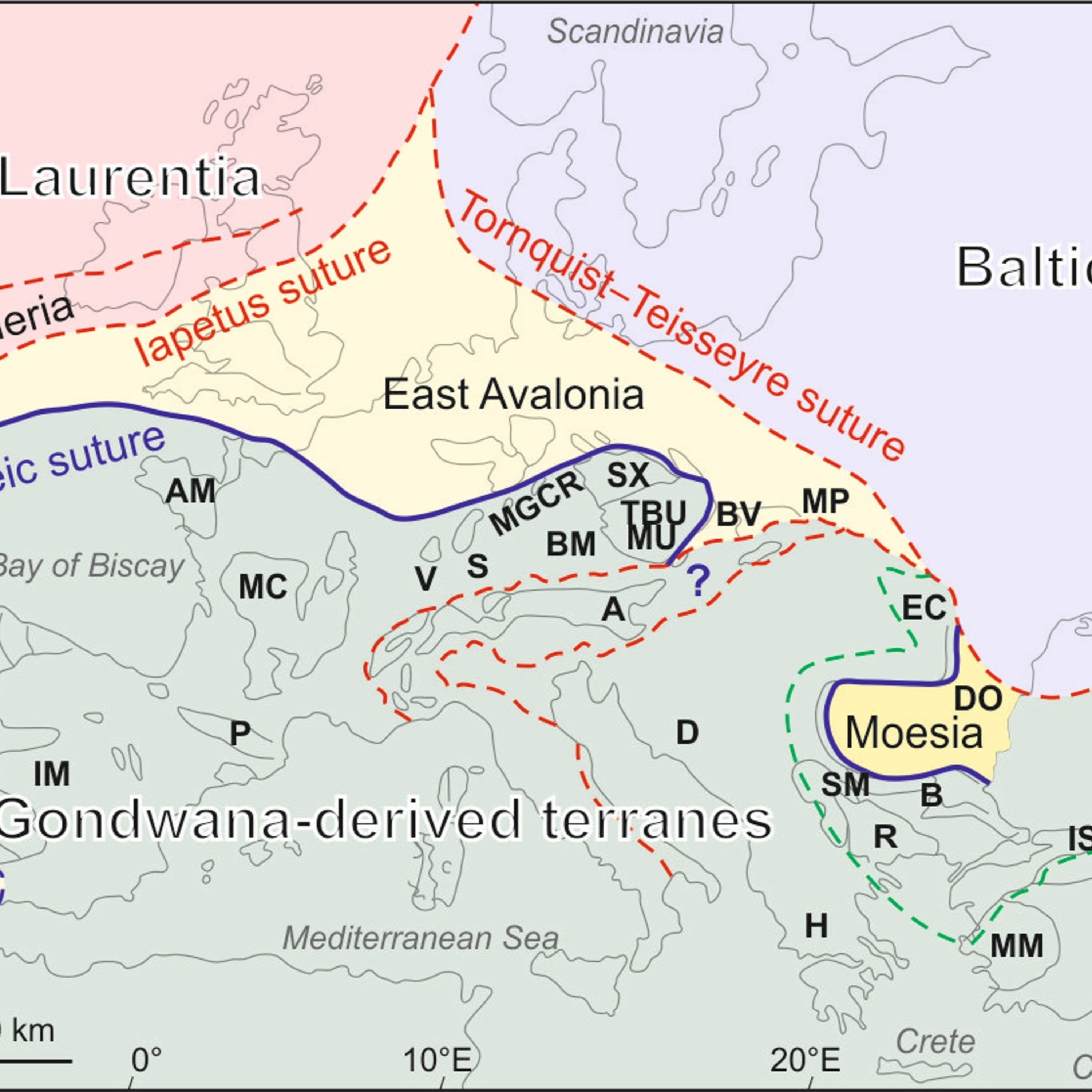 Jiří Žák on the Orogenies that Shaped Central Europe | In this episode, Jiří Žák describes the two main orogenies whose remnants figure prominently in central European geology: the Cadomian orogeny that lasted from the late Neoproterozoic to the early Cambrian (c. 700 Ma to c. 425 Ma) and the Variscan orogeny that occurred in the late Paleozoic (c. 380 Ma to 280 Ma). The Cadomian took place on the northern margins of Gondwana, only later to rift and travel north to form what was to become Europe. The Variscan was caused by the collision of Gondwana with Laurussia in the final stages of the assembly of the supercontinent Pangea. Both orogenies have been heavily eroded, and we see their imprint in the form of metamorphic rocks, volcanic rocks, granites, and deformation structures. These are scattered across Europe, from southern Britain to eastern Europe.Žák has been studying the geology of central Europe for over 25 years using methods ranging from structural studies in the field to detrital zircon geochronology. He is a Professor in the Institute of Geology and Paleontology at Charles University in Prague. | — | ||||||
| 9/17/25 | 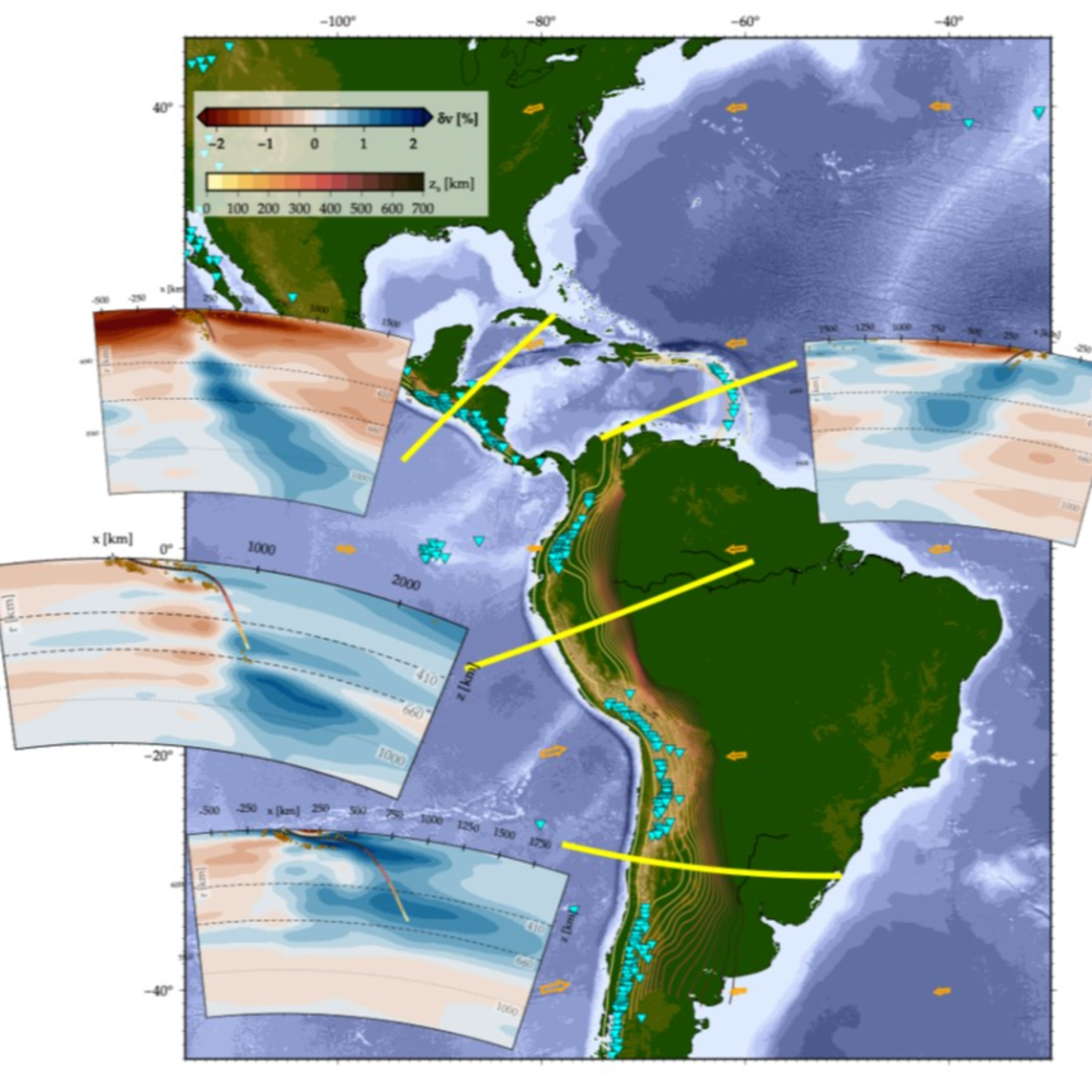 Claudio Faccenna on the Dynamics of Subduction Zones | Subduction zones can be very long-lived, persisting for tens of even hundreds of millions of years. During that time they rarely stay still, but instead retreat, advance, move laterally, or reverse direction. In the podcast, Claudio Faccenna discusses the processes that govern these movements. It turns out that they depend not only on the properties of the subducting slab, but also on the environment, including the proximity of other subduction zones.Faccenna has been studying how convergent margins evolve for over 30 years, concentrating particularly on the Mediterranean region. He is Head of the lithospheric dynamics section at the Helmholtz Center for Geosciences at GFZ in Potsdam in Germany and also a Professor at the Department of Science at Roma Tre University. | — | ||||||
| 8/17/25 | 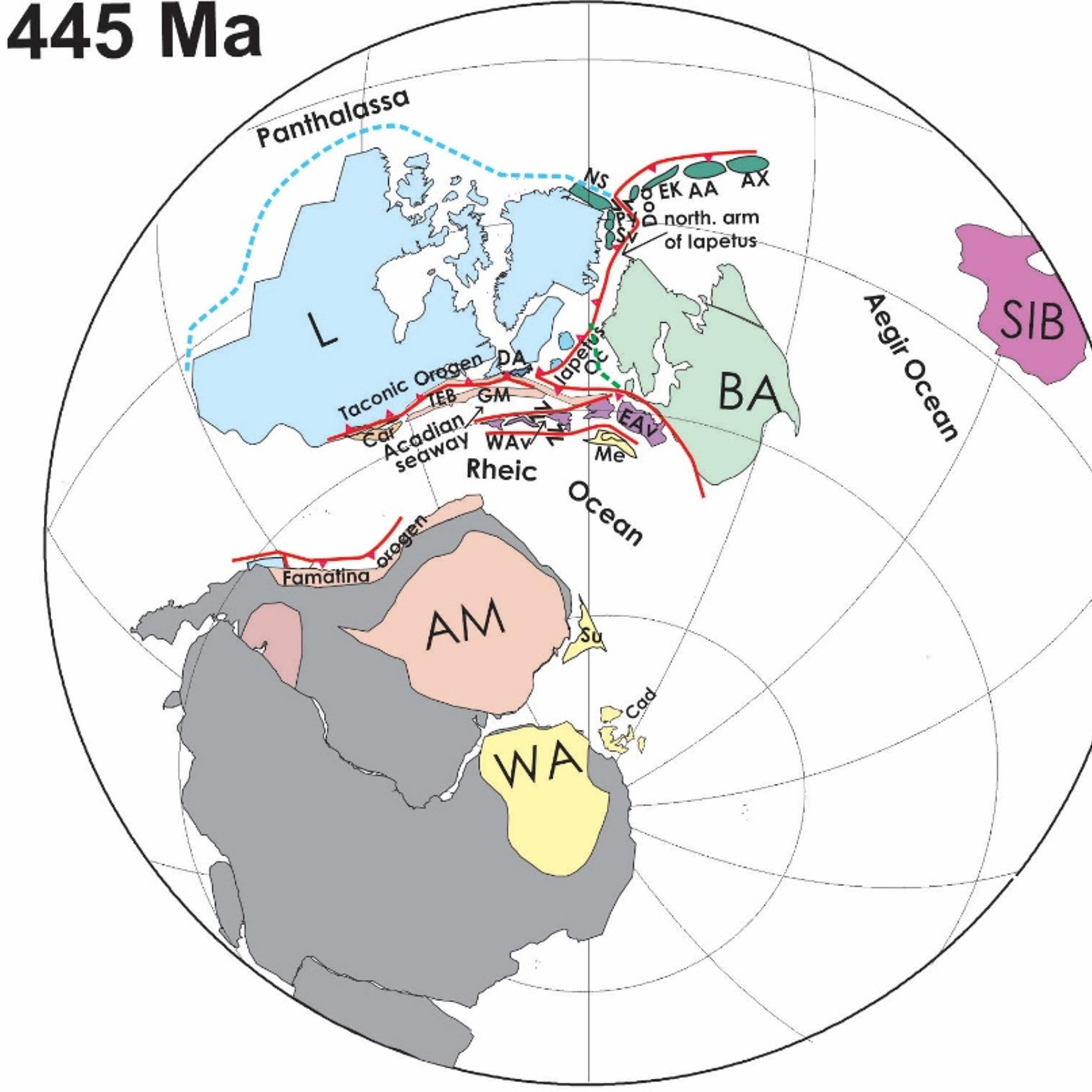 Cees Van Staal on the Origin of the Appalachians | In the podcast, Cees Van Staal tells us about the Paleozoic tectonic events that led to the formation of the Appalachians. The events are closely related to those involved in the Caledonian orogeny and the mountains it created in what is now Ireland, Scotland, east Greenland, and Norway, as discussed in the episode with Rob Strachan. However, the Appalachians that we see today are not the worn-down remnants of the Paleozoic mountains. Instead, they reflect much more a topography that was created during processes associated with rifting and magmatism that accompanied the opening of the Atlantic Ocean as well as the effects of the ice ages as recently as about 10,000 years ago.Van Staal has been studying the Appalachians for over 35 years, focusing especially on the large-scale tectonics of their formation. He is Emeritus scientist at the Geological Survey of Canada and an Adjunct/Research Professor in the Department of Earth and Environmental Sciences at the University of Waterloo in Ontario. | — | ||||||
| 7/21/25 | 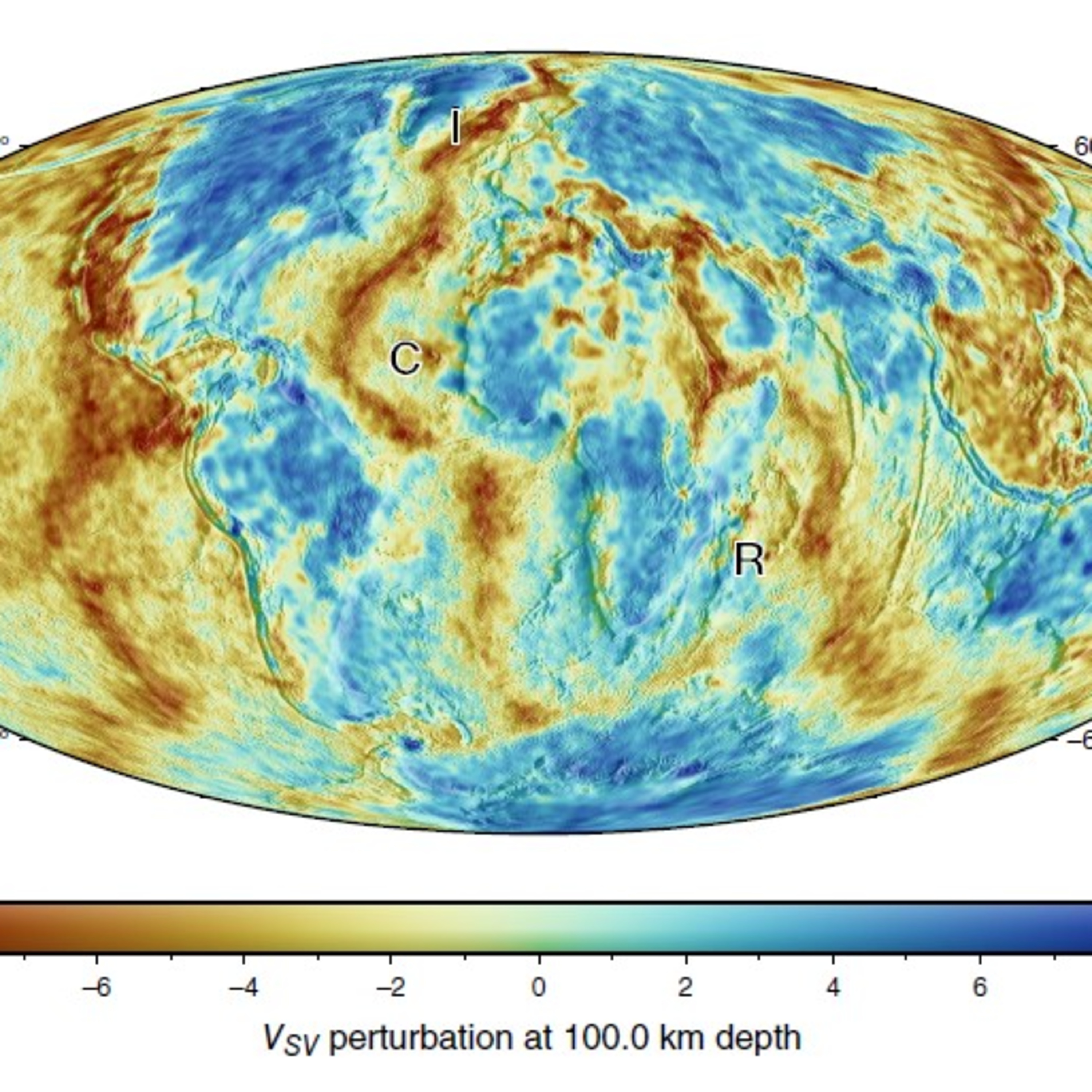 Andreas Fichtner on the Frontiers of Seismic Imaging | In previous episodes of Geology Bites, Barbara Romanowicz gave an introduction to seismic tomography and Ana Fereira talked about using seismic anisotropy to reveal flows within the mantle. In this episode, Andreas Fichtner explains how, despite the many fiendish obstacles that stand in our way, we are making steady improvements in our ability to image the Earth on both regional and global scales. These give us confidence that we can make three-dimensional maps of certain structures, such as the plume below Iceland, cold continental interiors, mid-ocean ridges, and the large low shear-velocity provinces.Fichtner is a Professor in the Department of Earth and Planetary Sciences at the Federal Institute of Technology in Zurich. | — | ||||||
| 7/3/25 |  Renée Tamblyn on the Origin of Continents | When the Earth formed, it was covered by a hot magma ocean. So when and how did thick, silica-rich continental lithosphere form? Were the first, ancient continents similar to the present-day continents? And did the continents form in a burst of activity at a certain point, or was it a gradual build-up over Earth history?In the podcast, Renée Tamblyn addresses these questions, as well as how early geological processes created molecular hydrogen that may have powered the first forms of life. In her own research, she has focused on the critical role played by water released from hydrous minerals that formed within oceanic lithosphere on the sea floor. Tamblyn is a Postdoctoral Researcher at the University of Bern. | — | ||||||
| 6/2/25 |  Folarin Kolawole on Continental Rifting | From East Africa to southwest USA, many regions of the Earth’s continental lithosphere are rifting. We see evidence of past rifting along the passive margins of continents that were once contiguous but are now separated by wide oceans. How does something as apparently solid and durable as a continent break apart?In the podcast, Folarin Kolawole describes the various phases of rifting, from initial widespread normal faulting to the localization of stretching along a rift axis, followed by rapid extension and eventual breakup and formation of oceanic lithosphere.Kolawole is especially interested in the early stages of rifting, and in his research he uses field observation, seismic imaging, and mechanical study of rocks. He is Assistant Professor of Earth and Environmental Sciences, Seismology, Geology, and Tectonophysics at the Lamont-Doherty Earth Observatory of Columbia University. | — | ||||||
| 5/11/25 |  Mike Hudec on Salt Tectonics | Most of Earth’s salt is dissolved in the oceans. But there is also a significant amount of solid salt among continental rocks. And because of their mechanical properties, salt formations can have a dramatic effect on the structure and evolution of the rocks that surround them. This gives rise to what we call salt tectonics – at first sight, a rather surprising juxtaposition of a soft, powdery substance with a word that connotes the larger scale structure of the crust.In the podcast, Mike Hudec explains the origin of salt in the Earth’s crust and describes the structures it forms when subjected to stresses. He also discusses how salt can play in important role in the formation of oil and gas reservoirs.Hudec is a research professor at the Bureau of Economic Geology at the University of Texas at Austin. | — | ||||||
| 4/13/25 |  Vic Baker on Megafloods | Megafloods are cataclysmic floods that are qualitatively different from weather-related floods. In the podcast, Vic Baker explains our ideas as to what causes megafloods and describes the striking evidence for such floods in the Channeled Scablands of Washington State and in the Mediterranean.Vic Baker has been studying megafloods for over 50 years. He is a Professor of Hydrology and Atmospheric Sciences, Geosciences, and Planetary Sciences at the University of Arizona. | — | ||||||
| 3/27/25 |  Lindy Elkins-Tanton on the Origin of Earth's Water | The planets formed out of a cloud of gas and dust around the nascent Sun. Within the so-called snow line, it was too hot for liquid water to exist. Since the Earth lies well within this line, why does it have water? Did it somehow manage to retain water from the outset or did it acquire its water later? In the podcast, Lindy Elkins-Tanton explains how these two scenarios might have played out but she says the evidence strongly favors one of these theories. Elkins-Tanton has concentrated much of her research career on the formation and evolution of planets, and especially the role of water. She is a Professor in the School of Earth and Space Exploration at Arizona State University and Principal Investigator of the NASA Psyche mission. | — | ||||||
| 3/16/25 | 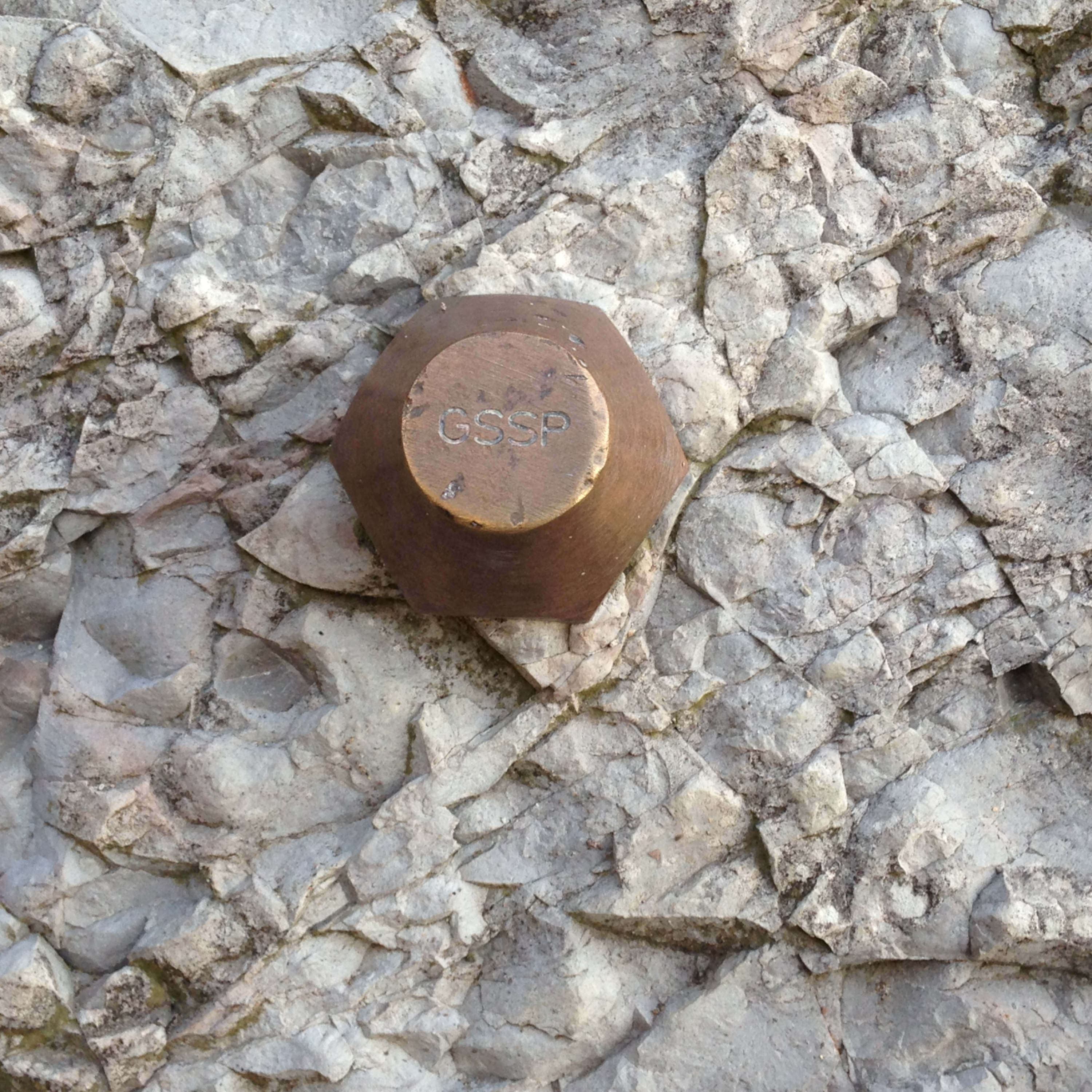 Joeri Witteveen on Golden Spikes | Golden spikes are not golden, nor are they generally spikes. So what are they, and, more importantly, what exactly do they represent? In the podcast, Joeri Witteveen explains how we arrived at our present system of defining the boundaries of stages in the rock record with a single marker. Paradoxically, it turns out that the best place for a golden spike is where “nothing happens.” Listen and find out why.Witteveen is Associate Professor of History and Philosophy of Science at the University of Copenhagen. | — | ||||||
| 3/8/25 | 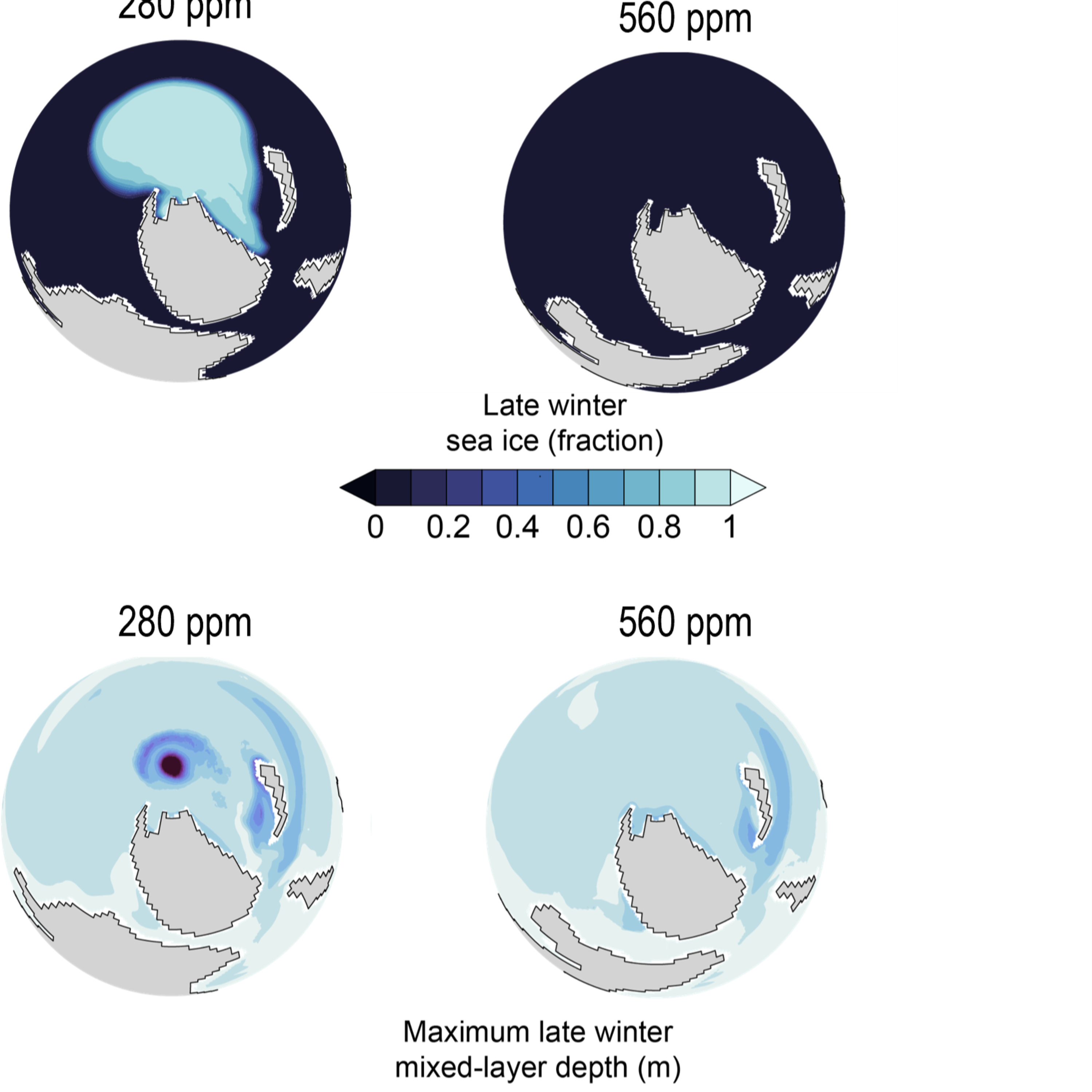 Isabel Montañez on Using the Late Paleozoic Ice Age as an Analog for Present Day Climate | The late Paleozoic ice age began in the Late Devonian and ended in the Late Permian, occurring from 360 to 255 million years ago. It was similar to the present day in two key respects: rising atmospheric CO2 and recurrent major ice sheets. In the podcast, Isabel Montañez explains how we can use proxies to learn about the climate and ocean conditions that prevailed then. And with the help of a model, she says that we can also learn about sensitivities and feedbacks of Earth systems to rising CO2. Among other things, the model suggests that when the atmosphere reaches the present day level of CO2, significant parts of the ocean may become anoxic and ocean circulation patterns alter.Montañez is a Distinguished Professor in the Department of Earth and Planetary Sciences at the University of California, Davis. | — | ||||||
| 2/20/25 | 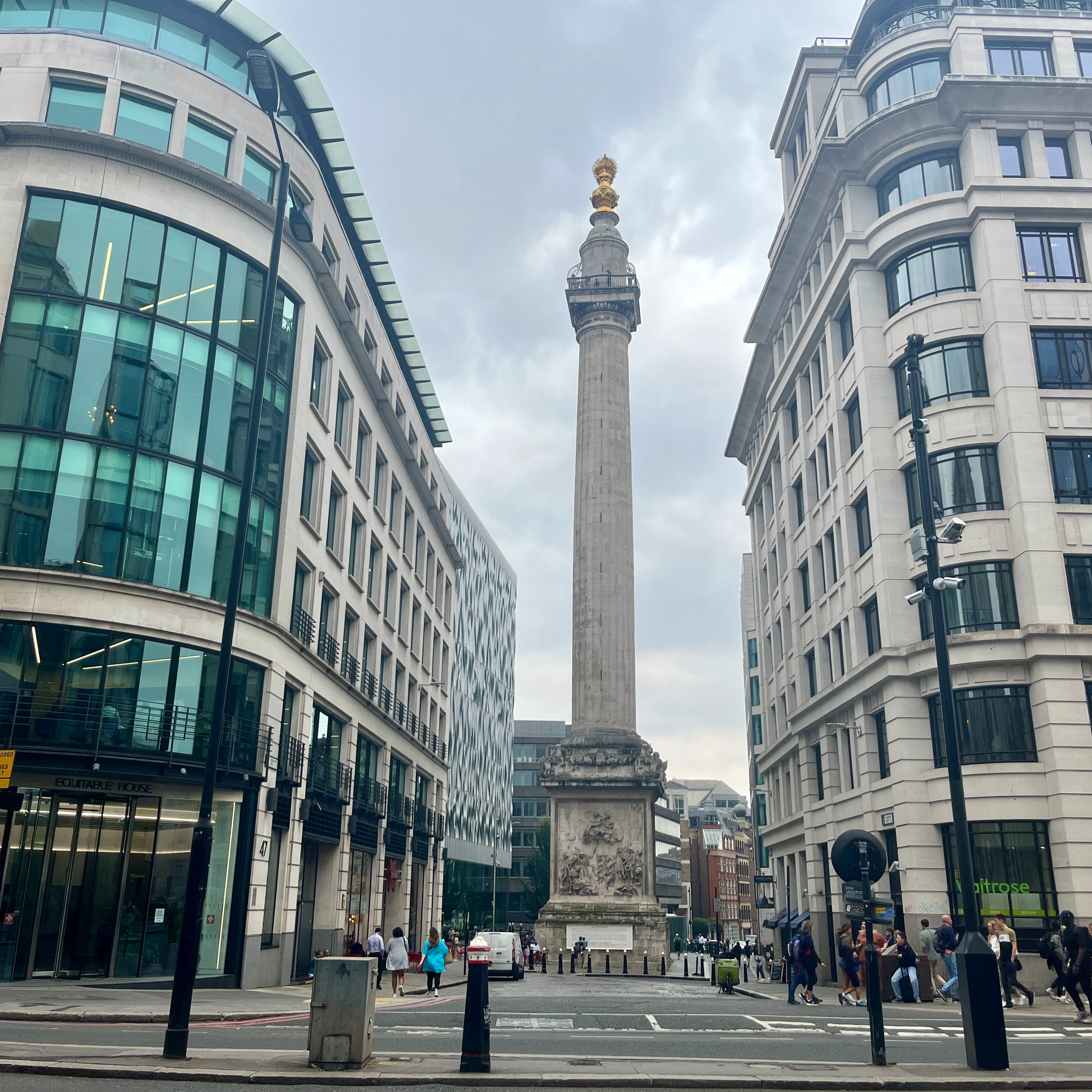 Ruth Siddall on Urban Geology | At first sight, urban geology sounds like an oxymoron. How can you do geology with no rocky outcrops anywhere in sight within the built-up environments of cities? It turns out you can do a great deal of geology, and Ruth Siddall has been doing just that for the past 10 years. In the podcast, she describes some of the many aspects of geology, from petrology to paleontology, that can be seen very clearly in building stone. She also takes us on a walking tour in London from the Monument to the Great Fire of London to the Tower of London.Siddall has developed nearly 50 urban geology-themed walks and built up a database of over 4,300 urban localities of geological interest. She is a postdoctoral researcher at Trinity College, Dublin, studying the social history and geological provenance of stone in 18th century buildings in Britain and Ireland. | — | ||||||
| 1/8/25 |  Richard Fortey on Deep Time | The Earth is about 4.5 billion years old. How can we begin to grasp what this vast period of time really means, given that it is so far beyond the time scale of a human life, indeed of human civilization? Richard Fortey has devoted his long and prolific research career at the Natural History Museum in London to the study of fossils, especially the long-extinct marine arthropods called trilobites. In an earlier episode of Geology Bites, he talked about measuring time with trilobites. In this episode, he describes how it was the fossils in the geological record that gave us the first markers along the runway of deep time, providing the structure and language within which our modern conception of deep time emerged. | — | ||||||
| 12/20/24 |  Mike Searle on the Mountain Ranges of Central Asia | The Himalaya are just one, albeit the longest and highest, of several mountain ranges between India and Central Asia. By world standards, these are massive ranges with some of the highest peaks on the planet. The Karakoram boasts four of the world’s fourteen 8,000-meter peaks, and the Hindu Kush, the Pamir, the Kunlun Shan, and the Tien Shan each have many peaks above 7,000 meters. No mountain ranges outside this region have such high mountains. Yet we seldom hear much about these ranges. In the podcast, Mike Searle describes the origin and geology of six central Asian ranges and how they relate to the Himalaya and the collision of India with Asia. India continues to plow into Asia to this day. How is this movement accommodated? Searle explains the extrusion and crustal shortening models that have been proposed and describes the detailed mapping he and his colleagues conducted in the field in northern India that showed that both mechanisms are operating. Searle is Emeritus Professor of Earth Sciences at the University of Oxford. | — | ||||||
Showing 25 of 122
Sponsor Intelligence
Sign in to see which brands sponsor this podcast, their ad offers, and promo codes.
Chart Positions
40 placements across 36 markets.
Chart Positions
40 placements across 36 markets.