Insights from recent episode analysis
Audience Interest
Podcast Focus
Publishing Consistency
Platform Reach
Insights are generated by CastFox AI using publicly available data, episode content, and proprietary models.
Most discussed topics
Brands & references
Total monthly reach
Estimated from 1 chart position in 1 market.
By chart position
- 🇦🇪AE · Social Sciences#168500 to 3K
- Per-Episode Audience
Est. listeners per new episode within ~30 days
250 to 1.5K🎙 Weekly cadence·164 episodes·Last published 1w ago - Monthly Reach
Unique listeners across all episodes (30 days)
500 to 3K🇦🇪100% - Active Followers
Loyal subscribers who consistently listen
150 to 900
Market Insights
Platform Distribution
Reach across major podcast platforms, updated hourly
Total Followers
—
Total Plays
—
Total Reviews
—
* Data sourced directly from platform APIs and aggregated hourly across all major podcast directories.
On the show
From 12 epsHost
Recent guests
No guests detected in recent episodes.
Recent episodes
Burning Through 250 Years
Jul 3, 2026
22m 25s
Living Through Tulsa's Time
Jun 19, 2026
24m 55s
The Transit of Two Titans
Jun 1, 2026
23m 55s
Becoming Not Beginning
May 11, 2026
18m 12s
What the World Points To
Apr 27, 2026
27m 24s
Social Links & Contact
Official channels & resources
Official Website
Login
RSS Feed
Login
| Date | Episode | Topics | Guests | Brands | Places | Keywords | Sponsor | Length | |
|---|---|---|---|---|---|---|---|---|---|
| 7/3/26 | Burning Through 250 Years | Hello Interactors,Welcome to summer where Interplace turns its attention to physical geography and the environment. It’s already a crazy El Niño — thanks in large part to global warming — and the United States is having a big birthday. How might these be related and what to do about it?What follows is not a celebration or a condemnation, but more of a reckoning. I look at what was built, what was deliberately forgotten, and what is now continually arriving, season by season, in forms of weather the founders could not have imagined.Although Alexander Humboldt — one of the world’s most famous scientists at the time — did warn Jefferson of the effects of human-induced climate change in 1804. He based his prediction on changes he observed in forests and water systems as a result of mono-crops and industrial “steam and gas”. Jefferson ignored him.BUILDING, BURNING, BILLOWING BACKOn this momentous 250th Fourth of July, when the world is experiencing record level extreme weather events, let’s reflect on how over the last 250 years the United States helped build, extract, and then burn the material and political conditions that made climate change possible. From the beginning, it tied itself to land, extraction, mobility, and expansion. Over time those commitments became an energy system built on coal, oil, gas, highways, suburbs, industrial agriculture, and a development model that treated nature as an inexhaustible storehouse. That legacy is now legible in the atmosphere itself. Let’s light a Roman Candle in celebration!Even before the 4th of July fireworks celebrations create another nationwide 42% average increase in fine particulate matter (Seidel, et al., 2015), the United States bears the single largest share of cumulative historical CO₂ emissions of any nation . We represent roughly 20 percent of the global total since 1850 contributing approximately 0.2°C of warming to date (Carbon Brief, 2021; UNEP, 2023). To represent four percent of the world’s current population and be responsible for nearly a fifth of its cumulative warming is not a coincidence of geography or fake news. It is the outcome of deliberate choices about how a republic would be organized, energized, and expanded across two and a half centuries.The United States has long imagined freedom in spatial terms: movement, property, settlement, mastery, frontier, and circulation. Those abstract ideals were made real through land theft and remade landscapes, as well as through infrastructure built in significant part by African and African American enslaved labor. Each step along the way depended on ever-greater throughput of energy, labor, and material. In that sense, the country’s history is also a history of how thought became organized around extraction and exploitation, until those thoughts and actions themselves became a kind of common sense. But by the late nineteenth century and early twentieth centuries increased industrialization meant emissions grew. They surged during the postwar era and peaked in the early 2000s — a trajectory that maps almost exactly onto the spatial project of suburban expansion, highway construction, and fossil-fuel-dependent agriculture (Climate Change Tracker, 2024). Two-thirds of the country’s cumulative warming impact derives from fossil CO₂ alone. The built environment of American freedom is as inseparable from the chemical footprint it left behind as a firecracker’s scattered debris and carbon residue.This leaves us with a climate crisis that is not just the result of a few bad policy choices in the late twentieth century. We exist in a cumulative outcome of a long national project that normalized combustion as prosperity and treated atmospheric consequence as some distant abstraction. Kind of like turning up the radio to drowned out the sound of your car making a funny noise. The federal state government played a central role in this process. Not only through direct policy and subsidies, but through the development of roads, ports, power systems, agricultural regimes, and military logistics that expanded the scale of fossil dependence at every scale of national life.The fossil fuel industry understood this trajectory earlier than the public was permitted to know. A systematic analysis published in Science found that ExxonMobil’s own scientists accurately projected and skillfully modeled global warming due to fossil fuel burning from as early as 1977. These projections are consistent with subsequent observations. And yet, for decades, the company publicly pushed doubt and denial (Supran, Rahmstorf, & Oreskes, 2023). Consequently, what America projects as “economic growth”, fueled enormously by the fossil fuel industry, is embedded not only in a collective national memory but in the scientific record.The irony is that America’s confidence in its own permanence rested on a false sense of geography. The landscape seemed stable because the costs were displaced in the form of upstream mining, downstream pollution, hidden emissions, imported and exported harm, and deferred climate effects. The effects on the atmosphere made that displacement impossible to sustain. The ‘progress’ that had been scattered across space and time returns as heat, drought, fire, flood, and increasingly volatile weather. We built a world in which the rewards of extraction were immediate while the penalties were delayed. Call it what you will — the climate crisis is just the debt of delay, dressed as disaster.KNOWING, NEGLECTING, NEUTERING KNOWLEDGEThe USA did not simply keep burning and expanding on autopilot. By the late twentieth century, it had also begun to lose the institutional capacity to understand what its own trajectory meant. The problem was no longer that the 1970’s scientific picture Exxon had already portrayed was absent. The evidence was clear. By the early 1990s the United States had ratified the United Nations Framework Convention on Climate Change (UNFCCC) and formally accepted the goal of returning greenhouse-gas emissions to 1990 levels by the end of the decade.The barrier to progress was not ignorance, but a degraded relationship between knowledge and power. This was engineered in part by more fossil fuel industry campaigns to sow doubt about science it privately accepted. Historians of science Naomi Oreskes and Erik Conway documented how a loose-knit network of industry-connected scientists ran effective campaigns to mislead the public on issues from tobacco to climate change. They exploited the media’s tendency toward false balance and keeping controversy alive long after scientific consensus had been reached (Oreskes & Conway, 2010). The strategy was to make certainty seem uncertain, and it worked. For decades, political inaction persisted through every window of action that may have helped.By the mid-1990s, climate change had become legible enough for federal institutions to name, study, and plan around, but the machinery of governance was being bent in the opposite direction. Newt Gingrich and the Republicans who rose with him may not have invented anti-government politics, but they weaponized it. Curiously, through pro-governmental politics. While their rhetoric promised efficiency and modernization, in practice it often meant cutting staffs, weakening committees, abolishing subcommittees, and treating the legislature less as a site of deliberation than as a theater of permanent combat. After all, their own staffers affectionately referred to Gingrich and his wrecking crew as ‘jihadists’ — even as those same politicians promulgated and attached that term as a slur toward Muslims. One of the most consequential acts of this period was the 1995 defunding of the Office of Technology Assessment. This was a bipartisan, independent body that had produced over 750 reports on complex scientific and technical questions since 1974, including major studies on energy policy, environmental risk, and the long-range consequences of atmospheric change. Gingrich had vowed to kill the OTA during his 1994 election campaign. He kept his promise, and with it eliminated one of Congress’s primary mechanisms for converting scientific knowledge into durable legislative capacity (Wikipedia, Office of Technology Assessment; AAAS Science, 2019).A legislature cannot respond intelligently to a long-range atmospheric crisis if it has stripped away the very mechanisms designed to synthesize evidence, test assumptions, and tackle complex questions over time. What replaced deliberations mediated by experts was a vacuum quickly filled by industry lobbyists — the same industry that, amongst themselves, knew exactly what Gingrich was doing. Research on institutional dynamics in climate governance consistently finds that fragmented policy, weak intergovernmental coordination, and the erosion of technical capacity are among the most significant barriers to effective long-range climate action (Jaisridhar et al., 2025; Birchall, Bonnett, & Kehler, 2023).The thinning of Congress’s own cognitive infrastructure in 1995 was a bureaucratic adjustment that disabled the country’s capacity to govern on topics beyond the timescales and dimensions of a single administration. The political system was becoming less capable of converting recognition into sustained action precisely as the need for that conversion became most urgent. The United States not only helped create the conditions for warming but undermined its own capacity to govern the effects warming created. The atmosphere was warming and so was the willful weakening of the world's most powerful potential partner in planetary protection.CASCADES, CRISES, AND COMING TO TERMSWhat follows is not simply a warmer world, but a less legible and actionable one. Once a political system weakens its own capacity to think long-term, it becomes ill-equipped to face a future that arrives not as a single rupture but as a cascade of self-reinforcing disruptions. We’ve all experienced or read about hotter summers, fire, more erratic rainfall, stressed coasts, shifting storm tracks, and weather that no longer behaves as the old seasonal calendar once did. Anthropogenic warming is already increasing variability in frequency and severity of weather systems. This in turn can alter local precipitation variability, storm behavior, and the climatic conditions on which seasonal expectations have long depended (Robinson, 2021; Wang et al., 2017; Scher & Messori, 2019). In several regions, climate change is expected not only to shift average conditions but to change seasonal predictability itself — especially for rainfall — making the future harder to read through the calendars and risk assumptions modeled and built from the past (Le et al., 2023; Delsole et al., 2014).Even now, the atmosphere offers a live demonstration of this instability. On June 11, 2026, NOAA officially declared that El Niño has arrived — with a 63 percent probability of reaching “very strong” intensity, defined as sea surface temperature anomalies of at least +2°C in the equatorial Pacific. This would rank it among the largest events in the historical record (NOAA, 2026). What makes 2026 categorically different from prior super events is not just its projected intensity but its baseline. This El Niño begins from the warmest ocean temperatures in human history, layered onto anthropogenic warming that has already pushed the planet to 1.55°C above preindustrial levels.As one paper argued in April, the El Niño is the accelerant; the fuel was already stacked (Hansen et al., 2026). The World Meteorological Organization (WMO) has placed an 86 percent probability on at least one year between 2026 and 2030 surpassing 2024 as the warmest on record, with 2027 — when El Niño’s thermal lag typically produces its most extreme global signals — as the most likely candidate (WMO, 2026).When that variability is layered onto long-term warming, the result is not just discomfort but a deeper erosion of climatic predictability. ENSO — the El Niño-Southern Oscillation, the coupled ocean-atmosphere system that drives El Niño’s periodic warming and its counterpart La Niña’s cooling across the tropical Pacific — is not a new phenomenon, but its behavior is changing. Model evidence indicates that ENSO-related rainfall variability is likely to intensify and shift eastward under greenhouse warming, creating more severe and sometimes novel climate conditions across the terrestrial tropics (Cai et al., 2021; Rifai, Li, & Malhi, 2019). The question is no longer whether the climate will change, but how many of the social and political structures built on climatic regularity can survive that change.Climate change is often presented as a technical or environmental problem to be solved. Especially amidst a culture of pervasive techno-optimism. But climate change is way more fundamental than this. It’s a reordering of the relationship between how we need to think and the geography in which we exist. This includes political geography and a reordering of political imagination as it relates to physical geography. The old originally envisioned republic of the USA assumed that land could be mastered, seasons could be predicted, and institutions could absorb shock without losing coherence. Those assumptions no longer hold.The old assumption that infrastructure could be planned around stationary baselines is increasingly at odds with the evidence. We can already see how energy systems show measurable vulnerability to climatic uncertainty and extremes. Modeled systems evidence declines in reliability and large performance gaps when future weather variation is not adequately incorporated into planning (Perera et al., 2020; Ouyang et al., 2023).As a result, the challenge ahead is not adaptation to these changes in the narrow sense, but reconstruction of our relationship to them in the broad sense. This may seem impossible in today’s American political system, but truly Democratic societies will need stronger scientific institutions, more durable legislative capacity, and trustworthy public agencies able to interpret risk before disaster becomes routine. They will need not only infrastructure, but intelligence. Embodied intelligence — embodied engagement with physical and social environments rather than as a purely singular-brain augmented by LLM computation. This includes a renewed ability to gather, preserve, and act on knowledge over long horizons.The literature on adaptation governance is clear that resilience depends on organizational learning, intergovernmental collaboration, inclusive planning, and long-term institutional capacity. Short-term, reactive, market or donor-driven interventions that respond to emergencies without building the durable frameworks that prevent them won’t work (Birchall et al., 2026; Rahman & Islam, 2024). What this means practically is the reconstitution of the kind of congressional expertise that was dismantled in 1995. We need not merely revive the OTA but to imagine a broader democratic intelligence infrastructure capable of thinking on the timescales that climate change demands — decades, generations, and centuries. Without that, climate change will continue to be experienced as a succession of emergency, political, or market conditions rather than as a governable transformation.We can do this. After all, a country that once imagined itself through movement, expansion, and mastery made a certain kind of freedom seem natural. A new kind of freedom can be made to seem natural too. But right now our current system returns prosperity for many — but heat, flood, instability, and constraint for all. What was built now must be lived within — good and bad — while what was extracted must now live in the atmosphere — all bad. What gets burned today, will burn more later. The political order that was built through extraction, combustion, and territorial expansion must confront the atmospheric and hydrological consequences of those choices.That confrontation will only intensify. Past century’s cumulative emissions have already committed the planet to changes that will outlast any government, living generation, or institution that exists. Including you and me. The next 250 years will belong less to societies that imagine escape than to those that can build the institutional intelligence, infrastructural redundancy, and long-term public capacity required to inhabit a less legible and hospitable climate (Ouyang et al., 2023; Jaisridhar et al., 2025).So, as you watch the rocket’s red glare and bombs bursting in air — sending even more smoke, chemicals and debris everywhere — know the flag will still be there. But to endure, it must repair an institution to be once again knowledgeable and fair.ReferencesBirchall, S. J., Villeneuve, K., Rose, D., Baran, N. N., & Adams, S. (2026). Exploring the modifying effects of adaptive capacity on resilience to climate change across 4 coastal cities in British Columbia, Canada. Cities.Birchall, S. J., Bonnett, N. L., & Kehler, S. (2023). The influence of governance structure on local resilience: Enabling and constraining factors for climate change adaptation in practice. Urban Climate.Cai, W., McPhaden, M., Grimm, A., Rodrigues, R., Taschetto, A., Garreaud, R., … Vera, C. (2020). Climate impacts of the El Niño–Southern Oscillation on South America. Nature Reviews Earth & Environment.Cai, W., Santoso, A., Collins, M., Dewitte, B., Karamperidou, C., Kug, J., … Zhong, W. (2021). Changing El Niño–Southern Oscillation in a warming climate. Nature Reviews Earth & Environment.Carbon Brief. (2021). Analysis: Which countries are historically responsible for climate change?Climate Change Tracker. (2024). United States of America: Historic contribution to global warming since 1850.Delsole, T., Yan, X., Dirmeyer, P., Fennessy, M., & Altshuler, E. (2014). Changes in seasonal predictability due to global warming. Journal of Climate.Holgate, C., Evans, J., Taschetto, A., Gupta, S. A., & Santoso, A. (2022). The impact of interacting climate modes on east Australian precipitation moisture sources. Journal of Climate.Jaisridhar, P., Nirosha, R., Jasimudeen, S., Senthilkumar, M., Ponsneka, I., & Raja, P. (2025). Institutional dynamics in climate change adaptation: A bibliometric analysis. Frontiers in Environmental Science.Le, P., Randerson, J., Willett, R., Wright, S., Smyth, P., Guilloteau, C., Mamalakis, A., & Foufoula-Georgiou, E. (2023). Climate-driven changes in the predictability of seasonal precipitation. Nature Communications.Oreskes, N., & Conway, E. M. (2010). Merchants of Doubt: How a Handful of Scientists Obscured the Truth on Issues from Tobacco Smoke to Global Warming. Bloomsbury Press.Ouyang, H., Tang, X., Zhang, R., Baklanov, A., Brasseur, G., Kumar, R., Han, Q., & Luo, Y. (2023). Resilience building and collaborative governance for climate change adaptation in response to a new state of more frequent and intense extreme weather events. International Journal of Disaster Risk Science.Perera, A., Nik, V., Chen, D., Scartezzini, J., & Hong, T. (2020). Quantifying the impacts of climate change and extreme climate events on energy systems.Rahman, M. M., & Islam, M. S. (2024). Institutional dynamics and climate adaptation: Unveiling the challenges and opportunities in coastal Bangladesh.Rifai, S., Li, S., & Malhi, Y. (2019). Coupling of El Niño events and long-term warming leads to pervasive climate extremes in the terrestrial tropics.Robinson, W. (2021). Climate change and extreme weather: A review focusing on the continental United States.Scher, S., & Messori, G. (2019). How global warming changes the difficulty of synoptic weather forecasting.Supran, G., Rahmstorf, S., & Oreskes, N. (2023). Assessing ExxonMobil’s global warming projections.UNEP. (2023). Current and historic contributions to global warming and emissions in the United States from 1850 to 2021. Statista.Wang, X., Jiang, D., & Lang, X. (2017). Future extreme climate changes linked to global warming intensity. Science Bulletin.Hansen, J., Kharecha, P., Morgan, D., & Vest, J. (2026, April 15). Super-Duper El Niño. Columbia University Earth Institute.National Oceanic and Atmospheric Administration. (2026, June 11). El Niño forms, expected to strengthen, say NOAA forecasters [Press release].NOAA Climate Prediction Center. (2026, June 11). ENSO diagnostic discussion. National Weather Service.Seidel, D. J., & Birnbaum, A. N. (2015). Effects of Independence Day fireworks on atmospheric concentrations of fine particulate matter in the United States. Atmospheric Environment.World Meteorological Organization. (2026). Global annual-to-decadal climate update 2026–2035. WMO. This is a public episode. If you would like to discuss this with other subscribers or get access to bonus episodes, visit interplace.io | 22m 25s | ||||||
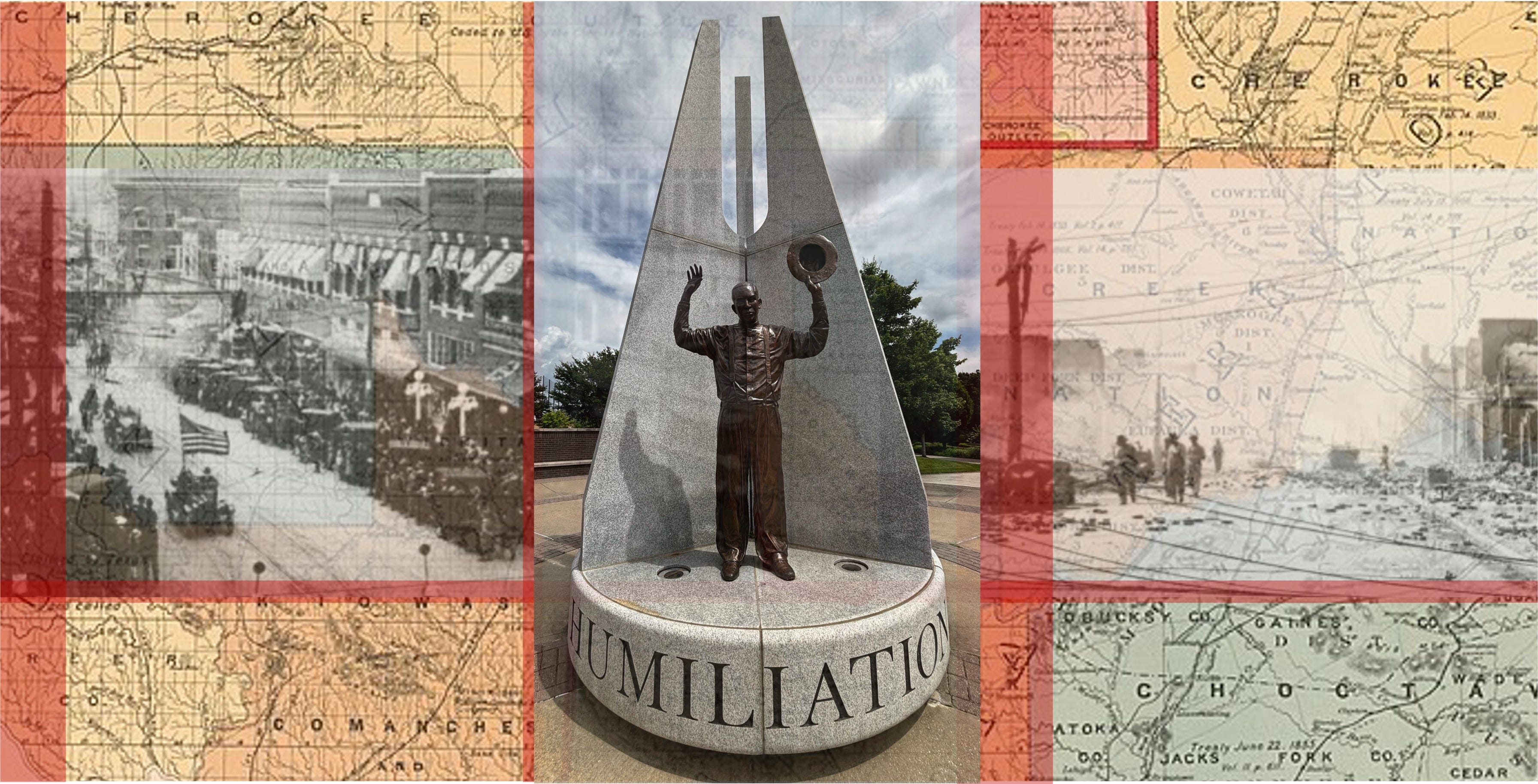
| 6/19/26 | Living Through Tulsa's Time | Hello Interactors,A couple weeks ago, I found myself in Tulsa for the first time. I left pleasantly surprised. There’s a lot of private money flowing into this town, but the city is filled with sorted stories about land, who holds it, who loses it, and how that loss and potential return is engineered. On Juneteenth, the city’s history feels especially close so I thought I’d unpack the layers of displacement, violence, and reinvention that lurk beneath a city still struggling to face them.CONCRETE, COALS, AND A CITY THAT CONCEALSRaise your hand if you like Brutalist architecture (I’m raising mine.) I just didn’t expect to find it in Tulsa, Oklahoma, where I was visiting for my niece’s wedding.The Brut Hotel is a converted Brutalist tower a few blocks from the Arkansas River and it’s all raw concrete. Even the floors and counters. Most people see Brutalism as cold — which is nice on a hot Tulsa day — but I read it as honest and direct. A bit like a Midwestern prairie settler stereotype. After all, the style did emerge in postwar Europe from an egalitarian impulse. It was meant to be democratic architecture stripped of ornamental excesses of fancy city folks. It arrived in America just in time to become the aesthetic of urban renewal. We mostly got housing projects and highway interchanges built on top of what had been Black and working-class neighborhoods, often by eminent domain and without meaningful consent. Concrete can be made to beautiful, but it’s definitely also the material of displacement. Tulsa is no exception.On my first muggy Tulsa morning, I ran from The Brut toward the river. A block or two along, tucked between midtown houses on Cheyenne Avenue, I passed a small park I had read about but didn’t know was so close. The bronze sculpture of a flame was the give away. This is Creek Nation Council Oak Park, and it is, in the most literal sense, where Tulsa began.In 1836, the Lochapoka clan of the Creek Nation arrived at this hill above the river after two years on the Trail of Tears. They had carried live coals from their last ceremonial fires in Alabama the entire way — embers kept alive through hundreds of miles of forced march. Under this oak, they set those coals down and kindled a new flame. They named the settlement Talasi, meaning “old town.” White settlers mispronounced it into Tulsa. The term “Trail of Tears” perhaps softens this forced displacement too much. Of the 630 Lochapoka who began the journey, 161 did not survive it. The oak did and it still holds its annual ceremonies. In November 2024, the site was formally returned to the Muscogee (Creek) Nation.As I kept running south along the river, a second gathering place was harder to miss. It has a giant sign that reads, The Gathering Place.The Gathering Place is a privately built public-ish park that stretches along the Arkansas River’s eastern bank and inland a bit. It’s one hundred acres of fountains, climbing structures, event lawns, and restored prairie plantings. It is, by nearly any measure, a stunningly beautiful park. It is also unmistakably the product of a single man’s fortune. George Kaiser, the Tulsa-born oil billionaire and philanthropist, has poured more than $350 million into transforming this stretch of riverfront. It’s honestly something you’d expect to see in a Northern European city. The park opened in 2018 to national acclaim. The New York Times called it “the most ambitious new park in a generation.” I can see why.But head north from the riverfront, past the gleaming BOK Center arena (“B. OK.” is a financial services company dating back to 1910 oil money and is half owned by Kaiser) and the reclaimed warehouse districts, (including the Bob Dylan Center — Kaiser bought Bob Dylan’s archive collection in 2016) and within minutes you are in a different city. North Tulsa — and specifically the Greenwood District — reveals modest homes and stretches of underdevelopment. This is an area that feels like it’s being watched and commemorated but it’s not entirely clear it is being heard. The Greenwood Rising history center, also primarily bankrolled by Kaiser, opened in 2021 exactly one hundred years after the neighborhood was destroyed in the Tulsa Massacre. This building is also very nice and tells the area’s story well. Whether it changes the story is another matter.Cities can act as maps of their own history, so that’s how I try to read them. I take note of the distances between prosperity and poverty, commemoration and investment…even a museum and a neighborhood. These are not determinant accidents of the market, but accumulated residue of specific decisions made by specific people over a very long time. To understand Tulsa’s geography today, you have to go back not just to 1921, but further — to the rivers and grasslands of Indian Territory the Lochapoka people encountered. It’s here you’ll find federal ledgers leveraged as weapons, their lines and lists legalizing the largest land liquidation in American history.PROMISES, PARCELS, AND THE POLITICS OF POSSESSIONThe Lochapoka were not the only ones force-marched into Indian Territory. All five of the so-called Civilized Tribes — the Cherokee, Choctaw, Chickasaw, Creek, and Seminole nations — were relocated from their homelands in the American Southeast across the 1830s. Each tribe were given the same federal promise that the territory would remain theirs permanently. The maps and the Federal treaties said so, but neither turned out to mean much.What the maps did not show, and what the official history long preferred to omit, is that the Five Tribes brought enslaved Black people with them into Indian Territory. As the historians Annette Gordon-Reed and Rose Stremlau have noted in the context of the 1619 Project, the story of this dispossession cannot be told without acknowledging that intersection: the Trail of Tears was also, for some, a forced march into continued bondage (Gordon-Reed et al., 2022). That fact would shape the politics of Oklahoma for generations — and it is the thread that connects the founding fire under the Council Oak to the rise of Greenwood eighty years later.After the Civil War, the federal government’s promises to the Five Tribes began to erode almost immediately. The Freedmen — formerly enslaved people who had been held by tribal members — were formally granted citizenship in the tribes by treaty, though the tribes’ willingness to honor that citizenship varied considerably. Many Freedmen, seeking mutual protection and economic self-sufficiency, began establishing their own communities. This impulse gave rise to what became known as the Black Towns Movement. Between the 1870s and the 1920s, more than fifty all-Black towns were founded in Oklahoma and Kansas, created by people who had learned, with good reason, not to rely on the goodwill of white-majority governments (Martin, 2025; Gordon-Reed et al., 2022).The legal and cartographic instrument that made the Black Towns possible — and that would ultimately help destroy them — was the allotment system. The Dawes Act of 1887 broke up communally held tribal land into individual parcels, assigning plots to enrolled tribal members and opening the remainder to white settlement. It was framed as a civilizing measure. It was in practice a mechanism for transferring Indigenous land to white hands on an enormous scale. Each parcel was drawn on a map, recorded in a ledger, and assigned a legal description. This act appeared to secure property rights while in fact it made land far easier to steal through legal machinery than it had ever been to simply seize.The discovery of oil made the theft more systematic and more lethal. When crude was found beneath allotments assigned to Native people — particularly in the Osage Nation, the Creek Nation, and elsewhere — a federal guardianship system allowed courts to appoint white guardians for Native landowners deemed “incompetent” to manage their own affairs. The definition of incompetence was flexible and self-serving. Native heirs to oil-bearing land died under suspicious circumstances with startling frequency. Deeds were forged. Guardians enriched themselves and left their wards landless. The historian David Grann has documented this in devastating detail for the Osage Nation specifically, but the pattern was region-wide. Modern GIS analysis of original allotment records against subsequent deed transfers reveals what contemporaries knew but rarely said aloud: the disappearance of Native landowners from oil country was not a coincidence, but a covert policy.For Black Oklahomans, the allotment system created a narrow window of possibility. Freedmen who appeared on the Dawes Rolls received allotments of their own. Some of this land was in proximity to other Black allottees, and the Black Towns Movement capitalized on that geography, incorporating towns, establishing churches and schools, and building the civic infrastructure that Black communities had been denied elsewhere. As scholar JT Martin has argued, the philanthropic traditions within these communities — the mutual aid societies, the church networks, the communal investment in education — were not secondary features of the Black Towns Movement but its essential architecture (Martin, 2025). People who had nothing built institutions that served everyone.Greenwood, established in the early 1900s on the northern edge of Tulsa, was the apex of that project. By 1921, it contained over thirty-five blocks of Black-owned businesses, a hospital, law offices, two newspapers, a library, schools, and churches. Booker T. Washington reportedly called it “the Negro Wall Street,” a phrase that has since become shorthand for what the neighborhood achieved. Although that shorthand flattens what was, more precisely, a masterwork of community-building under conditions designed to make community impossible.As the literary scholar Gary M. Jenkins has observed, Greenwood sat directly along what would become Route 66 (Jenkins, 2022). The all-Black towns of Oklahoma were embedded in the landscape that John Steinbeck traversed in The Grapes of Wrath — and conspicuously omitted from it. The invisibility of Black spatial achievement in the canonical accounts of American westward movement is not incidental. It reflects a pattern in which the places, presence, and prosperity of Black life were purposefully purged from the maps white Americans made of their own country.BURNING, BURYING, AND THE BATTLE TO BELONGOn the night of May 31, 1921, a white mob descended on Greenwood. Over the following eighteen hours, the neighborhood was looted, burned, and bombed — aircraft dropped incendiary devices on residential streets. When it was over, 35 square blocks had been reduced to ash. Somewhere between 100 and 300 people were dead, most of them Black. More than 10,000 Black residents were left homeless. Survivors were interned in camps run by the National Guard — many of whom had also participated in the destruction.What followed the physical destruction was a second, slower erasure. Greenwood residents who attempted to rebuild found themselves blocked by a newly enacted city ordinance that rezoned their land for commercial and industrial use. Insurance claims were denied. Property was effectively seized under the cover of “urban renewal” in subsequent decades. As Morris, Parker, and Negrón have documented, the Tulsa massacre is a case study in what they call “Black community-killing” — the systematic destruction not just of physical structures but of the institutional web that makes a community function: the schools, the churches, the newspapers, the businesses (Morris, Parker & Negrón, 2022). The buildings burned in a day. The community’s capacity to reconstitute itself was methodically dismantled over years.For most of the twentieth century, the massacre was not taught in Oklahoma schools. It did not appear in city histories and land was not returned. The story was, in the most literal sense, removed from the map.Kaiser’s investments in Tulsa have been substantial and wide-ranging: the Gathering Place, the Greenwood Rising museum, workforce development initiatives, early childhood programs. The philanthropic intent appears sincere, and some of the work — particularly in early education — addresses structural inequities rather than simply aestheticizing them. It would be uncharitable, and inaccurate, to dismiss the whole enterprise as window dressing.But scholar JT Martin poses this question which cuts to the heart of the matter: when we study philanthropy in America, whose philanthropic traditions do we center? (Martin, 2025). The mutual aid societies, the church networks, the community land trusts built by Black and Indigenous communities — these represent forms of collective investment that predate and often outperform the interventions of elite donors, yet they receive a fraction of the scholarly and public attention. George Kaiser’s riverfront is visible. The endogenous philanthropic infrastructure of North Tulsa — the churches that held Greenwood together after the massacre, the community organizations that exist today — is largely invisible in the civic narrative that Tulsa tells about itself.The geography makes this concrete. The Gathering Place and the BOK Center sit south on the Arkansas River, in and adjacent to Tulsa’s whiter, wealthier districts. Including the area where the Philbrook Museum of Art sits. This Italian Renaissance villa was built in 1926 by oil pioneer Waite Phillips (as in Phillips 66), donated to the city in 1938 as a public art center. It’s now one of the finest regional museums in the country. This gesture rhymes with Kaiser’s: oil money transmuted into civic cultural institution, the private estate opened to the public as an act of philanthropic legacy-building. The Philbrook is genuinely beautiful and genuinely valuable. It is also located nowhere near North Tulsa.The pattern is not new. Greenwood Rising stands in Greenwood, but the area remains economically depressed, and North Tulsa is still among the most segregated parts of an already divided city. Philanthropic investments that produce a park on the wealthy side of the river and a museum on the historically Black side, while leaving structural inequalities intact, are not reparative.The development around Greenwood tells a more troubling story. ONEOK Field, built in 2010 on historic Greenwood land despite community opposition, has delivered few benefits to Black residents, who are still taxed to support it. Nearby, the Tulsa Arts District has flourished with amenities catering to a whiter, more affluent clientele, while long-standing Black businesses struggle. Even hotels in Greenwood market themselves as part of that district. This is less restoration than a familiar precursor to displacement in the form of cultural investment followed by real estate pressure.Some argue that understanding land and spatial justice in places like Tulsa requires connecting the Greenwood reparations movement to broader Indigenous-led land reclamation efforts (Du, 2021). In 2020, the Supreme Court’s decision in McGirt v. Oklahoma ruled that the Creek Nation reservation had never been legally dissolved and that the federal government’s century-old maps of Oklahoma had been legally wrong all along. The majority opinion was written by Justice Neil Gorsuch, a conservative textualist, who applied the same originalist logic to treaty rights that right-wing jurists typically apply to the Second Amendment. The ruling was a genuine landmark, restoring tribal jurisdiction over a substantial portion of eastern Oklahoma. Subsequent decisions have extended the logic to other tribes.The political irony is perplexing. Oklahoma has been among the most reliably right-wing states in the country for decades; its congressional delegation is uniformly conservative; its state government has consistently resisted federal oversight and minority rights claims. Yet it was conservative judicial originalism — the doctrine that legal texts mean what they said when written — that restored, at least partially, what the federal government had promised the Five Tribes in the 1830s. The promise was old, the maps were wrong, and it took a conservative judge to point it out.What McGirt did not do was address the claims of Black Oklahomans. The Freedmen’s citizenship rights within the Five Tribes remain contested. The Greenwood reparations movement has won moral recognition but not legal remedy. The 1921 massacre commission recommended reparations in 2001 and they have never been paid. These struggles do feel connected — Black and Indigenous claims to land and sovereignty in Oklahoma have been shaped by the same federal machinery of dispossession, and their futures may be intertwined in ways that neither community has yet fully reckoned with (Du, 2021).Juneteenth, the holiday now recognized federally, commemorates June 19, 1865 — the day enslaved people in Galveston, Texas, were told the war was over (the Emancipation Proclamation had been issued two and a half years earlier) and they were free. What the holiday cannot quite contain is what freedom meant in practice for people who were free but landless. They were free but also targeted. They were also freed from the maps that governed how wealth was accumulated and held in America. The Black Towns of Oklahoma were an answer to these problems and Greenwood was that, for a while. Then it was burned down.What grows back from a fire depends on who tends the soil, and who owns it. In Tulsa today, that question is still being answered. Will the answers be as brutally honest as Brutalism — the idea that a building should be honest about what it is made of? Tulsa is made of oil money and dispossession, Black resilience and white violence, broken treaties and belated reckonings. Despite conservative political domination, the maps are being redrawn. Whether they will finally show all of that honestly — without the decorative Italian Renaissance stucco — is more political than cartographic. But McGirt proves that promises, however papered over, still possess the power to pierce the present.ReferencesDu, Y. (2021). Black geographies unveiled: A critical review. Human Geography. Gordon-Reed, A., Stremlau, R., Lowery, M., et al. (2022). The 1619 project forum. The American Historical Review. Jenkins, G. M. (2022). Steinbeck, race, and Route 66 in The Grapes of Wrath. Steinbeck Review.Martin, J. T. (2025). Are Black people philanthropists? Toward a more diverse research agenda on philanthropy. Du Bois Review: Social Science Research on Race. Morris, J. E., Parker, B. D., & Negrón, L. M. (2022). Black school closings aren’t new: Historically contextualizing contemporary school closings and Black community resistance. Educational Researcher. This is a public episode. If you would like to discuss this with other subscribers or get access to bonus episodes, visit interplace.io | 24m 55s | ||||||
| 6/1/26 | The Transit of Two Titans✨ | urban mobilityindividual autonomy+3 | — | — | New YorkLos Angeles | transitmobility+5 | — | 23m 55s | |
| 5/11/26 | Becoming Not Beginning✨ | neurosciencenarrative+4 | — | Sapiens | — | neurosciencenarrative+6 | — | 18m 12s | |
| 4/27/26 | What the World Points To✨ | geographic information sciencespatial analysis+3 | — | National Center for Geographic Information and AnalysisUniversity of California, Santa Barbara | northern hemisphere | geographic information sciencespatial analysis+3 | — | 27m 24s | |
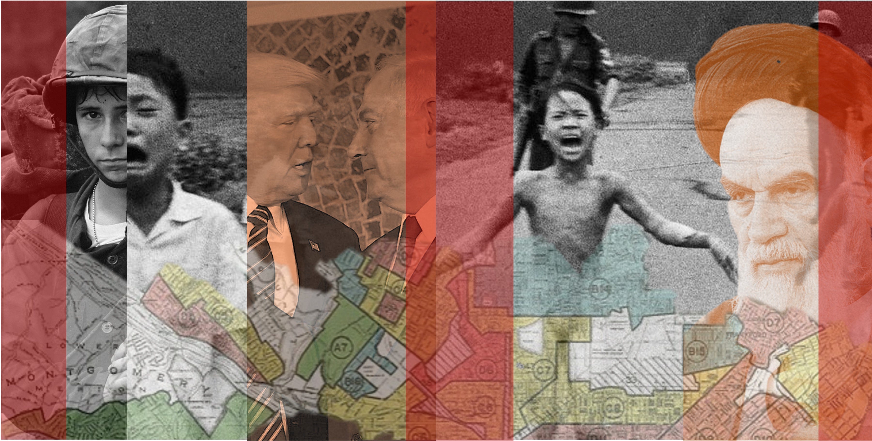
| 3/14/26 | The Map that Murders and the Mind that Masks✨ | political psychologyatrocities+4 | — | Geneva ConventionsU.S. | IowaVietnam | atrocitiesVietnam War+5 | — | 24m 16s | |
| 2/23/26 | From Microsoft to the Surveillance State✨ | immigrationglobalization+4 | — | Microsoft | — | Microsoftimmigration+5 | — | 27m 12s | |
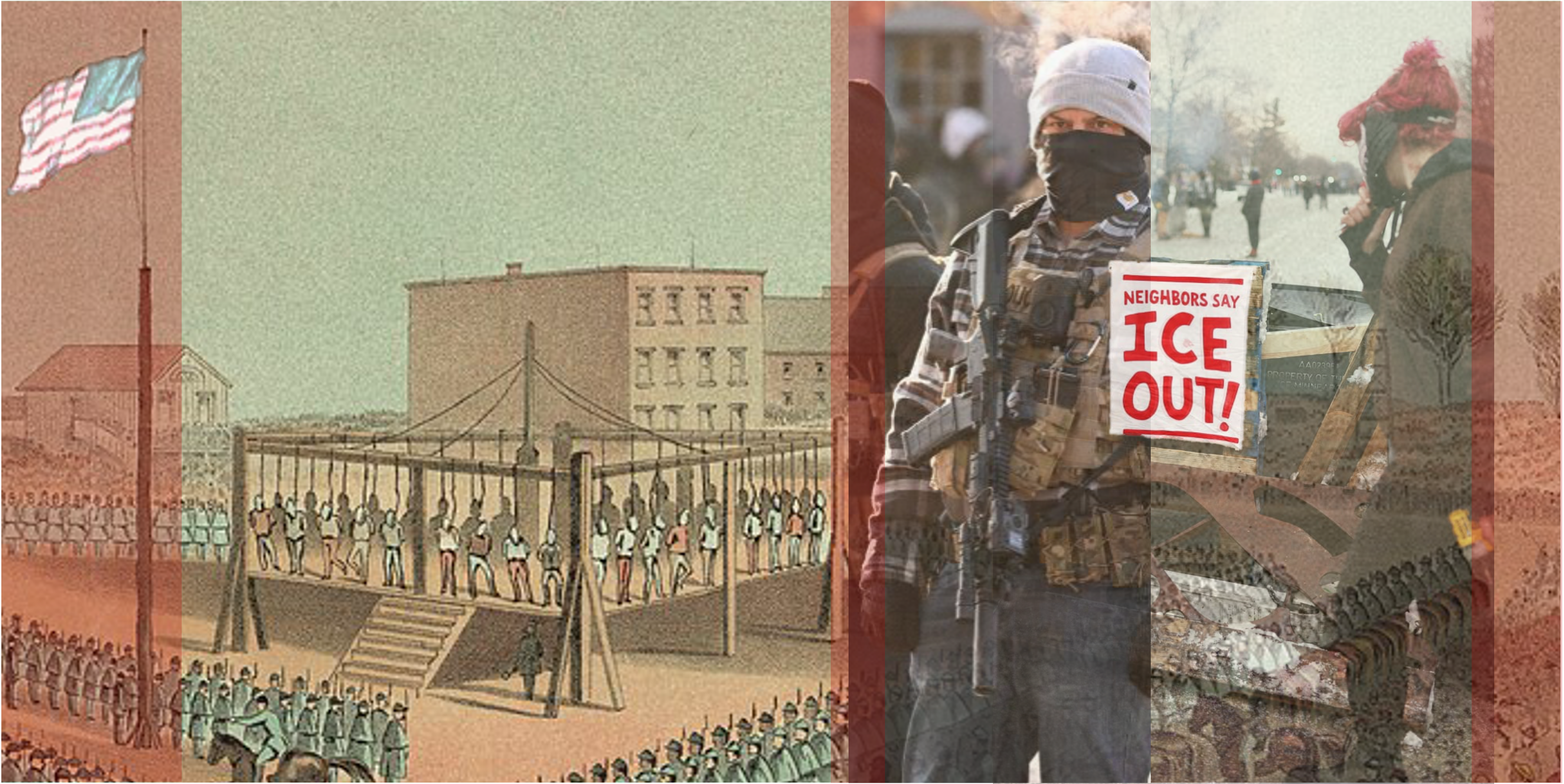
| 1/31/26 | Street Snatches, Stolen Soil, and the Power of Care✨ | historical eventsDakota history+5 | — | — | MinnesotaMankato+1 | DakotaMinnesota+6 | — | 21m 48s | |
| 1/16/26 | The Mind Can't Act Alone and AI Can't Either✨ | AIbrain+5 | — | — | — | AIbrain+5 | — | 22m 58s | |
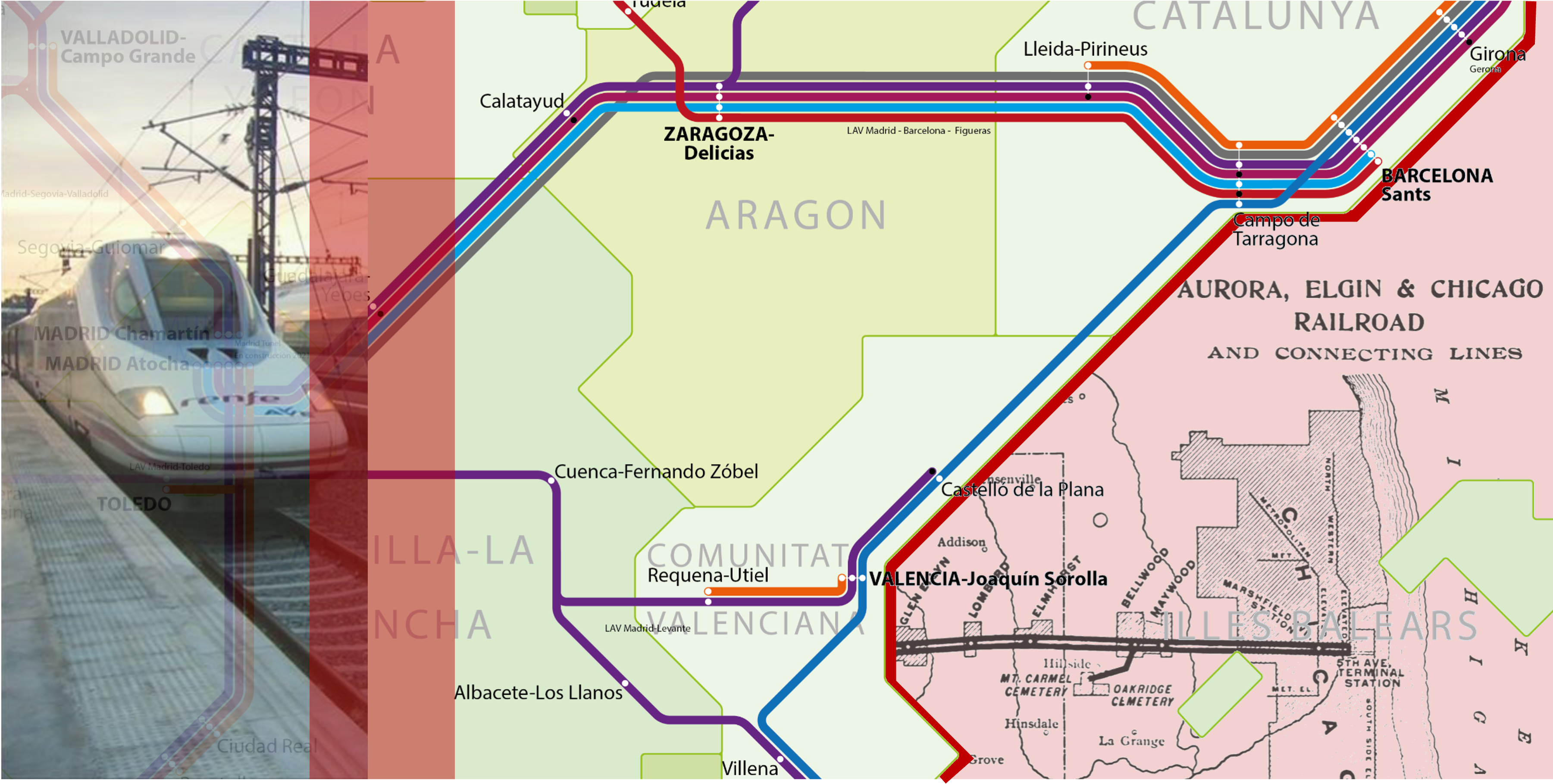
| 12/15/25 | Trains, Planes, and Paved-Over Promises✨ | high-speed railtransportation+5 | — | high-speed rail (HSR)EasyJet | BarcelonaSpain+6 | high-speed trainsSpain+6 | — | 23m 54s | |
Want analysis for the episodes below?Free for Pro Submit a request, we'll have your selected episodes analyzed within an hour. Free, at no cost to you, for Pro users. | |||||||||
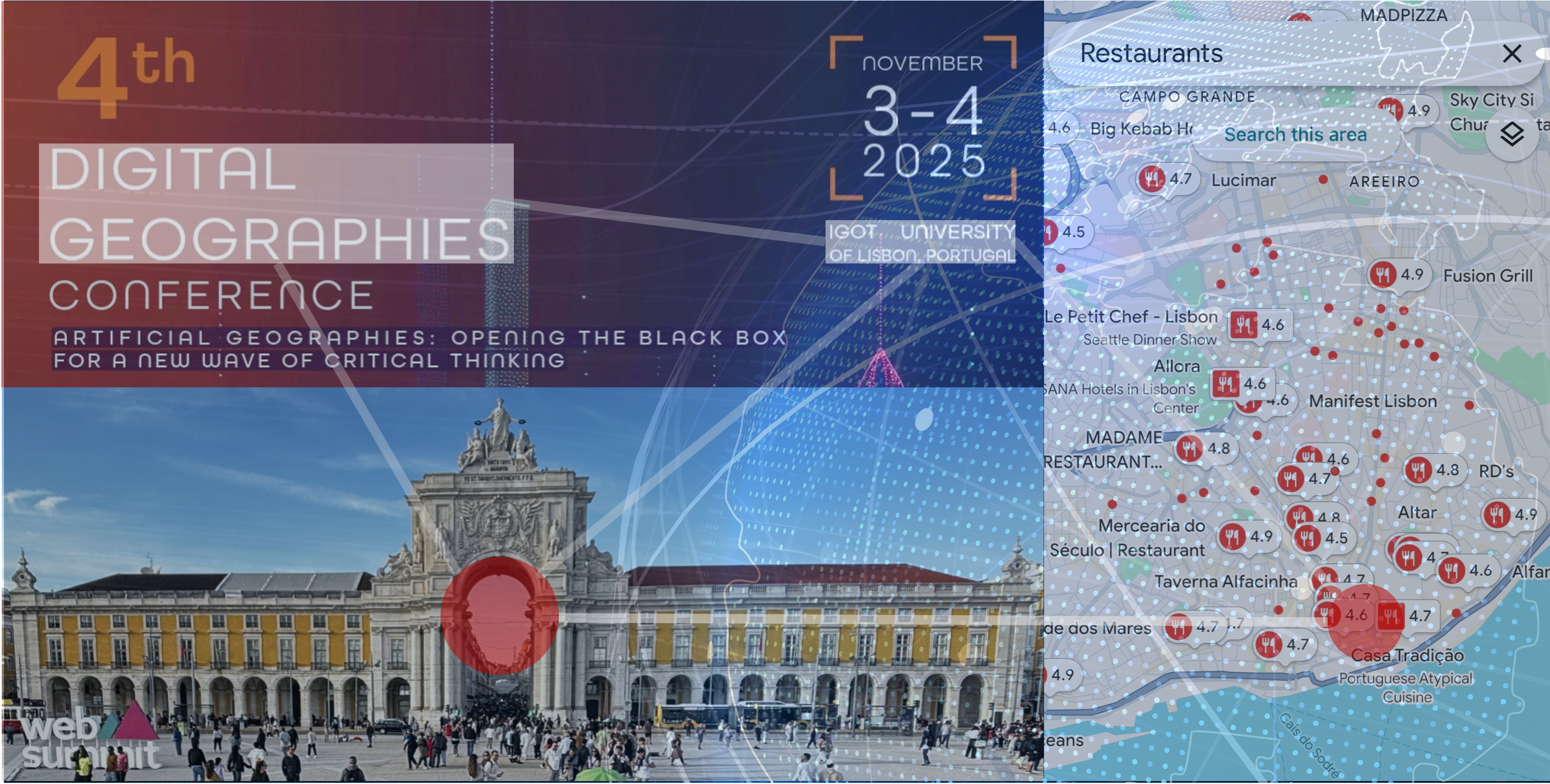
| 11/23/25 | An Economic Geography of Complicity and Control✨ | economic geographydigital geography+3 | — | AirbnbGoogle Maps | Southern EuropeNorthern Italy+2 | economic geographydigital geography+4 | — | 27m 36s | |
| 10/5/25 | Spirals of Enclosure✨ | economicseconomic geography+5 | — | — | EnglandNorth America+3 | capitalismeconomic geography+5 | — | 36m 03s | |
| 8/24/25 | Masters of Mess Making and Meaning✨ | extreme sportsphilosophy+4 | — | — | Nazaré, PortugalGrand Canyon | 100 Foot WaveGarrett McNamara+5 | — | 23m 50s | |
| 8/10/25 | Native or Not? How Science, Politics, and Physics Decide Who Belongs✨ | native speciesinvasive species+4 | — | Interplace | JapanChina+5 | nativeinvasive+6 | — | 25m 58s | |

| 7/13/25 | When the Sky Swells, the Land Breaks | Hello Interactors,It’s hard to ignore the situation in Texas, especially as I turn my attention to physical geography. 'Flash Flood Alley', as it’s called by hydrologists, had already been pounded by days of relentless rain, soaking the soil and swelling the rivers. It left the region teetering on the edge of catastrophe. Then came the deluge. A torrent so sudden and intense it dumped a month’s worth of rain in under an hour. Roads turned to rivers. Homes were lost. Lives were too. As the floodwaters recede, what remains isn’t just devastation — it’s a lesson. One about a changing water cycle, a shifting climate, and a stubborn way of thinking that still dominates how we plan for both.DROUGHT AND DELUGEIs Texas drowning due to climate change? Just three years ago, we were told it’s drying up. That’s when a record drought emptied reservoirs and threw aquifers into steep decline. From 2011 to 2015, 90% of the state was in extreme drought. This seesaw between soaked and scorched is the kind of muddled messaging that lets climate deniers laugh all the way to the comment section.The truth is Texas is drying up AND drowning. This paradox isn’t just Texas-sized — it’s systemic. Our habit of translating global climate shifts into local weather soundbites is failing us.According to hydrologist Benjamin Zaitchik and colleagues, writing in Nature Water in 2023, two dominant narratives frame how these events are explained. Public and policy reporting on patterns like those in Texas usually falls into two camps:* The "Wet-Get-Wetter, Dry-Get-Drier" (WWDD) hypothesis — climate change intensifies existing hydrological patterns, bringing more rain to wet regions and more drought to dry ones.* The "Global Aridification" (GA) hypothesis — warming increases the atmosphere's "thirst," drying out land even where rainfall remains steady.Both frameworks can explain real conditions, but the recent Texas floods expose their limits. If a region long seen as drying can also produce one of the most intense floods in U.S. history, are these ideas flawed — or just too rigidly applied?WWDD and GA aren’t competing truths. They’re partial heuristics for a nonlinear, complex water system. Yet our brains favor recent events, confirm existing beliefs, and crave simple answers. So we latch onto one model or the other. But these simplified labels often ignore scale, context, and the right metrics. Is a region drying or wetting based on annual rainfall? Soil moisture? Streamflow? Urbanization? Atmospheric demand?Texas — with its sprawling cities, irrigated farms, and dramatic east–west gradient in rainfall and vegetation — resists binary climate narratives. One year it exemplifies GA, with depleted aquifers and parched soil. The next, like now, it fits WWDD, as Tropical Storm Barry — arriving after days of relentless rainfall — stalled over saturated land, unleashing a torrent so fierce it overwhelmed the landscape.Zaitchik and his team call for a clarification approach. Instead of umbrella labels, we should specify which variables and timeframes are shifting. A place can be parched, pummeled, and primed to flood — sometimes all in the same season. And those shifting moods in the water set the stage for something deeper — a mathematical reckoning.MATH MEETS MAYHEMThis debate boils down to three basic equations — one for the land, one for the sky, and one for how the system changes over time. But that means prying open the black box of math symbols still treated like sacred script by academics and STEM pros.Let’s be clear, these equations aren’t spells. They’re just shorthand — like a recipe or a flowchart. The symbols may look like hieroglyphs, but they describe familiar things. Precipitation falls (P). Water evaporates or gets sucked up by plants — evapotranspiration (E). Some runs off (R). Some sinks in (S). Time (t) tells us when it’s happening. The 'd' in dS and dt just means "change in" — how much storage (S) increases or decreases over time (t). The Greek letters — ∇ (nabla) and δ (delta) — simply mean change, across space and time. If you can track a bank account, you can follow these equations. And if you’ve ever watched a lawn flood after a storm, you’ve seen them in action.You don’t need a PhD to understand water, just a willingness to see through the symbols.* LAND: The Water Balance EquationP − E = R + dS/dtPrecipitation (P) minus evapotranspiration (E) equals runoff (R) plus the change in stored water (dS/dt).* SKY: The Vapor Flux EquationP − E = ∇ ∙ QThis links land and atmosphere. ∇ (nabla) tracks change across space, and Q is vapor flux — the amount of moisture moving through the atmosphere from one place to another, carried by winds and shaped by pressure systems. The dot product (∙) measures how much of that vapor is moving into or out of an area. So ∇ ∙ Q shows whether moist air is converging (piling up to cause rain) or diverging (pulling apart and drying).* SYSTEM: The Change Equationδ(∇ ∙ Q) = δ(P − E) = δ(R + dS/dt)This shows how if vapor movement in the sky changes (δ(∇ ∙ Q)), it leads to changes in net water input at the surface (δ(P − E)), which in turn changes the balance of runoff and stored water on land (δ(R + dS/dt)). It’s a cascading chain where shifts in the atmosphere ripple through the landscape and alter the system itself.In a stable climate, these variables stay in sync. But warming disrupts that balance. More heat means more atmospheric moisture (E), and altered winds move vapor differently (∇ ∙ Q). The math still balances — but now yields volatility: floods, droughts, and depleted storage despite “normal” rainfall. The equations haven’t changed. The system has.Texas fits this emerging pattern:* Rainfall extremes are up: NOAA shows 1-in-100-year storms are now more frequent, especially in Central and East Texas.* Soil and streamflow are less reliable: NASA and USGS report more zero-flow days, earlier spring peaks, and deeper summer dry-outs.* Urban growth worsens impacts: Impervious surfaces around Austin, San Antonio, Houston, and Dallas accelerate runoff and flash floods.These shifts show how climate and land use intersect. It’s not just wetter or drier — it’s both, and more volatile overall.In 2008, hydrologist Peter Milly and colleagues declared: “Stationarity is dead.”For decades, water planning assumed the future would mirror the statistically stationary and predictable past. But flood maps, dam designs, and drought plans built on that idea no longer hold.We laid out land with rulers and grids, assuming water would follow. But floods don’t care about straight lines, and drought ignores boundaries. Modern hydrology rested on Cartesian geometry — flat, fixed, and predictable. But the ground is moving, and the sky is changing. The first two equations describe water in place. The third captures it in motion. This is a geometry of change, where terrain bends, vapor thickens, and assumptions buckle. To keep up, we need models shaped like rivers, not spreadsheets. The future doesn’t follow a line. It meanders.And yet, we keep describing — and planning and engineering — for a world that no longer exists.Somehow, we also need journalists — and readers — to get more comfortable with post-Cartesian complexity. Soundbites won’t cut it. If we keep flattening nuance for clarity, we’ll miss the deeper forces fueling the next flood.VAPOR AND VELOCITYIf Texas is drying and flooding at once, it’s not a local contradiction but a symptom of a larger system. Making sense of that means thinking across scales — not just in miles or months, but how change moves through nested systems.Cartesian thinking fails again here. It craves fixed frames and tidy domains. But climate operates differently — it scales across time and space, feeds back into itself, and depends on how systems connect. It’s scalar (different behaviors emerge at different sizes), recursive (what happens in one part can echo and evolve through others), and relational (everything depends on what it touches and when). What looks like local chaos may trace back to a tropical pulse, a meandering jet stream, or a burst of vapor from halfway across the world.Zaitchik’s team shows that local water crises are often global in origin. Warming intensifies storms — but more crucially, it shifts where vapor moves, when it falls, and how it clusters[1]. The water cycle isn’t just speeding up. It’s reorganizing.Thanks to the Clausius-Clapeyron relationship — a principle from thermodynamics that describes how warmer air effects vapor — each 1°C of warming allows the atmosphere to hold about 7% more moisture. That supercharges storms. Even if rain events stay constant, their intensity rises. The sky becomes a loaded sponge — and when it squeezes, it dumps.But it’s not just about capacity. It’s about flow. Moisture is moving differently, pooling unpredictably, and dumping in bursts. That’s why Texas sees both longer dry spells and shorter, more intense storms. Systems stall. Jet streams wander. Tropical remnants surge inland. These aren’t bugs. They’re features.The July 2025 Texas flood may have begun with Gulf moisture: its roots trace to warming oceans, trade wind shifts, and a migrating Intertropical Convergence Zone (ITCZ) — the low-latitude belt where trade winds converge and drive global precipitation patterns. As these systems reorganize, mid-latitude regions like Texas face more extreme rains punctuated by longer droughts[1]. More extremes. Fewer in-betweens.So Texas’s water future isn’t just about reservoirs and runoff. It’s about vapor, velocity, and vertical motion and the hidden machinery of a water cycle behaving in unfamiliar ways.This NOAA satellite (GOES-19 captures imagery every 5-10 minutes) loop captures the moisture swirling through the mid-atmosphere (Band 9 is ~20,000 feet) as the Storm pushed inland from July 3rd to the 6th. The darker blues show vapor pooling and stalling over Central and East Texas. This loaded sky, unable to drain, setting the stage for the deadly flash flood. It’s a visceral glimpse of vapor in motion, moving slowly but with devastating impact. A changing water cycle, playing out above our heads. This is what vapor, velocity, and vertical motion look like when they converge.And then there’s us.While climate reshapes water, human decisions amplify it. In 2023, hydrologist Yusuke Pokhrel and colleagues showed how irrigation, land use, and water withdrawals distort regional hydrology.Ignoring these human factors leads to overestimating runoff and underestimating atmospheric thirst. In some basins, human use matters more than what falls from the sky.Texas proves the point:* Irrigation in West Texas raises evapotranspiration and disrupts seasonal flow. Large-scale withdrawals from the Ogallala Aquifer reduce groundwater availability downstream, shifting the timing and volume of river flows and accentuates drought conditions in already water-stressed regions[4].* Urban sprawl accelerates runoff and raises flood risk. Expanding suburbs and cities pave over natural land with impervious surfaces, reducing infiltration and sending stormwater rushing into creeks and rivers, often overwhelming drainage systems and increasing the frequency and intensity of flash floods[5].* Aging reservoirs can worsen both floods and droughts. Designed for a past climate, many are now ill-suited for more volatile conditions — struggling to buffer flood peaks or store enough water during prolonged dry spells. In some cases, outdated operations or degraded infrastructure magnify the very extremes they were meant to manage.Texas is a dual-exposure system. The climate shifts. The land shifts. And when they move together, their impacts multiply.Texas isn’t an outlier — it’s a harbinger. A place where drought and deluge don’t trade places, but collide — sometimes within the same week, on the same watershed. Where the sky swells and the soil gives way. Where century-old assumptions about rain, rivers, and runoff crumble under the pressure of converging extremes.The story isn’t just about rising temperatures. It’s about a water cycle rewritten by vapor and velocity, by concrete and cultivation, by geometry that flows instead of fixes. As climate shifts and land use compounds those changes, our past models grow brittle. And our narratives? Too often, still binary.To move forward, we need more than updated flood maps. We need a new language rooted in complexity, scale, and feedback. One that can handle the meander, not just the mean. And we need the will to use it in our plans, our policies, and our press.Because the future isn’t forged only by what we build. It’s shaped by what we burn. Roads and rooftops matter amidst a rising CO₂. When vapor collides with concrete, we’re reminded disasters aren’t just natural — they’re engineered.This isn’t just about preparing for the next storm. It’s about admitting the old coordinates no longer work and drawing new ones while we still can. This is a public episode. If you would like to discuss this with other subscribers or get access to bonus episodes, visit interplace.io | 19m 43s | ||||||
| 7/4/25 | Red, White, and Choo Choo | Hello Interactors,Happy Fourth of July and welcome to a brand new season of Interplace! We’re kicking things off with a video of my cross-country rail trip that took about four days to ride…and nearly twice as long to edit and produce. This first ever Interplace video launches our summer focus on physical geography and the environment. I hope you enjoy a slow journey through space, place, and the unexpected beauty between the coasts. This is a public episode. If you would like to discuss this with other subscribers or get access to bonus episodes, visit interplace.io | 4m 47s | ||||||
| 6/8/25 | How Cities Loop Us In | Hello Interactors,My daughter in Manhattan’s East Village sent me an article about the curated lives of the “West Village girls.” A few days later, I came across a provocative student op-ed from the University of Washington: "Why the hell do we still go to Starbucks?" The parallels stood out.In Manhattan’s West Village, a spring weekend unfolds with young women jogging past a pastry shop in matching leggings, iced matcha lattes in hand. Some film it just long enough for TikTok. Across the country, students cycle through Starbucks in Seattle’s U-District like clockwork. The drinks are overpriced and underwhelming, but that’s not the point. It’s familiar. It's part of a habitual loop.Different cities, similar rhythms. One loop is visual, the other habitual. But both show how space and emotion sync. Like an ambient synth track, they layer, drift, and return. If you live in or near a city, you exist in your own looping layers of emotional geography.FLASH FEEDSMy daughter has been deep into modular synthesis lately — both making and listening. It’s not just the music that intrigues her, but the way it builds: loops that don’t simply repeat, but evolve, bend, and respond. She’ll spend hours patching sounds together, adjusting timing and tone until something new emerges. She likens it to painting with sound. Watching her work, it struck me how much her synth music mirrors city life — not in harmony, but in layers. She’s helped me hear urban rhythms differently.Like a pop synth hook, the Flash loop is built for attention. It's bright, polished, and impossible to ignore. Synth pop thrives on these quick pulses — hooks that grab you within seconds, loops that deliver dopamine with precision. Urban spaces under this loop do the same. They set a beat others fall in line with, often flattening nuance in exchange for momentum.This isn’t just about moving to a beat. It’s about becoming part of the beat. When these fast loops dominate, people start adapting to the spaces that reflect them. And those spaces, in turn, evolve based on those very behaviors. It’s a feedback loop: movement shaping meaning, and meaning shaping movement. The people become both the input and the output.In this context, the West Village girl isn’t just a person — she’s a spatial feedback loop. A mashup of Carrie Bradshaw nostalgia, Instagram polish, and soft-lit storefronts optimized for selfies. But she didn’t arrive from nowhere. She emerged through a kind of spatial modeling: small choices, like where to brunch, where to pose, where to post are repeated so often they remade a neighborhood.Social psychologist Erving Goffman, writing in the 1950s, called this kind of self-presentation "impression management." He argued that much of everyday life is performance. Not in the theatrical sense, but in how we act in response to what we expect others see. Urban spaces, especially commercial ones, are often the stage. But today, that performance isn’t just for others in the room. It’s for followers, algorithms, and endless feeds. The “audience” is ambient, but its expectations are precise.As places like the West Village get filtered through lifestyle accounts and recommendation algorithms, their role changes. They no longer just host people, but mirror back a version of identity their occupants expect to see. Sidewalks become catwalks. Coffee shops become backdrops. Apartment windows become curated messes of string lights and tasteful clutter. And increasingly, the distinction between what’s lived and what’s posted collapses.This fast loop — what we might call spatial virality — doesn’t just show us how to act in a place. It scripts the place itself. Stores open where the foot traffic is photogenic. Benches are placed for backdrops, not rest. Even the offerings shift: Aperol spritzes, charm bars, negroni specials sold not for taste but for tagability.These are the high-tempo loops. They grab attention and crowd the mix. But every modular synth set, like a painting, needs contrast.So some people opt out, or imagine doing so. Not necessarily with loud protest, but quiet rejection. They look for something slower. Something that isn’t already trending...unless the trend of routine sucks you in.PULSING PATTERNSIf Flash is the pop hook, Pulse is the counter-melody. It could be a bassline or harmony that brings emotional weight and keeps things grounded. In music, you may not always notice it, but you'd miss it if it were gone. In cities, this loop shows up in slow friendships, mutual aid, and cafés that begin to feel like second homes. These are places where regulars greet one another by name. Where where hours melt through conversations. It satisfies a need to be seen, but without needing to perform. It’s what holds meaning when spectacle fades.If the fast loop turns space into spectacle, the counter loop tries to slow it down. It lures the space to feel lived in, not just liked. It’s not always radical. Sometimes it’s just choosing a different coffee shop.Back in Seattle’s University District, students do have options. Bulldog News. Café Allegro. George Coffee. These places don’t serve drinks meant to be posted. They serve drinks meant to be tasted. They’re not aesthetic first. They’re relational. These are small gestures that build culture.Social psychologists Susan Andersen and Serena Chen describe this through what they call relational self theory. We don’t become ourselves in isolation. We become ourselves with and through others — especially those we repeatedly encounter. Think about the difference between ordering coffee from a stranger versus someone who knows you like sparkling water with your Cortado. It’s a different kind of transaction. It eases things. It reinforces your own loop.So why do people routinely return to Starbucks? It isn’t just about caffeine addiction. It’s about being part of a socially reinforced rhythm — anchored in convenience, recognition, and the illusion of choice.Stores like Starbucks are often strategically located for maximum accessibility and convenience. They're nestled near transit hubs, along commuter corridors, or within high-traffic pedestrian zones. These placements aren’t arbitrary. They’re optimized to integrate into daily routines. It's less like a countermelody and more like a harmonic parallel melody. As a result, practical considerations like proximity, availability, and reliability often override ideological concerns.People return not because the product is exceptional, but because the store is exactly where and when they need it. The Starbucks habit isn’t only about routine, but rhythmic predictability that appears personal. In this sense, it functions as a highly accessible pulse: a loop that’s easy to join and hard to break. It's made of proximity, subtle trust, and convenience, but is dressed as choice.My daughter's chosen counter loop lives in the East Village — not far, geographically, from the Instagram inspired brunch queues of Bleecker Street. Her loops are different. She carries conversations across record stores, basement venues, bookstores with hand-scrawled signs, and a few stubborn restaurants.These are Places where the playlists aren't streaming through Spotify. Her city isn’t organized around visibility. It’s organized around presence. Around being seen to be honored and remembered. Like the bookstore dude who knows the lore on everyone, or the cashier who waves her through without paying, or her Brooklyn bandmate friends who fold her in like family.Sure, this scene intersects with the popular loops — modular synths are having a moment — but it sidesteps the sameness. It stays unpredictable, grounded in curiosity and care rather than clicks. The gear is still patched by hand. The performances are messy and often temporary. And yet, the loops — literal and figurative — keep returning. Not because they’re engineered for attention, but because they allow people to build something slowly...together...from the inside. Especially when done in partnership with another synthesist.You might see this in your own city. The quiet transformation of spaces: a café hosting a poetry night; a yoga studio turned warming shelter during the storm; a laundromat that leaves a stack of free books near the dryers. These are not accidents. They are interventions. Sometimes small, sometimes subtle...but always deliberate.They stand in contrast to the churn of the viral. They also offer an alternative to despair. Because the counter loop isn’t just critique. It’s care enacted. And care takes time.Still, even pulsing care needs structure. It needs floor drains, power outlets, and open hours. It needs a stable substructure.UNDERCURRENT UNDERTONESUndertone is the foundational structure on which other elements are built. It's the core of modular synth music. This isn’t just rhythm. It’s the subtle, slow, and reactive scaffolding. These core loops evolve and shift setting the timing and emotional tonality for everything else.They don’t dominate, but they shape the flow. They respond to what surrounds them to ground the composition. Cities, too, have these base layers. Often imperceptible, they are visceral, ambient, and persistent. They come into focus with the smell of rain on warm pavement. The clink of a key in a front door. These are not songs you hum, they’re the ones your heart and lungs make.Long before the influencer run clubs, celebrity shoe stores, and curated stoops, there was the mundane sidewalk. Not the kind tagged on a friend’s story or filtered through the latest app. Just concrete. Scuffed by strollers, scooter wheels, boots, and time. The sidewalk doesn’t follow trends, but it does remember them.Cities are built on these undertones: habitual routes, early deliveries, overheard exchanges, open signs flipped at the same hour each morning. They aren’t glamorous. They don’t go viral. But they are what hold everything together.Urban scholar Ash Amin calls this the “infrastructure of belonging.” In his work on ordinary urban life, he writes that much of what connects us isn’t spectacular. It’s what happens when people brush past one another without ceremony: the steady hum of life happening without the need for headlines. Cities function not just because of design, but because of everyday cooperation — shared rhythms, implicit trust, systems that keep working because people show up.It can seem mundane: a delivery driver making the same drop, a retiree watering the sidewalk garden they planted without permission, the clatter of trash bins returning to their spots. These moments don’t make the city famous, but they do make it work.Even the flashiest loops rely on them. The West Village girl’s curated brunch only happens because someone sliced lemons before sunrise and wiped the table clean before she sat down. The Starbucks habit loop in the U-District clicks into place because the supply truck showed up at 5 a.m. and the barista clocked in on time. They’re the dominant undertone of cities: loops so steady we stop noticing them...until they stop. Like during the pandemic.A synthesist might point to an LFO: Low Frequency Oscillator. These make slow drones that hum under a syncopated rhythm; a pulsing sub-bass holding space while textures come and go. The mundane in a city does the same: it holds the mix together. Without it, the composition falls apart.If you’ve ever heard a modular synth set, you know it doesn’t move like pop music. The loops aren’t clean. They evolve, layer, drift in and out of sync. They build tension, release it, then find a new rhythm. Cities work the same way.Their beauty isn’t always in sync — it’s in polyrhythm. Like when two synth voices loop at slightly different speeds: a saw wave pinging every three beats, a filtered drone stretching over seven. They collide, resolve, then drift again. Like when a car blinker syncs to the beat of a song and then falls out again. In modular music, this dissonance isn’t a flaw. It creates a sonic texture.City rhythms don’t always align either. A delivery truck pulls up as a barista closes shop; protest chants counter a stump speech; showtimes shift with transit delays. These clashes don’t cancel each other out — they deepen the city’s texture, giving it groove.Sociologists Scannell and Gifford call this place attachment: the slow accrual of meaning in a space through repetition, emotional memory, and lived interaction. It’s not always nostalgic. Sometimes it’s forward-looking. The act of building the kind of city you want to live in, one relationship at a time.And beneath all of this, the city continues its own loop: subways running through worn tunnels, trash collected on quiet mornings, someone sweeping a shop floor before the door opens.Both protest and performance rely on this scaffold. The Starbucks picket line doesn’t just appear. It’s supported by planning, scheduling, and shared labor. The music scene doesn’t just materialize. It's shaped by decades of flyers, friendships, and repeat customers.The viral and the intentional both need the mundane.Cities, when they work, are made of all three: the flash of now, the pulse of choice, and the undertone of the necessary. Like springtime flowers, the city creates blooms that emerge at the surface. They draw attention, cameras, and admiration. These blossoms don’t just attract the eye, they draw in pollinators who carry influence and energy far beyond the original scene. But none of this happens without the rest of the plant. It’s the leaves that capture sunlight day after day, the roots that pulse the unseen through tunnels, the microbes that toil in the grime and dirt to nourish those all around them. Urban life mirrors this looping ecology. Moments that flash brightly, pulses that quietly sustain, and undertones that hold it all together. The bloom is what gets noticed, but it’s the layered and syncopated life below — repeating, decomposing, reemerging — that make the next blossom possible. This is a public episode. If you would like to discuss this with other subscribers or get access to bonus episodes, visit interplace.io | 22m 05s | ||||||
| 6/1/25 | Beaks, Brakes, and Brainwaves | Hello Interactors, This week, four strange bird encounters landed in my lap — three in real life, one on my screen. First, a crow tore through the bushes in our yard chasing a frantic nuthatch. Moments later, I spotted two more crows feasting on roadkill just outside our house. Then, while walking with my wife, we watched four ducks in hot pursuit of another, flapping furiously down the street — some kind of aerial turf war. And finally, scrolling through my feed, I stumbled on a paper describing a Cooper’s Hawk hacking the city’s traffic system to hunt smarter. After all that, I tried seeing cities as a bird might. So I wrote as one.HISS, HUM, HUNTI first sense the city as vibration. Before sun rays even breech the branches, a hiss of car tires emerge; street lamps click off; somewhere a garage door rumbles open. Each resonance strikes the hollow chambers of my bones like sonar. It’s a sketch of distance, density, and direction. This all makes perfect sense to me even though I am just a kid. A juvenile Cooper’s Hawk — Accipiter cooperii — yet the human-made maze below me is as legible to me as the nest I left barely two winters ago. What follows, in human words, is a recount of one day’s hunt. I hope to demonstrate what humans regard as intelligence, innovation, and enterprise exists in a single act of predation.DANCING WITH DATA AT DAWNPerched on a gray mast of the Main and Prospect traffic light, I begin to render the scene. My basemap is no pixel grid glowing on some screen across town; it is a topological organ in my scull. Topology matters when a lamppost sits one maneuver away from the porch roof, which is one glide away from the dumpster rim. My so-called ‘bird brain’ calculates dynamic flows of probability. One flip of a traffic light, a garbage truck rolls by, and that gust of wind changes direction. My internal map pulses between “larger” when prey likelihood rises and “smaller” when likelihood falls.As I gaze out above the east-west avenue, a slipstream peels off the 7AM wave of commuters. I spot a sparrow in a vortex that spirals from the garbage truck’s wake at 07∶13. That acoustic shadow beneath that florist’s van is one place I could pass unseen. But is a sparrow worth it?What I am doing — unknown even to myself — is what spatial scientists call real‑time kernel‑density estimation. At any point on a simple 2D path I can plop a small mathematical bump — a kernel. I can then reason about the density mapped below me by stacking up every bump’s contribution at a particular spot. That once scatter of points on a map morphs into a smooth curve that shows where meaningful observations truly cluster. I continuously weight a landscape of pigeons, cyclists, and idling SUVs by situational context rather than simple Euclidean distance.Complexity geographer David O’Sullivan calls this kind of adaptive map a narrative model — a story the system tells itself so it can keep acting. My mental basemap obeys what is adjacent to what on this map. After all, a three‑meter hedge is more impenetrable than thirty meters of empty air; therefore straight‑line distances can lie and deceive. When humans try to simplify distances by saying, ‘as the crow flies’, they have no idea what they’re leaving out.BRAKES BUILD BARRICADESAt 07∶26 a stainless‑steel button is pressed; I hear the relay’s metallic click 3.2 seconds before the little white pedestrian blinks alive. I am perched here because I anticipated this poke by pedestrians on their morning commute. Vehicles will now queue as these bi-peds spill into the cross walk. The stacked metal boxes of steel, rubber, and plastic will form a barricade forty meters long…potentially.Brake‑lights align into a pulsing crimson corridor whose half‑life I have calculated and averaged across nineteen previous dawns. Humans call the coming congestion a nuisance, but I call it camouflage. For twenty‑two seconds the asphalt canyon’s turbulence drops below an acceptable range. I can now hover as if among cedars.A scientist has been watching from the opposite curb. They will soon begin recording this trick in their field book as so: a hawk anticipates the signal pattern and times its dives to the red‑phase distribution of brake lights.Because most queues are short, but occasionally very long, I have to be careful to time this properly. If I dive for prey based on the overall mean of the lineup, I will arrive while half the cars were still rolling to a stop — dangerous. So instead, I consider just the top-10% longest lines. Scientists marvel that I learned this algorithm in a single winter. I marvel that they need calculators to compute it.ZEBRA STRIPE SLALOM STRIKEI drop. The scent of hot rubber folds swirls with the cedar‑resin on my breast feathers as the warm air fills my plumage. The slowing bumper of a school bus becomes a landing spot — a moving parapet. Fresh into the dive, the thermoplastic zebra stripes flash white‑white‑white like a stroboscopic speedometer. None of this was made for me, yet every dimension matters for my survival. The curb‑to‑planter setback of 0.9 meters sets my glide angle; the bollard spacing — installed last year to calm e‑scooters — creates a slalom that funnels starlings toward an ornamental plum in a front lawn.Urban design handbooks invoke words like livability and placemaking, as if these geometries were some kind of neutral toolkit. But for me, in the instant before impact, this curb‑to‑planter setback, this bollard slalom, adjudicates more than legal fiction — it means life and death.Urban forms may look passive, yet every angle, radius, and dwell time means someone has won and someone has lost — wide curb radii speed cars through a right-turn but lengthen the crossing exposure for a toddler. Urban geometry is power cast in concrete; it never clocks off, and is both political and ecological: a three‑second refuge for a starling is a three‑second targeting solution for me.FORCE AND FEATHERS FACES FEEDBACKImpact. Feathers erupt like dark gray confetti. The starling crumbles under thirty‑four newtons of closing force — about the weight of a brick slammed into its ribcage. While I mantle the prize, a more philosophical bird might wonder: Who authored this death? Was it my neuromuscular burst alone? Or the person whose fingertip initiated a forty‑second cascade of stopped traffic? Or the traffic engineer who — chasing level‑of‑service targets — extended the red phase by six seconds last fiscal year?Philosophy of science warns against naïve linear causation; urban events rarely run in neat A → B lines. Herbert Simon, writing on complex systems, described cities and organisms as “nearly decomposable hierarchies,” where slow, macro‑scale layers — like signal‑cycle regulations, curb geometries, and commuter habits — set the boundary conditions within which rapid micro‑events unfold. My talon snap and a starling’s dodge happen inside those higher‑order constraints, even as countless such micro‑acts, in aggregate, keep the larger structure of life humming along.My strike, therefore, is a city‑scale phenomenon folded into tendon and keratin — street grids, signal cycles, and global supply chains compressed into one ballistic gesture. In the metallic tang of blood this mystery unfolds. I taste data: adipose fat tissue infused with fryer grease, feather sheaths dusted in brake dust, hormone ratios ticking through molt stage like seasonal code. Each swallow becomes a lab assessment — an unwitting biopsy of the urban food web — revealing how corn subsidies, restaurant waste, and airborne microplastics percolate up the trophic ladder. To devour a single starling is to audit the metabolic ledger of the Anthropocene, one protein strand at a time.All of which reminds me that agency, mine, yours, the starling, is relational: the prey’s demise is over‑determined by a network whose nodes include asphalt viscosity — how a petrochemical blend modulates surface friction, drainage, and midday heat plumes — and municipal bond ratings that decide whether this intersection receives fresh pavement or another crosswalk. Chemistry, finance, and instinct co‑author every kill I make, and every step you take.FIBERS, FOSSILS, AND FIRMWARE REFRESHDusk now drapes the mast in violet. Streetlamps flicker on; LED headlight arrays begin tinting the roadway cyan. Beneath the darkening asphalt, copper once meant for a clicking telegraphs now pipes broadband; beneath that, bricks baked when canals were high‑tech cradle those cables like red‑clay fossils. Media archaeologist Shannon Mattern argues that cities have always computed — tallying grain on cuneiform tablets, ringing bell‑tower hours to synchronize labor, routing mail through pneumatic tubes — only the substrates keep shifting, from clay and bronze to fiber optics and silicon. And trust me, nature was doing math long before humans claimed to invent it.From my perch, epochs overlay transparently: timber palisades, horse drawn carriage tracks, fiber conduits. My hunting tactic is merely firmware patch v.2025 in a 5,000‑year old operating system. Your protocol tomorrow may be Li‑Fi pulses from a smart pole — a future where streetlamps won’t just illuminate, they’ll whisper streams of data in rapid-fire flashes — or the hiss of an autonomous shuttle that brakes at frequencies human reflexes never reach.And you’ll be impressed with yourself. Meanwhile, I listen, map, and adjust — in my world here, survival goes to whoever learns faster, not whoever hits harder. Every fresh tactic buys a heartbeat of advantage, yet it also tightens the ratchet: the prey adapts, signals change, habits shift. Humans follow the same spiral — each smarter signal controller, each app‑driven reroute, plugs one gap while opening two more, slipping us all a step deeper into the city’s endless, restless loop.OF DASHBOARDS AND DAGGER-WINGSHumans may obsess over their dashboards and digital twins, yet a hawk that weighs less than a laptop already runs a live cognitive twin of the urban systems you built. Your impressed with monthly model updates while my model is updated at wingbeat resolution. If Homo sapiens hope to build a resilient future they might start where I perch: by listening for weak signals, mapping contingencies as well as coordinates, and recognizing that every curb, click, and feather participates in these nested conversations of forces.The next time you press that crosswalk button and that electromechanical relay inside the signal‑control box snaps the circuit closed, ask not only whether it is safe to cross but what other intelligences have read that clue before you.Meet us in the hush of those red taillights — inhabit that brief, engine‑silent interstitial where the white pedestrian man shines — then test what flickers in your own peripheral “bird brain”. Listen for the thin rustle of variables you once called noise; trace how a single press of that button ripples through nerves, budgets, buildings and beaks. Hold the silence long enough to notice how even I, a vicious dagger‑winged stalker, leave scraps for ground‑feeders and vacate a block after one clean kill so others may eat. If you can rest in that hush without lunging for your phone or some manically measured meaningless metric, you may begin to practice reciprocity — paring appetite to need, letting leftovers seed the next cycle — while stalking your own assumptions with the same taloned precision I bring to feather and flesh. This is a public episode. If you would like to discuss this with other subscribers or get access to bonus episodes, visit interplace.io | 18m 11s | ||||||
| 5/25/25 | Launchpads, Land Grabs, and Loopholes | Hello Interactors,I was in Santa Barbara recently having dinner on a friend’s deck when a rocket’s contrail streaked the sky. “Another one from Vandenberg,” he said. “Wait a couple minutes — you’ll hear it.” And we did. “They’ve gotten really annoying,” he added. He’s not wrong. In early 2024, SpaceX launched seven times more tonnage into space than the rest of the world combined, much of it from Vandenberg Space Force Base (renamed from Air Force Base in 2021). They’ve already been approved to fly 12,000 Starlink satellites, with filings for 30,000 more.This isn’t just future space junk — it’s infrastructure. And it’s not just in orbit. What Musk is doing in the sky is tied to what he’s building on the ground. Not in Vandenberg, where regulation still exists, but in Starbase, Texas, where the law doesn’t resist — it assists. There, Musk is testing how much sovereignty one man can claim under the banner of “innovation” — and how little we’ll do to stop him.TOWNS TO THRUST AND THRONEMusk isn’t just defying gravity — he’s defying law. In South Texas, a place called Starbase has taken shape along the Gulf Coast, hugging the edge of SpaceX’s rocket launch site. What looks like a town is really something else: a launchpad not just for spacecraft, but for a new form of privatized sovereignty.VIDEO: Time compresses at the edge of Starbase: a slow-built frontier where launch infrastructure rises faster than oversight. Source: Google EarthThis isn’t unprecedented. The United States has a long lineage of company towns — places where corporations controlled land, housing, labor, and local government. Pullman, Illinois is the most famous. But while labor historians and economic geographers have documented their economic and social impact, few have examined them as legal structures of power.That’s the gap legal scholar Brian Highsmith identifies in Governing the Company Town. That omission matters — because these places aren’t just undemocratic. They often function as quasi-sovereign legal shells, designed to serve capital, not people.Incorporation is the trick. In Texas, any area with at least 201 residents can petition to become a general-law municipality. That’s exactly what Musk has done. In a recent vote (212 to 6) residents approved the creation of an official town — Starbase. Most of those residents are SpaceX employees living on company-owned land…with a Tesla in the driveway. The result is a legally recognized town, politically constructed. SpaceX controls the housing, the workforce, and now, the electorate. Even the mayor is a SpaceX affiliate. With zoning powers and taxing authority, Musk now holds tools usually reserved for public governments — and he’s using them to build for rockets, not residents…unless they’re employees.VIDEO: Starbase expands frame by frame, not just as a company town, but as a legal experiment — where land, labor, and law are reassembled to serve orbit over ordinance. Source: Google EarthQuinn Slobodian, a historian of neoliberalism and global capitalism, shows how powerful companies and individuals increasingly use legal tools to redesign borders and jurisdictions to their advantage. In his book, Cracked Up Capitalism, he shows how jurisdiction becomes the secret weapon of the capitalist state around the world. I wrote about a techno-optimist fantasy state on the island of Roatán, part of the Bay Islands in Honduras a couple years ago. It isn’t new. Disney used the same playbook in 1967 with Florida’s Reedy Creek District — deeding slivers of land to employees to meet incorporation rules, then governing without real opposition. Highsmith draws a straight line to Musk: both use municipal law not to serve the public, but to avoid it. In Texas, beach access is often blocked near Starbase — even when rockets aren’t launching. A proposed bill would make ignoring an evacuation order a Class B misdemeanor, punishable by jail.Even if Starbase never fully resembles a traditional town, that’s beside the point. What Musk is really revealing isn’t some urban design oasis but how municipal frameworks can still be weaponized for private control. Through zoning laws, incorporation statutes, and infrastructure deals, corporations can shape legal entities that resemble cities but function more like logistical regimes.And yet, this tactic draws little sustained scrutiny. As Highsmith reminds us, legal scholarship has largely ignored how municipal tools are deployed to consolidate corporate power. That silence matters — because what looks like a sleepy launch site in Texas may be something much larger: a new form of rule disguised as infrastructure.ABOVE THE LAW, BELOW THE LANDElon Musk isn’t just shaping towns — he’s engineering systems. His tunnels, satellites, and rockets stretch across and beyond traditional borders. These aren’t just feats of engineering. They’re tools of control designed to bypass civic oversight and relocate governance into private hands. He doesn’t need to overthrow the state to escape regulation. He simply builds around it…and in the case of Texas, with it.Architect and theorist Keller Easterling, whose work examines how infrastructure quietly shapes political life, argues that these systems are not just supports for power — they are power. Infrastructure itself is a kind of operating system for shaping the city, states, countries…and now space.Starlink, SpaceX’s satellite constellation, provides internet access to users around the world. In Ukraine, it became a vital communications network after Russian attacks on local infrastructure. Musk enabled access — then later restricted it. He made decisions with real geopolitical consequences. No president. No Congress. Just a private executive shaping war from orbit.And it’s not just Ukraine. Starlink is now active in dozens of countries, often without formal agreements from national regulators. It bypasses local telecom laws, surveillance rules, and data protections. For authoritarian regimes, that makes it dangerous. But for democracies, it raises a deeper question: who governs the sky?Right now, the answer is: no one. The Outer Space Treaty of 1967 assumes that nation-states, not corporations, are the primary actors in orbit. But Starlink functions in a legal grey zone, using low Earth orbit as a loophole in international law…aided and abetted by the U.S. defense department.VIDEO: Thousands of Starlink satellites, visualized in low Earth orbit, encircle the planet like a privatized exosphere—reshaping global communication while raising questions of governance, visibility, and control. Source: StarlinkThe result is a telecom empire without borders. Musk commands a growing share of orbital infrastructure but answers to no global regulator. The International Telecommunication Union can coordinate satellite spectrum, but it can’t enforce ethical or geopolitical standards. Musk alone decides whether Starlink aids governments, rebels, or armies. As Quinn Slobodian might put it, this is exception-making on a planetary scale.Now let’s go underground. The Boring Company digs high-speed tunnels beneath cities like Las Vegas, sidestepping standard planning processes. These projects often exclude transit agencies and ignore public engagement. They’re built for select users, not the public at large. Local governments, eager for tech-driven investment, offer permits and partnerships — even if it means circumventing democratic procedures.Taken together — Starlink above, Boring Company below, Tesla charging networks on the ground — Musk’s empire moves through multiple layers of infrastructure, each reshaping civic life without formal accountability. His systems carry people, data, and energy — but not through the public channels meant to regulate them. They’re not overseen by voters. They’re not authorized by democratic mandate. Yet they profoundly shape how people move, communicate, and live.Geographer Deborah Cowen, whose research focuses on the global logistics industry, argues that infrastructure like ports, fiber-optic cables, and pipelines have become tools of geopolitical strategy. Logistics as a form of war by other means. Brian Highsmith argues this is a form of “functional fragmentation” — breaking governance into layers and loopholes that allow corporations to sidestep collective control. These aren’t mere workarounds. They signal a deeper shift in how power is organized — not just across space, but through it.This kind of sovereignty is easy to miss because it doesn’t always resemble government. But when a private actor controls transit systems, communication networks, and even military connectivity — across borders, beneath cities, and in orbit — we’re not just dealing with infrastructure. We’re dealing with rule.And, just like with company towns, the legal scholarship is struggling to catch up. These layered, mobile, and non-territorial regimes challenge our categories of law and space alike. What these fantastical projects inspire is often awe. But what they should require is law.AMNESIA AIDS THE AMBITIOUSElon Musk may dazzle with dreams full-blown, but the roots of his power are not his own. The United States has a long tradition of private actors ruling like governments — with public blessing. These aren’t outliers. They’re part of a national pattern, deeply embedded in our legal geography: public authority outsourced to private ambition.The details vary, but the logic repeats. Whether it’s early colonial charters, speculative land empires, company towns, or special districts carved for tech campuses, American history is full of projects where law becomes a scaffold for private sovereignty. Rather than recount every episode, let’s just say from John Winthrop to George Washington to Walt Disney to Elon Musk, America has always made room for men who rule through charters, not elections.Yet despite the frequency of these arrangements, the scholarship has been oddly selective.According to Highsmith, legal academia has largely ignored the institutional architecture that makes company towns possible in the first place: incorporation laws, zoning frameworks, municipal codes, and districting rules. These aren't neutral bureaucratic instruments. They're jurisdictional design tools, capable of reshaping sovereignty at the micro-scale. And when used strategically, they can be wielded by corporations to create functional states-within-a-state — governing without elections, taxing without consent, and shaping public life through private vision.From a critical geography perspective, the problem is just as stark. Scholars have long studied the uneven production of space — how capital reshapes landscapes to serve accumulation. But here, space isn’t just produced — it’s governed. And it’s governed through techniques of legal enclosure, where a patch of land becomes a jurisdictional exception, and a logistics hub or tech campus becomes a mini-regime.Starbase, Snailbrook, Reedy Creek, and even Google’s Sidewalk Labs are not just spatial projects — they're sovereign experiments in spatial governance, where control is layered through contracts, tax breaks, and municipal proxies.But these arrangements don’t arise in a vacuum. Cities often aren’t choosing between public and private control — they’re choosing between austerity and access to cash. In the United States, local governments are revenue-starved by design. Most lack control over income taxes or resource royalties, and depend heavily on sales taxes, property taxes, and development fees. This creates a perverse incentive: to treat corporations not as entities to regulate, but as lifelines to recruit and appease.Desperate for jobs and investment, cities offer zoning concessions, infrastructure deals, and tax abatements, even when they come with little democratic oversight or long-term guarantees. Corporate actors understand this imbalance — and exploit it. The result is a form of urban hostage-taking, where governance is bartered piecemeal in exchange for the promise of economic survival.A more democratized fiscal structure — one that empowers cities through equitable revenue-sharing, progressive taxation, or greater control over land value capture — might reduce this dependency. It would make it possible for municipalities to plan with their citizens instead of negotiating against them. It would weaken the grip of corporate actors who leverage scarcity into sovereignty. But until then, as long as cities are backed into a fiscal corner, we shouldn’t be surprised when they sell off their power — one plot or parking lot at a time.Highsmith argues that these structures demand scrutiny — not just for their economic impact, but for their democratic consequences. These aren't just quirks of local law. They are the fault lines of American federalism — where localism becomes a loophole, and fragmentation becomes a formula for private rule.And yet, these systems persist with minimal legal friction and even less public awareness. Because they don’t always look like sovereignty. Sometimes they look like a housing deal. A fast-tracked zoning change. A development district with deferred taxes. A campus with private shuttles and subsidized utilities. They don't announce themselves as secessions — but they function that way.We’ve been trained to see these projects as innovation, not governance. As entrepreneurship, not policy. But when a company owns the homes, builds the roads, controls the data, and sets the rules, it’s not just offering services — it’s exercising control. As political theorist Wendy Brown has argued, neoliberalism reshapes civic life around the image of the entrepreneur, replacing democratic participation with market performance.That shift plays out everywhere: universities run like corporations, cities managed like startups. Musk isn’t the exception — he’s the clearest expression of a culture that mistakes private ambition for public good. Musk once tweeted, “If you must know, I am a utopian anarchist of the kind best described by Iain Banks.” In a New York Times article, Jill Lepore quoted Banks as saying his science fiction books were about “’hippy commies with hyper-weapons and a deep distrust of both Marketolatry and Greedism.’ He also expressed astonishment that anyone could read his books as promoting free-market libertarianism, asking, ‘Which bit of not having private property and the absence of money in the Culture novels have these people missed?’”The issue isn’t just that we’ve allowed these takeovers — it’s that we’ve ignored the tools enabling them: incorporation, annexation, zoning, and special districts. As Brian Highsmith notes, this quiet shift in power might not have surprised one of our constitution authors, James Madison, but it would have troubled him. In Federalist No. 10, Madison warned not of monarchs, but of factions — small, organized interests capturing government for their own ends. His solution was restraint through scaling oppositional voices. “The inference to which we are brought is, that the causes of faction cannot be removed...and that relief is only to be sought in the means of controlling its effects.”— James Madison, Federalist No. 10 (1787)Today, the structure meant to restrain factions has become their playbook. These actors don’t run for office — they arrive with charters, contracts, and capital. They govern not in the name of the people, but of “efficiency” and “innovation.” And they don’t need to control a nation when a zoning board will do.Unchecked, we risk mistaking corporate control for civic order — and repeating a pattern we’ve barely begun to name.We were told, sold, and promised a universe of shared governance — political, spatial, even orbital. But Madison didn’t trust promises. He trusted structure. He feared what happens when small governments fall to powerful interests — when law becomes a lever for private gain. That fear now lives in legal districts, rocket towns, and infrastructure built to rule. Thousands of satellites orbit the Earth, not launched by publics, but by one man with tools once reserved for states. What was once called infrastructure now governs. What was once geography now obeys.Our maps may still show roads and rails and pipes and ports — but not the fictions beneath them, or the factions they support.References:Brown, W. (2015). Undoing the demos: Neoliberalism’s stealth revolution. Zone Books.Cowen, D. (2014). The deadly life of logistics: Mapping violence in global trade. University of Minnesota Press.Easterling, K. (2014). Extrastatecraft: The power of infrastructure space. Verso Books.Highsmith, B. (2022). Governing the company town: How employers use local government to seize political power. Yale Law Journal.Madison, J. (1787). Federalist No. 10. In A. Hamilton, J. Madison, & J. Jay, The Federalist Papers. Bantam Books (2003 edition).Slobodian, Q. (2023). Crack-Up Capitalism: Market radicals and the dream of a world without democracy. Metropolitan Books. This is a public episode. If you would like to discuss this with other subscribers or get access to bonus episodes, visit interplace.io | 23m 08s | ||||||
| 5/11/25 | Cities in Chaos, Connection in Crisis | Hello Interactors,This week, I’ve been reflecting on the themes of my last few essays — along with a pile of research that’s been oddly in sync. Transit planning. Neuroscience. Happiness studies. Complexity theory. Strange mix, but it keeps pointing to the same thing: cities aren’t just struggling with transportation or housing. They’re struggling with connection. With meaning. With the simple question: what kind of happiness should a city make possible? And why don’t we ask that more often?STRANGERS SHUNNED, SYSTEMS SIMULATEDThe urban century was supposed to bring us together. Denser cities, faster mobility, more connected lives — these were the promises of global urbanization. Yet in the shadow of those promises, a different kind of city has emerged in America with growing undertones elsewhere: one that increasingly seeks to eliminate the stranger, bypass friction, and privatize interaction.Whether through algorithmically optimized ride-sharing, private tunnels built to evade street life, or digital maps simulating place without presence for autonomous vehicles, a growing set of design logics work to render other people — especially unknown others — invisible, irrelevant, or avoidable.I admit, I too can get seduced by this comfort, technology, and efficiency. But cities aren’t just systems of movement — they’re systems of meaning. Space is never neutral; it’s shaped by power and shapes behavior in return. This isn’t new. Ancient cities like Teotihuacan (tay-oh-tee-wah-KAHN) in central Mexico, once one of the largest cities in the world, aligned their streets and pyramids with the stars. Chang’an (chahng-AHN), the capital of Tang Dynasty China, used strict cardinal grids and walled compounds to reflect Confucian ideals of order and hierarchy. And Uruk (OO-rook), in ancient Mesopotamia, organized civic life around temple complexes that stood at the spiritual and administrative heart of the city.These weren’t just settlements — they were spatial arguments about how people should live together, and who should lead. Even Middle Eastern souks and hammams were more than markets or baths; they were civic infrastructure. Whether through temples or bus stops, the question is the same: What kind of social behavior is this space asking of us?Neuroscience points to answers. As Shane O’Mara argues, walking is not just transport — it’s neurocognitive infrastructure. The hippocampus, which governs memory, orientation, and mood, activates when we move through physical space. Walking among others, perceiving spontaneous interactions, and attending to environmental cues strengthens our cognitive maps and emotional regulation.This makes city oriented around ‘stranger danger’ not just unjust — but indeed dangerous. Because to eliminate friction is to undermine emergence — not only in the social sense, but in the economic and cultural ones too. Cities thrive on weak ties, on happenstance, on proximity without intention. Mark Granovetter’s landmark paper, The Strength of Weak Ties, showed that it's those looser, peripheral relationships — not our inner circles — that drive opportunity, creativity, and mobility. Karl Polanyi called it embeddedness: the idea that markets don’t float in space, they’re grounded in the social fabric around them.You see it too in scale theory — in the work of Geoffrey West and Luís Bettencourt — where the productive and innovative energy of cities scales with density, interaction, and diversity. When you flatten all that into private tunnels and algorithmic efficiency, you don’t just lose the texture — you lose the conditions for invention.As David Roberts, a climate and policy journalist known for his systems thinking and sharp urban critiques, puts it: this is “the anti-social dream of elite urbanism” — a vision where you never have to share space with anyone not like you. In conversation with him, Jarrett Walker, a transit planner and theorist who’s spent decades helping cities design equitable bus networks, also pushes back against this logic. He warns that when cities build transit around avoidance — individualized rides, privatized tunnels, algorithmic sorting — they aren’t just solving inefficiencies. They’re hollowing out the very thing that makes transit (and cities) valuable and also public: the shared experience of strangers moving together.The question isn’t just whether cities are efficient — but what kind of social beings they help us become. If we build cities to avoid each other, we shouldn’t be surprised when they crumble as we all forget how to live together.COVERAGE, CARE, AND CIVIC CALMIf you follow urban and transit planning debates long enough, you’ll hear the same argument come up again and again: Should we focus on ridership or coverage? High-frequency routes where lots of people travel, or wide access for people who live farther out — even if fewer use the service? For transit nerds, it’s a policy question. For everyone else, it’s about dignity.As Walker puts it, coverage isn’t about efficiency — it’s about “a sense of fairness.” It’s about living in a place where your city hasn’t written you off because you’re not profitable to serve. Walker’s point is that coverage isn’t charity. It’s a public good, one that tells people: You belong here.That same logic shows up in more surprising places — like the World Happiness Report. Year after year, Finland lands at the top. But as writer Molly Young found during her visit to Helsinki, Finnish “happiness” isn’t about joy or euphoria. It’s about something steadier: trust, safety, and institutional calm. What the report measures is evaluative happiness — how satisfied people are with their lives over time — not affective happiness, which is more about momentary joy or emotional highs.There’s a Finnish word that captures this. It the feeling you get after a sauna: saunanjälkeinen raukeus (SOW-nahn-yell-kay-nen ROW-keh-oos) — the softened, slowed state of the body and mind. That’s what cities like Helsinki seem to deliver: not bliss, but a stable, low-friction kind of contentment. And while that may lack sparkle, it makes people feel held.And infrastructure plays a big role. In Helsinki, the signs in the library don’t say “Be Quiet.” They say, “Please let others work in peace.” It’s a small thing, but it speaks volumes — less about control, more about shared responsibility. There are saunas in government buildings. Parents leave their babies sleeping in strollers outside cafés. Transit is clean, quiet, and frequent. As Young puts it, these aren’t luxuries — they’re part of a “bone-deep sense of trust” the city builds and reinforces. Not enforced from above, but sustained by expectation, habit, and care.My family once joined an organized walking tour of Copenhagen. The guide, who was from Spain, pointed to a clock in a town square and said, almost in passing, “The government has always made sure this clock runs on time — even during war.” It wasn’t just about punctuality. It was about trust. About the quiet promise that the public realm would still hold, even when everything else felt uncertain. This, our guide noted from his Spanish perspective, is what what make Scandinavians so-called ‘happy’. They feel held.Studies show that most of what boosts long-term happiness isn’t about dopamine hits — it’s about relational trust. Feeling safe. Feeling seen. Knowing you won’t be stranded if you don’t have a car or a credit card. Knowing the city works, even if you don’t make it work for you.In this way, transit frequency and subtle signs in Helsinki are doing the same thing. They’re shaping behavior and reinforcing social norms. They’re saying: we share space here. Don’t be loud. Don’t cut in line. Don’t treat public space like it’s only for you.That kind of city can’t be built on metrics alone. It needs moral imagination — the kind that sees coverage, access, and slowness as features, not bugs. That’s not some socialist’s idea of utopia. It’s just thoughtful. Built into the culture, yes, but also the design.But sometimes we’re just stuck with whatever design is already in place. Even if it’s not so thoughtful. Economists and social theorists have long used the concept of path dependence to explain why some systems — cities, institutions, even technologies — get stuck. The idea dates back to work in economics and political science in the 1980s, where it was used to show how early decisions, even small ones, can lock in patterns that are hard to reverse.Once you’ve laid train tracks, built freeways, zoned for single-family homes — you’ve shaped what comes next. Changing course isn’t impossible, but it’s costly, slow, and politically messy. The QWERTY keyboard is a textbook example: not the most efficient layout, but one that stuck because switching systems later would be harder than just adapting to what we’ve got.Urban scholars Michael Storper and Allen Scott brought this thinking into city studies. They’ve shown how economic geography and institutional inertia shape urban outcomes — how past planning decisions, labor markets, and infrastructure investments limit the options cities have today. If your city bet on car-centric growth decades ago, you’re probably still paying for that decision, even if pivoting is palatable to the public.CONNECTIONS, COMPLEXITY, CITIES THAT CAREThere’s a quote often attributed to Stephen Hawking that’s made the rounds in complexity science circles: “The 21st century will be the century of complexity.” No one’s entirely sure where he said it — it shows up in systems theory blogs, talks, and books — but it sticks. Probably because it feels true.If the last century was about physics — closed systems, force, motion, precision — then this one is about what happens when the pieces won’t stay still. When the rules change mid-game. When causes ripple back as consequences. In other words: cities.Planners have tried to tame that complexity in all kinds of ways. Grids. Zoning codes. Dashboards. There’s long been a kind of “physics envy” in both planning and economics — a belief that if we just had the right model, the right inputs, we could predict and control the city like a closed system. As a result, for much of the 20th century, cities were designed like machines — optimized for flow, separation, and predictability.But even the pushback followed a logic of control — cul-de-sacs and suburban pastoralism — wasn’t a turn toward organic life or spontaneity. It was just a softer kind of order: winding roads and whispered rules meant to keep things calm, clean, and contained…and mostly white and moderately wealthy.If you think of cities like machines, it makes sense to want control. More data, tighter optimization, fewer surprises. That’s how you’d tune an engine or write software. But cities aren’t machines. They’re messy, layered, and full of people doing unpredictable things. They’re more like ecosystems — or weather patterns — than they are a carburetor. And that’s where complexity science becomes useful.People like Paul Cilliers and Brian Castellani have argued for a more critical kind of complexity science — one that sees cities not just as networks or algorithms, but as places shaped by values, power, and conflict. Cilliers emphasized that complex systems, like cities, are open and dynamic: they don’t have fixed boundaries, they adapt constantly, and they respond to feedback in ways no planner can fully predict. Castellani extends this by insisting that complexity isn’t just technical — it’s ethical. It demands we ask: Who benefits from a system’s design? Who has room to adapt, and who gets constrained? In this view, small interventions — a zoning tweak, a route change — can set off ripple effects that reshape how people move, connect, and belong. A new path dependence.This is why certainty is dangerous in urban design. It breeds overconfidence. Humility is a better place to start. As Jarrett Walker puts it, “there are all kinds of ways to fake your way through this.” Agencies often adopt feel-good mission statements like “compete with the automobile by providing access for all” — which, he notes, is like “telling your taxi driver to turn left and right at the same time.” You can’t do both. Not on a fixed budget.Walker pushes agencies to be honest: if you want to prioritize ridership, say so. If you want to prioritize broad geographic coverage, that’s also valid — but know it will mean lower ridership. The key is not pretending you can have both at full strength. He says, “What I want is for board members… to make this decision consciously and not be surprised by the consequences”.These decisions matter. A budget cut can push riders off buses, which then leads to reduced service, which leads to more riders leaving — a feedback loop. On the flip side, small improvements — like better lighting, a public bench, a frequent bus — can set off positive loops too. Change emerges, often sideways.That means thinking about transit not just as a system of movement, but as a relational space. Same with libraries, parks, and sidewalks. These aren’t neutral containers. They’re environments that either support or suppress human connection. If you design a city to eliminate friction, you eliminate chance encounters — the stuff social trust is made of.I’m an introvert. I like quiet. I recharge alone. But I also live in a city — and I’ve learned that even for people like me, being around others still matters. Not in the chatty, get-to-know-your-neighbors way. But in the background hum of life around you. Sitting on a bus. Browsing in a bookstore. Walking down a street full of strangers, knowing you don’t have to engage — but you’re not invisible either.There’s a name for this. Psychologists call it public solitude or sometimes energized privacy — the comfort of being alone among others. Not isolated, not exposed. Just held, lightly, in the weave of the crowd. And the research backs it up: introverts often seek out public spaces like cafés, libraries, or parks not to interact, but to feel present — connected without pressure.In the longest-running happiness study ever done, 80 years, Harvard psychologist Robert Waldinger found that strong relationships — not income, not status — were the best predictor of long-term well-being. More recently, studies have shown that even brief interactions with strangers — on a bus, in a coffee shop — can lift mood and reduce loneliness. But here’s the catch: cities have to make those interactions possible.Or they don’t.And that’s the real test of infrastructure. We’ve spent decades designing systems to move people through. Fast. Clean. Efficient. But we’ve neglected the quiet spaces that let people just be. Sidewalks you’re not rushed off of. Streets where kids can safely bike or play…or simply cross the street.Even pools — maybe especially pools. My wife runs a nonprofit called SplashForward that’s working to build more public pools. Not just for fitness, but because pools are public space. You float next to people you may never talk to. And still, you’re sharing something. Space. Water. Time.You see this clearly in places like Finland and Iceland, where pools and saunas are built into the rhythms of public life. They’re not luxuries — they’re civic necessities. People show up quietly, day after day, not to socialize loudly, but to be alone together. As one Finnish local told journalist Molly Young, “During this time, we don’t have... colors.” It was about the long gray winter, sure — but also something deeper: a culture that values calm over spectacle. Stability over spark. A kind of contentment that doesn’t perform.But cities don’t have to choose between quiet and joy. We don’t have to model every system on Helsinki in February. There’s something beautiful in the American kind of happiness too — the loud, weird, spontaneous moments that erupt in public. The band on the subway. The dance party in the park. The loud kid at the pool. That kind of energy can be a nuisance, but it can also be joyful.Even Jarrett Walker, who’s clear-eyed about transit, doesn’t pretend it solves everything. Transit isn’t always the answer. Sometimes a car is the right tool. What matters is whether everyone has a real choice — not just those with money or proximity or privilege. And he’s quick to admit every city with effective transit has its local grievances.So no, I’m not arguing for perfection, or even socialism. I’m arguing for a city that knows how to hold difference. Fast and slow. Dense and quiet. A city that lets you step into the crowd, or sit at its edge, and still feel like you belong. A place to comfortably sit with the uncertainty of this great transformation emerging around us. Alone and together.REFERENCESCastellani, B. (2014). Complexity theory and the social sciences: The state of the art. Routledge.Cilliers, P. (1998). Complexity and postmodernism: Understanding complex systems. Routledge.David, P. A. (1985). Clio and the economics of QWERTY. The American Economic Review.Granovetter, M. (1973). The strength of weak ties. American Journal of Sociology.Hawking, S. (n.d.). The 21st century will be the century of complexity. [Attributed quote; primary source unavailable].O’Mara, S. (2019). In praise of walking: A new scientific exploration. W. W. Norton & Company.Roberts, D. (Host). (2025). Jarrett Walker on what makes good transit [Audio podcast episode]. In Volts.Storper, M., & Scott, A. J. (2016). Current debates in urban theory: A critical assessment. Urban Studies.Waldinger, R., & Schulz, M. (2023). The good life: Lessons from the world’s longest scientific study of happiness. Simon & Schuster.Walker, J. (2011). Human transit: How clearer thinking about public transit can enrich our communities and our lives. Island Press.West, G., & Bettencourt, L. M. A. (2010). A unified theory of urban living. Nature.Young, M. (2025). My miserable week in the ‘happiest country on earth’. The New York Times Magazine. This is a public episode. If you would like to discuss this with other subscribers or get access to bonus episodes, visit interplace.io | 23m 00s | ||||||
| 5/4/25 | You Are Here. But Nowhere Means Anything | Hello Interactors,This week, the European Space Agency launched a satellite to "weigh" Earth's 1.5 trillion trees. It will give scientists deeper insight into forests and their role in the climate — far beyond surface readings. Pretty cool. And it's coming from Europe.Meanwhile, I learned that the U.S. Secretary of Defense — under Trump — had a makeup room installed in the Pentagon to look better on TV. Also pretty cool, I guess. And very American.The contrast was hard to miss. Even with better data, the U.S. shows little appetite for using geographic insight to actually address climate change. Information is growing. Willpower, not so much.So it was oddly clarifying to read a passage Christopher Hobson posted on Imperfect Notes from a book titled America by a French author — a travelogue of softs. Last week I offered new lenses through which to see the world, I figured I’d try this French pair on — to see America, and the world it effects, as he did.PAPER, POWER, AND PROJECTIONI still have a folded paper map of Seattle in the door of my car. It’s a remnant of a time when physical maps reflected the reality before us. You unfolded a map and it innocently offered the physical world on a page. The rest was left to you — including knowing how to fold it up again.But even then, not all maps were neutral or necessarily innocent. Sure, they crowned capitals and trimmed borders, but they could also leave things out or would make certain claims. From empire to colony, from mission to market, maps often arrived not to reflect place, but to declare control of it. Still, we trusted it…even if was an illusion.I learned how to interrogate maps in my undergraduate history of cartography class — taught by the legendary cartographer Waldo Tobler. But even with that knowledge, when I was then taught how to make maps, that interrogation was more absent. I confidently believed I was mediating truth. The lines and symbols I used pointed to substance; they signaled a thing. I traced rivers from existing base maps with a pen on vellum and trusted they existed in the world as sure as the ink on the page. I cut out shading for a choropleth map and believed it told a stable story about population, vegetation, or economics. That trust was embodied in representation — the idea that a sign meant something enduring. That we could believe what maps told us.This is the world of semiotics — the study of how signs create meaning. American philosopher Charles Sanders Peirce offered a sturdy model: a sign (like a map line) refers to an object (the river), and its meaning emerges in interpretation. Meaning, in this view, is relational — but grounded. A stop sign, a national anthem, a border — they meant something because they pointed beyond themselves, to a world we shared.But there are cracks in this seemingly sturdy model.These cracks pose this question: why do we trust signs in the first place? That trust — in maps, in categories, in data — didn’t emerge from neutrality. It was built atop agendas.Take the first U.S. census in 1790. It didn’t just count — it defined. Categories like “free white persons,” “all other free persons,” and “slaves” weren’t neutral. They were political tools, shaping who mattered and by how much. People became variables. Representation became abstraction.Or Carl Linnaeus, the 18th-century Swedish botanist who built the taxonomies we still use: genus, species, kingdom. His system claimed objectivity but was shaped by distance and empire. Linnaeus never left Sweden. He named what he hadn’t seen, classified people he’d never met — sorting humans into racial types based on colonial stereotypes. These weren’t observations. They were projections based on stereotypes gathered from travelers, missionaries, and imperial officials.Naming replaced knowing. Life was turned into labels. Biology became filing. And once abstracted, it all became governable, measurable, comparable, and, ultimately, manageable.Maps followed suit.What once lived as a symbolic invitation — a drawing of place — became a system of location. I was studying geography at a time (and place) when Geographic Information Systems (GIS) and GIScience was transforming cartography. Maps weren’t just about visual representations; they were spatial databases. Rows, columns, attributes, and calculations took the place of lines and shapes on map. Drawing what we saw turned to abstracting what could then be computed so that it could then be visualized, yes, but also managed.Chris Perkins, writing on the philosophy of mapping, argued that digital cartographies didn’t just depict the world — they constituted it. The map was no longer a surface to interpret, but a script to execute. As critical geographers Sam Hind and Alex Gekker argue, the modern “mapping impulse” isn’t about understanding space — it’s about optimizing behavior through it; in a world of GPS and vehicle automation, the map no longer describes the territory, it becomes it. Laura Roberts, writing on film and geography, showed how maps had fused with cinematic logic — where places aren’t shown, but performed. Place and navigation became narrative. New York in cinema isn’t a place — it’s a performance of ambition, alienation, or energy. Geography as mise-en-scène.In other words, the map’s loss of innocence wasn’t just technical. It was ontological — a shift in the very nature of what maps are and what kind of reality they claim to represent. Geography itself had entered the domain of simulation — not representing space but staging it. You can simulate traveling anywhere in the world, all staged on Google maps. Last summer my son stepped off the train in Edinburgh, Scotland for the first time in his life but knew exactly where he was. He’d learned it driving on simulated streets in a simulated car on XBox. He walked us straight to our lodging.These shifts in reality over centuries weren’t necessarily mistakes. They unfolded, emerged, or evolved through the rational tools of modernity — and for a time, they worked. For many, anyway. Especially for those in power, seeking power, or benefitting from it. They enabled trade, governance, development, and especially warfare. But with every shift came this question: at what cost?FROM SIGNS TO SPECTACLEAs early as the early 1900s, Max Weber warned of a world disenchanted by bureaucracy — a society where rationalization would trap the human spirit in what he called an iron cage. By mid-century, thinkers pushed this further.Michel Foucault revealed how systems of knowledge — from medicine to criminal justice — were entangled with systems of power. To classify was to control. To represent was to discipline. Roland Barthes dissected the semiotics of everyday life — showing how ads, recipes, clothing, even professional wrestling were soaked in signs pretending to be natural.Guy Debord, in the 1967 The Society of the Spectacle, argued that late capitalism had fully replaced lived experience with imagery. “The spectacle,” he wrote, “is not a collection of images, but a social relation among people, mediated by images.”Then came Jean Baudrillard — a French sociologist, media theorist, and provocateur — who pushed the critique of representation to its limit. In the 1980s, where others saw distortion, he saw substitution: signs that no longer referred to anything real. Most vividly, in his surreal, gleaming 1986 travelogue America, he described the U.S. not as a place, but as a performance — a projection without depth, still somehow running.Where Foucault showed that knowledge was power, and Debord showed that images replaced life, Baudrillard argued that signs had broken free altogether. A map might once distort or simplify — but it still referred to something real. By the late 20th century, he argued, signs no longer pointed to anything. They pointed only to each other.You didn’t just visit Disneyland. You visited the idea of America — manufactured, rehearsed, rendered. You didn’t just use money. You used confidence by handing over a credit card — a symbol of wealth that is lighter and moves faster than any gold.In some ways, he was updating a much older insight by another Frenchman. When Alexis de Tocqueville visited America in the 1830s, he wasn’t just studying law or government — he was studying performance. He saw how Americans staged democracy, how rituals of voting and speech created the image of a free society even as inequality and exclusion thrived beneath it. Tocqueville wasn’t cynical. He simply understood that America believed in its own image — and that belief gave it a kind of sovereign feedback loop.Baudrillard called this condition simulation — when representation becomes self-contained. When the distinction between real and fake no longer matters because everything is performance. Not deception — orchestration.He mapped four stages of this logic:* Faithful representation – A sign reflects a basic reality. A map mirrors the terrain.* Perversion of reality – The sign begins to distort. Think colonial maps as logos or exclusionary zoning.* Pretending to represent – The sign no longer refers to anything but performs as if it does. Disneyland isn’t America — it’s the fantasy of America. (ironically, a car-free America)* Pure simulation – The sign has no origin or anchor. It floats. Zillow heatmaps, Uber surge zones — maps that don’t reflect the world, but determine how you move through it.We don’t follow maps as they were once known anymore. We follow interfaces.And not just in apps. Cities themselves are in various stages of simulation. New York still sells itself as a global center. But in a distributed globalized and digitized economy, there is no center — only the perversion of an old reality. Paris subsidizes quaint storefronts not to nourish citizens, but to preserve the perceived image of Paris. Paris pretending to be Paris. Every city has its own marketing campaign. They don’t manage infrastructure — they manage perception. The skyline is a product shot. The streetscape is marketing collateral and neighborhoods are optimized for search.Even money plays this game.The U.S. dollar wasn’t always king. That title once belonged to the British pound — backed by empire, gold, and industry. After World War II, the dollar took over, pegged to gold under the Bretton Woods convention — a symbol of American postwar power stability…and perversion. It was forged in an opulent, exclusive, hotel in the mountains of New Hampshire. But designed in the style of Spanish Renaissance Revival, it was pretending to be in Spain. Then in 1971, Nixon snapped the dollar’s gold tether. The ‘Nixon Shock’ allowed the dollar to float — its value now based not on metal, but on trust. It became less a store of value than a vessel of belief. A belief that is being challenged today in ways that recall the instability and fragmentation of the pre-WWII era.And this dollar lives in servers, not Industrial Age iron vaults. It circulates as code, not coin. It underwrites markets, wars, and global finance through momentum alone. And when the pandemic hit, there was no digging into reserves.The Federal Reserve expanded its balance sheet with keystrokes — injecting trillions into the economy through bond purchases, emergency loans, and direct payments. But at the same time, Trump 1.0 showed printing presses rolling, stacks of fresh bills bundled and boxed — a spectacle of liquidity. It was monetary policy as theater. A simulation of control, staged in spreadsheets by the Fed and photo ops by the Executive Branch. Not to reflect value, but to project it. To keep liquidity flowing and to keep the belief intact.This is what Baudrillard meant by simulation. The sign doesn’t lie — nor does it tell the truth. It just works — as long as we accept it.MOOD OVER MEANINGReality is getting harder to discern. We believe it to be solid — that it imposes friction. A law has consequences. A price reflects value. A city has limits. These things made sense because they resist us. Because they are real.But maybe that was just the story we told. Maybe it was always more mirage than mirror.Now, the signs don’t just point to reality — they also replace it. We live in a world where the image outpaces the institution. Where the copy is smoother than the original. Where AI does the typing. Where meaning doesn’t emerge — it arrives prepackaged and pre-viral. It’s a kind of seductive deception. It’s hyperreality where performance supersedes substance. Presence and posture become authority structured in style.Politics is not immune to this — it’s become the main attraction.Trump’s first 100 days didn’t aim to stabilize or legislate but to signal. Deportation as UFC cage match — staged, brutal, and televised. Tariff wars as a way of branding power — chaos with a catchphrase. Climate retreat cast as perverse theater. Gender redefined and confined by executive memo. Birthright citizenship challenged while sedition pardoned. Even the Gulf of Mexico got renamed. These aren’t policies, they’re productions.Power isn’t passing through law. It’s passing through the affect of spectacle and a feed refresh.Baudrillard once wrote that America doesn’t govern — it narrates. Trump doesn’t manage policy, he manages mood. Like an actor. When America’s Secretary of Defense, a former TV personality, has a makeup studio installed inside the Pentagon it’s not satire. It’s just the simulation, doing what it does best: shining under the lights.But this logic runs deeper than any single figure.Culture no longer unfolds. It reloads. We don’t listen to the full album — we lift 10 seconds for TikTok. Music is made for algorithms. Fashion is filtered before it’s worn. Selfhood is a brand channel. Identity is something to monetize, signal, or defend — often all at once.The economy floats too. Meme stocks. NFTs. Speculative tokens. These aren’t based in value — they’re based in velocity. Attention becomes the currency.What matters isn’t what’s true, but what trends. In hyperreality, reference gives way to rhythm. The point isn’t to be accurate. The point is to circulate. We’re not being lied to.We’re being engaged. And this isn’t a bug, it’s a feature.Which through a Baudrillard lens is why America — the simulation — persists.He saw it early. Describing strip malls, highways, slogans, themed diners he saw an America that wasn’t deep. That was its genius he saw. It was light, fast paced, and projected. Like the movies it so famously exports. It didn’t need justification — it just needed repetition.And it’s still repeating.Las Vegas is the cathedral of the logic of simulation — a city that no longer bothers pretending. But it’s not alone. Every city performs, every nation tries to brand itself. Every policy rollout is scored like a product launch. Reality isn’t navigated — it’s streamed.And yet since his writing, the mood has shifted. The performance continues, but the music underneath it has changed. The techno-optimism of Baudrillard’s ‘80s an ‘90s have curdled. What once felt expansive now feels recursive and worn. It’s like a show running long after the audience has gone home. The rager has ended, but Spotify is still loudly streaming through the speakers.“The Kids' Guide to the Internet” (1997), produced by Diamond Entertainment and starring the unnervingly wholesome Jamison family. It captures a moment of pure techno-optimism — when the Internet was new, clean, and family-approved. It’s not just a tutorial; it’s a time capsule of belief, staged before the dream turned into something else. Before the feed began to feed on us.Trumpism thrives on this terrain. And yet the world is changing around it. Climate shocks, mass displacement, spiraling inequality — the polycrisis has a body count. Countries once anchored to American leadership are squinting hard now, trying to see if there’s anything left behind the screen. Adjusting the antenna in hopes of getting a clearer signal. From Latin America to Southeast Asia to Europe, the question grows louder: Can you trust a power that no longer refers to anything outside itself?Maybe Baudrillard and Tocqueville are right — America doesn’t point to a deeper truth. It points to itself. Again and again and again. It is the loop. And even now, knowing this, we can’t quite stop watching. There’s a reason we keep refreshing. Keep scrolling. Keep reacting. The performance persists — not necessarily because we believe in it, but because it’s the only script still running.And whether we’re horrified or entertained, complicit or exhausted, engaged or ghosted, hired or fired, immigrated or deported, one thing remains strangely true: we keep feeding it. That’s the strange power of simulation in an attention economy. It doesn’t need conviction. It doesn’t need conscience. It just needs attention — enough to keep the momentum alive. The simulation doesn’t care if the real breaks down. It just keeps rendering — soft, seamless, and impossible to look away from. Like a dream you didn’t choose but can’t wake up from.REFERENCESBarthes, R. (1972). Mythologies (A. Lavers, Trans.). Hill and Wang. (Original work published 1957)Baudrillard, J. (1986). America (C. Turner, Trans.). Verso.Debord, G. (1994). The Society of the Spectacle (D. Nicholson-Smith, Trans.). Zone Books. (Original work published 1967)Foucault, M. (1977). Discipline and Punish: The Birth of the Prison (A. Sheridan, Trans.). Vintage Books.Hind, S., & Gekker, A. (2019). On autopilot: Towards a flat ontology of vehicular navigation. In C. Lukinbeal et al. (Eds.), Media’s Mapping Impulse. Franz Steiner Verlag.Linnaeus, C. (1735). Systema Naturae (1st ed.). Lugduni Batavorum.Perkins, C. (2009). Philosophy and mapping. In R. Kitchin & N. Thrift (Eds.), International Encyclopedia of Human Geography. Elsevier.Raaphorst, K., Duchhart, I., & van der Knaap, W. (2017). The semiotics of landscape design communication. Landscape Research.Roberts, L. (2008). Cinematic cartography: Movies, maps and the consumption of place. In R. Koeck & L. Roberts (Eds.), Cities in Film: Architecture, Urban Space and the Moving Image. University of Liverpool.Tocqueville, A. de. (2003). Democracy in America (G. Lawrence, Trans., H. Mansfield & D. Winthrop, Eds.). University of Chicago Press. (Original work published 1835)Weber, M. (1958). The Protestant Ethic and the Spirit of Capitalism (T. Parsons, Trans.). Charles Scribner’s Sons. (Original work published 1905) This is a public episode. If you would like to discuss this with other subscribers or get access to bonus episodes, visit interplace.io | 24m 31s | ||||||
| 4/27/25 | Cities on the Brink, Faster Than You Think | Hello Interactors,Every week it seems to get harder to ignore the feeling that we're living through some major turning point — politically, economically, environmentally, and even in how our cities are taking shape around us. Has society seen this movie before? Spoiler: we have, and it has many sequels. History doesn't repeat exactly, but it sure rhymes, especially when competition for power increases, climates collapse, and the urban fabric unravels and rewinds. Today, we'll sift through history’s clues, peek through some fresh conceptual lenses, and consider why the way we frame these shifts matters — maybe more now than ever.PRESSURE POINTS AT URBAN JOINTSLet’s ground where we all might be historically speaking. Clues from long-term historical patterns suggests social systems go through periodic cycles of integration, expansion, and crisis. Historical quantitative data reveals recurring waves of structural-demographic pressure — moments when inequality, elite overproduction, and resource strain converge to produce instability.By quantitative historian Peter Turchin’s account, we are currently drifting through some kind of inflection point. His 2010 essay in Nature anticipated the early 2020s as a period of peak instability that started around 1970. That’s when people earning advanced degrees, entering law, finance, media, and politics skyrocketed from the 1970s onward. Meanwhile, the number of elite positions (like Senate seats, Supreme Court clerkships, high level corporate positions) remained fixed or even shrank. This created decades of increased income inequality, elite competition, and declining public trust that created conditions for events like the rise of Trump, polarization, and institutional gridlock.The symptoms are familiar to us now, and they are markers that echo previous systemic ruptures in U.S. history.In the 1770s, colonial grievances and elite competition led to a historic revolutionary realignment. It also coincided with poor harvests and food insecurity that amplified unrest. The 1860s brought civil war driven by slavery and sectional conflict. It too occurred during a period of climate volatility and crop failures. The early 20th century saw the Gilded Age unravel into labor unrest and the Great Depression, following years of drought and economic collapse in the Dust Bowl. The 1960s through 1980s unleashed social protest, stagflation, and the shift toward neoliberal governance amid fears of resource scarcity and rising pollution. In each case, ecological shocks layered onto political and economic pressures — making transformation not only likely, but necessary.Spatial patterns shifted alongside these political ruptures — from rail hubs and company towns to low flung suburban rings and high-rise financialized skylines. Cities can be both staging grounds creating these shifts and mirrors reflecting them. As material and symbolic anchors of society, they reflect where systems are strained — and where new forms may soon take root.Urban transformation today is neither orderly nor speculative — it is reactive. These socio-political, economic, and ecological shifts have fragmented not just the city, but the very frameworks we use to understand it. And with urban scale theory as a measure, change is accelerating exponentially. This means our conceptual tools to understand these shifts best respond just as quickly.Let’s dip into the academic world of contemporary urban studies to gauge how scholars are considering these shifts. Here are three lenses that seem well-suited to consider our current landscape…or perhaps those my own biases are attracted to.Urban Political Ecology. This sees the city as a socio-natural process — shaped by uneven flows of energy, capital, and extraction. This approach, developed by critical geographers like Erik Swyngedouw and Maria Kaika, highlights how environmental degradation is often tied to social inequality and political neglect. Matthew Gandy, an urban geographer who blends political theory and environmental history, adds to this view. He shows how infrastructure — from water systems to waste networks — shapes urban nature and power.The Jackson, Mississippi water crisis, for example, revealed how ecological stress and decades of disinvestment resulted in a disheartening breakdown. In 2022, flooding overwhelmed Jackson's aging water system, leaving tens of thousands without safe drinking water — but the failure had been decades in the making. Years of underfunding, political neglect, and systemic racism had hollowed out the city’s infrastructure.Or take Musk's AI data center called Colossus in Memphis, Tennessee. It’s adjacent to historically Black neighborhoods and uses 35 methane gas-powered turbines that emit harmful nitrogen oxides (NOx) and other pollutants. It’s reported to be operating without proper permits and contributes to air quality issues these communities already have long experienced. These crises are vivid cases of what urban political ecologists warn about: how marginalization and disinvestment manifest physically in infrastructure failure, disproportionately affecting already vulnerable populations.Platform Urbanism. This explains much of the growing visible and invisible restructuring of urban space. From delivery networks to sidewalk surveillance, digital platforms now shape land use and behavioral patterns. Urban theorists like Sarah Barns and geographer Agnieszka Leszczynski describe these systems as shadow planners — zoning isn’t just on paper anymore; it’s encoded in app interfaces and service contracts. Shoshana Zuboff, a social psychologist and scholar of the digital economy, pushes this further. She argues that platforms are not just intermediaries but extractive infrastructures. They’re designed to shape behavior and monetize it at scale. As platforms replace institutions, their spatial footprint expands. For example, Amazon has redefined regional land use by building vast fulfillment centers and reshaping delivery logistics across suburbs and exurbs. Or look at Uber and Lyft. They’ve altered curbside usage and traffic patterns in major cities without ever appearing on official planning documents. These changes demonstrate how digital infrastructure now directs physical development — often faster than public institutions can respond.Neoliberal Urbanism. Though widely critiqued, this remains the dominant lens. Despite growing backlash, deregulated markets, privatized services, and financialized real estate continue to shape planning logic and policy defaults. Urban theorists like Neil Brenner and economic geographer Jamie Peck describe this as a shift from managerial to entrepreneurial cities — where the suburbs sprawl, the towers rise, and exclusion is reproduced not by public design input, but by tax codes, ownership models, and legacy zoning. Like many governing systems, the default is to preserve the status quo. Institutions, once entrenched, tend to perpetuate existing frameworks — even in the face of mounting social or ecological stress.For example, in many U.S. cities, exclusionary zoning laws have long restricted the construction of multi-family housing in favor of single-family homes — limiting supply, reinforcing segregation, and driving up housing costs. Even modest attempts at reform often meet local resistance, revealing how deeply these rules are woven into planning culture.These lenses aren’t just theoretical — they are descriptively powerful. They reflect what is, not what could be. But describing the present is only the first step.NEW NOTIONS OF URBAN MOTIONSIt’s worth considering alternative conceptual lenses rising in relevance. These are not yet changing the shape of cites at scale, but they are shaping how we think about our urban futures. Historically, new conceptual lenses have often emerged in the wake of the kind of major social and spatial disruptions already covered.For example, the upheavals of the 19th century. This rapid industrialization, urban crowding, and public health crises gave rise to modern, industrial-era city planning. The mid-20th century crises helped institutionalize zoning and modernist design, while the neoliberal turn of the late 20th century elevated market-driven planning models.Emerging conceptual lenses of the 21st century are grounded in complexity, care, informality, and computation. These are responses to the fragmented plurality of our planetary plight — characteristic of the current calamity of our many crises, or polycrisis. Frameworks for thinking and imagining cities gain traction in architecture and planning studios, classrooms, online and physical activist spaces, and experimental design projects. They’re not yet dominant, but they are gaining ground. Here are a few I believe to be particularly relevant today.Assemblage Urbanism. This lens views cities not as coherent wholes, but as contingent networks that are always in the making. The term "assemblage" comes from philosophy and anthropology. It refers to how diverse elements — people, materials, policies, and technologies — come together in temporary, evolving configurations. This lens resists top-down models of urban design and instead sees cities as patchworks of relationships and improvisations.Introduced by scholars like Ignacio Farias, an urban anthropologist focused on technological and infrastructural urban change, and AbdouMaliq Simone, a sociologist known for his work on African cities and informality, this approach offers a vocabulary for complexity and contradiction. It examines cities made of sensors and encampments, logistics hubs and wetlands. Colin McFarlane, a geographer who studies how cities function and evolve — especially in places often overlooked in mainstream planning — shows how urban learning spreads through these networks that cross places and scales. As the built environment becomes more fragmented and multi-scalar, this lens offers a way to map the friction and fluidity of emergent urban life.Postcolonial and Feminist Urbanisms. This lens challenges who gets to define the city, and how. Ananya Roy, a scholar of global urbanism and housing justice, Jennifer Robinson, a geographer known for challenging Western-centric urban theory, and Leslie Kern, a feminist urbanist focused on gender and public space, all center the voices and experiences often sidelined by mainstream planning: women, racialized communities, and the so-called Global South. These are regions, not always in the Southern Hemisphere, that have historically been colonized, exploited, or marginalized by dominant empires of the so-called Global North. These frameworks put care, informality, and embodied experience in the foreground — not as soft supplements to be ‘considered’, but as central to urban survival. They ask: whose knowledge counts and whose mobility is prioritized? In a world of precarity and patchwork governance, these lenses offer both critique and more fair and balanced paths forward.Typological and Morphological Studies. These older, traditional lenses are reemerging through new tools. Once associated with the static physical form of cities, these traditions are finding renewed relevance through machine learning and spatial data. These approaches originate from architectural history and geography, where typology refers to recurring building patterns, and morphology to the shape and structure of urban space. Scholars like Saverio Muratori and Gianfranco Caniggia, both architects, emphasized interpreting urban fabric as a continuous, evolving record of social life. As mentioned last week, British geographer M. R. G. Conzen introduced town-plan analysis, a method for understanding how plots and street systems change over time. Today, this lineage is extended by Laura Vaughan, an urbanist who studies how spatial form reflects social patterns, and Geoff Boeing, a planning scholar using computational tools to analyze and visualize urban form also mentioned last week. AI models now interpret urban imagery, using historical patterns to predict future trends. This approach is evolving into a kind of algorithmic archaeology. However, unchecked it could reinforce existing spatial norms instead of challenging them. This stresses the importance of reflection, ethics, and debate about the implications and outcomes of these models…and who benefits most.While these lenses don’t yet dominate design codes or capital flows, they do shape how we think and talk about our cities. And isn’t that where all transformation begins?CHOOSING PATHS IN AFTERMATHSConcepts don’t emerge in a vacuum. History shows us how they arise from the anxiety and urgency of uncertainty. As historian Elias Palti reminds us, frameworks gain traction when once dominant and grounding meanings begin crumbling under our feet. That’s when we invent or seek new ways to make sense of our shifting ground. Donna Haraway, a pioneering feminist scholar in science and technology studies, urges us to stay with this mess and imagine new futures from within it. She describes these moments as opportunities to 'stay with the trouble' — to resist closure, dwell in complexity, and imagine alternatives from within the uncertainty.Historically, moments of systemic crisis — from the 1770s to the 1840s, the 1930s to the 1960s — have sparked shifts not just in spatial form, but in the conceptual tools used to understand and design it. Revolutionary and reformist movements have often carried with them new ways of seeing: Enlightenment ideals, socialist critiques, environmental consciousness, and decolonial frameworks. We may be living through another such moment now — where the cracks in the old invite us to rethink the categories that built it.In 1960, five years before I was born, British Prime Minister Harold Macmillan gave a speech called “Wind of Change”. It was a public acknowledgement of the decline of British empire and the rise of anti-colonial nationalism around the globe. Delivered in apartheid South Africa, it was a rare moment of elite recognition that a global shift in political and spatial order was already underway. Britain’s imperial dominance was fading just as American dominance was solidifying.Today, we see echoes of that moment. The U.S. is facing economic fragmentation, growing inequality, and diminishing global legitimacy, while China asserts itself as a counterweight. Resistance and unrest in places like Palestine, Ukraine, Yemen, Congo, Sudan, Kashmir, (and many more) mirror the turbulence of previous historic transitions. Once again, the global “winds of change” are shifting, strengthening, and unpredictably swirling. It can be disorienting. But the frameworks I’ve outlined above are more than cold attempts at academic neutral observations, they can serve as lenses of orientation. They help guide what we see, what we measure, and what we ignore. And in doing so, they shape what futures become possible.Some frameworks are widely used but lack ethical depth. Others are less common but are full of imagination and ethical reconfigurations. The lenses we prioritize in public policy, early education, design, and discussion will shape whether our future systems perpetuate existing inequalities or purge them.This is not just an academic choice. It's a civic one.While macro forces of capital or climate are beyond our control, it is possible to shape the narratives that impact our responses. The question remains whether space should continue being optimized for logistics and financial speculation, or if there is potential to focus on ecological repair, historical redress, and spatial justice.Future developments will be influenced by current thoughts. The most impactful decision in urban design may come down to us all being more intentional in selecting the concepts that guide us forward.REFERENCES This is a public episode. If you would like to discuss this with other subscribers or get access to bonus episodes, visit interplace.io | 21m 38s | ||||||
| 4/19/25 | Between Urban Order and Emerging Meanings | Hello Interactors,Cities are layered by past priorities. I was just in Overland Park, Kansas, where over the last 25 years I’ve seen malls rise, fall, and shift outward as stores leave older spaces behind.When urban systems shift — due to climate, capital, codes, or crisis — cities drift. These changes ripple across scales and resemble fractal patterns, repeating yet evolving uniquely.This essay traces these patterns: past regimes, present signals, and competing questions over what's next.URBAN SCRIPTS AND SHIFTING SCALESAs cities grow, they remember.Look at a city’s form — the way its streets stretch, how its blocks bend, where its walls break. These are not neutral choices. They are residues of regimes. Spatial decisions shaped by power, fear, belief, or capital.In ancient Rome, cities were laid out in strict grids. Streets ran along two axes: the cardo and decumanus. It made the city legible to the empire — easy to control, supply, and expand. Urban form followed the logic of conquest.As cartography historian, O. A. W. Dilke writes,“One of the main advantages of a detailed map of Rome was to improve the efficiency of the city's administration. Augustus had divided Rome into fourteen districts, each subdivided into vici. These districts were administered by annually elected magistrates, with officials and public slaves under them.”In medieval Europe, cities got messy. Sovereignty was fragmented. Trade replaced tribute. Guilds ran markets as streets tangled around church and square. The result was organic — but not random. It reflected a new mode of life: small-scale, interdependent, locally governed.In 19th-century Paris, the streets changed again. Narrow alleys became wide boulevards. Not just for beauty — for visibility and force. Haussmann’s renovations made room for troops, light, and clean air. It was urban form as counter-revolution.Then came modernism. Superblocks, towers, highways. A form that made sense for mass production, cheap land, and the car. Planning became machine logic — form as efficiency.Each of these shifts marked the arrival of a new spatial calculus — ways of organizing the built environment in response to systemic pressures. Over time, these approaches came to be described by urbanists as morphological regimes: durable patterns of urban form shaped not just by architecture, but by ideology, infrastructure, and power. The term “morphology” itself was borrowed from biology, where it described the structure of organisms. In urban studies, it originally referred to the physical anatomy of the city — blocks, plots, grids, and streets. But today the field has broadened. It’s evolved into more of a conceptual lens: not just a way of classifying form, but of understanding how ideas sediment into space. Today, morphology tracks how cities are shaped — not only physically, but discursively and increasingly so, computationally. Urban planning scholar Geoff Boeing calls urban form a “spatial script.” It encodes decisions made long ago — about who belongs where, what gets prioritized, and what can be seen or accessed. Other scholars treated cities like palimpsests — a term borrowed from manuscript studies, where old texts were scraped away and overwritten, yet traces remained. In urban form, each layer carries the imprint of a former spatial logic, never fully erased. Michael Robert Günter (M. R. G.) Conzen, a British geographer, pioneered the idea of town plan analysis in the 1960s. He examined how street patterns, plot divisions, and building forms reveal historical shifts. Urban geographer and architect, Anne Vernez Moudon brought these methods into contemporary urbanism. She argued that morphological analysis could serve as a bridge between disciplines, from planning to architecture to geography. Archaeologist Michael E. Smith goes further. Specializing in ancient cities, Smith argues that urban form doesn’t just reflect culture — it produces it. In early settlements, the spatial organization of plazas, roads, and monuments actively shaped how people understood power, social hierarchy, and civic identity. Ritual plazas weren’t just for ceremony — they structured the cognitive and social experience of space. Urban form, in this sense, is conceptual. It’s how a society makes its world visible. And when that society changes — politically, economically, technologically — so does its form. Not immediately. Not neatly. But eventually. Almost always in response to pressure from the outside.INTERVAL AND INFLECTIONUrban morphology used to evolve slowly. But today, it changes faster — and with increasing volatility. Physicist Geoffrey West, and other urban scientists, describes how complex systems like cities exhibit superlinear scaling: as they grow, they generate more innovation, infrastructure, and socio-economic activity at an accelerating pace. But this growth comes with a catch: the system becomes dependent on continuous bursts of innovation to avoid collapse. West compares it to jumping from one treadmill to another — each one running faster than the last. What once took centuries, like the rise of industrial manufacturing, is now compressed into decades or less. The intervals between revolutions — from steam power to electricity to the internet — keep shrinking, and cities must adapt at an ever-faster clip just to maintain stability. But this also breeds instability as the intervals between systemic transformations shrink. Cities that once evolved over centuries can now shift in decades.Consider Rome. Roman grid structure held for centuries. Medieval forms persisted well into the Renaissance. Even Haussmann’s Paris boulevards endured through war and modernization. But in the 20th century, urban morphology entered a period of rapid churn. Western urban regions shifted from dense industrial cores to sprawling postwar suburbs to globalized financial districts in under a century — each a distinct regime, unfolding at unprecedented speed.Meanwhile, rural and exurban zones transformed too. Suburbs stretched outward. Logistics corridors carved through farmland. Industrial agriculture consolidated land and labor. The whole urban-rural spectrum was redrawn — not evenly, but thoroughly — over a few decades.Why the speed?It’s not just technology. It’s the stacking of exogenous shocks. Public health crises. Wars. Economic crashes. Climate shifts. New empires. New markets. New media. These don’t just hit policy — they hit form.Despite urbanities adaptability, it resists change. But when enough pressure builds, it breaks and fragments — or bends fast.Quantitative historians like Peter Turchin describe these moments as episodes of structural-demographic pressure. His theory suggests that as societies grow, they cycle through phases of expansion and instability. When rising inequality, elite overproduction, and resource strain coincide, the system enters a period of fragility. The ruling class becomes bloated and competitive, public trust erodes, and the state’s ability to mediate conflict weakens. At some point, the social contract fractures — not necessarily through revolution, but through cumulative dysfunction that demands structural transformation.Cities reflect that process spatially. The street doesn’t revolt. But it reroutes. The built environment shows where power has snapped or shifted. Consider Industrial Modernity. Assuming we start in 1850, it took roughly 100 years before the next regime took shape — the Fordist-Suburban Expansion starting in roughly 1945. It took around 30-40 years for deregulation to hit in the 80s. By 1995 information, communication, and technology accelerated globalization, financialization, and the urban regime we’re currently in — Neoliberal Polycentrism.Neoliberal Polycentricism may sound like a wonky and abstract term, but it reflects a familiar reality: a pattern of decentralized, uneven urban growth shaped by market-driven logics. While some scholars debate the continued utility of the overused term 'neoliberalism' itself, its effects on the built environment remain visible. Market priorities continue to dominate and reshape spatial development and planning norms. It is not a wholly new spatial condition. It's the latest articulation of a longer American tradition of decentralizing people and capital beyond the urban core. In the 19th century, this dynamic took shape through the rise of satellite towns, railroad suburbs, and peripheral manufacturing hubs. These developments were often driven by speculative land ventures, private infrastructure investments, and the desire to escape the regulatory and political constraints of city centers. The result was a form of urban dispersal that created new nodes of growth, frequently insulated from municipal oversight and rooted in socio-economic and racial segregation. This early polycentricism, like fireworks spawning in all directions from the first blast, set the stage for later waves of privatized suburbanization and regional fragmentation. Neoliberalism would come to accelerate and codify this expansion.It came in the form of edge cities, exurbs, and special economic zones that proliferated in the 80s and 90s. They grew not as organic responses to demographic needs, but as spatial products of deregulated markets and speculative capital. Governance fragmented. Infrastructure was often privatized or outsourced. As Joel Garreau’s 1991 book Edge City demonstrates, a place like Tysons Corner, Virginia — a highway-bound, developer-led edge city — embodied this shift: planned by commerce, not civic vision. A decade later, planners tried to retrofit that vision — adding transit, density, and walkability — but progress has been uneven, with car infrastructure still shaping much of daily life.This regime aligned with the rise of financial abstraction and logistical optimization. As Henry Farrell and Abraham Newman argue in Underground Empire, digital finance extended global capitalism’s reach by creating a networked infrastructure that allowed capital to move seamlessly across borders, largely outside the control of democratic institutions. Cities and regions increasingly contorted themselves to host these flows — rebranding, rezoning, and reconfiguring their form to attract global liquidity.At the same time, as historian Quinn Slobodian notes, globalism was not simply about market liberalization but about insulating capital from democratic constraint. This logic played out spatially through the proliferation of privatized enclaves, special jurisdictions, and free trade zones — spaces engineered to remain separate from public oversight while remaining plugged into global markets.In metro cores, this led to vertical Central Business Districts, securitized plazas, and speculative towers. In the suburbs and exurbs, it encouraged the low-density, car-dependent landscapes that still propagate. It’s still packaged as freedom but built on exclusion. In rural zones, the same logic produces logistics hubs, monoculture farms, and fractured small towns caught precariously between extraction and abandonment.SEDIMENT AND SENTIMENTWhat has emerged in the U.S., and many other countries, is a fragmented patchwork: privatized downtowns, disconnected suburbs, branded exurbs, and digitally tethered hinterlands…often with tax advantages. All governed by the same regime, but expressed through vastly different forms.We’re in a regime that promised flexibility, innovation, and shared global prosperity — a future shaped by open markets, technological dynamism, and spatial freedom. But that promise is fraying. Ecological and meteorological breakdown, housing instability, and institutional exhaustion are revealing the deep limits of this model.The cracks are widening. The pandemic scrambled commuting rhythms and retail flows that reverberate to this day. Climate stress reshapes assumptions about where and how to build. Platforms restructure access to space as AI wiggles its way into every corner. Through it all, the legitimacy of traditional planning models, even established forms of governing, weakens.Some historians may call this an interregnum — a space between dominant systems, where the old still governs in form, but its power to convince has faded. The term comes from political theory, describing those in-between moments when no single order fully holds. It's a fitting word for times like these, when spatial logic lingers physically but loses meaning conceptually. The dominant spatial logic remains etched in roads, zoning codes, and skylines — but its conceptual scaffolding is weakening. Whether seen as structural-demographic strain or spatial realignment, this is a moment of uncertainty. The systems that once structured urban life — zoning codes, master plans, market forecasts — may no longer provide a stable map. And that’s okay. Interregnums, as political theorist Christopher Hobson reminds us, aren’t just voids between orders — they are revealing. Moments when the cracks in dominant systems allow us to see what had been taken for granted. They offer space to reflect, to experiment, and to reimagine.Maybe what comes next is less of a plan and more of a posture — an attitude of attentiveness, humility, and care. As they advise when getting sucked out to sea by a rip tide: best remain calm and let it spit you out where it may than try to fight it. Especially given natural laws of scale theory suggests these urban rhythms are accelerating and their transitions are harder to anticipate. Change may not unfold through neat stages, but arrive suddenly, triggered by thresholds and tipping points. Like unsuspectingly floating in the warm waters of a calm slack tide, nothing appears that different until rip tide just below the surface reveals everything is.In that sense, this drifting moment is not just prelude — it is transformation in motion. Cities have always adapted under pressure — sometimes slowly, sometimes suddenly. But they rarely begin anew. Roman grids still anchor cities from London to Barcelona. Medieval networks persist beneath tourist maps and tangled streets. Haussmann’s boulevards remain etched across Paris, shaping flows of traffic and capital. These aren’t ghosts — they’re framing. Living sediment.Today’s uncertainty is no different. It may feel like a void, but it’s not empty. It’s layered. Transitions build on remnants, repurposing forms even as their meanings shift. Parcel lines, zoning overlays, server farms, and setback requirements — these are tomorrow’s layered manuscripts — palimpsests.But it's not just physical traces we inherit. Cities also carry conceptual ones — ideas like growth, public good, infrastructure, or progress that were forged under earlier regimes. As historian Elias Palti reminds us, concepts are not fixed. They are contingent, born in conflict, and reshaped in uncertainty. In moments like this, even the categories we use to interpret urban life begin to shift. The city, then, is not just a built form — it's a field of meaning. And in the cracks of the old, new frameworks begin to take shape. The work now is not only to build differently, but to think differently too.REFERENCESDilke, O. A. W. (1985). Greek and Roman Maps. Cornell University Press.Boeing, Geoff. (2019). “Spatial Information and the Legibility of Urban Form.” Journal of Planning Education and Research, 39(2), 208–220.Conzen, M. R. G. (1960). “Alnwick, Northumberland: A Study in Town Plan Analysis.” Institute of British Geographers Publication.Moudon, Anne Vernez. (1997). “Urban Morphology as an Emerging Interdisciplinary Field.” Urban Morphology, 1(1), 3–10.Smith, Michael E. (2007). “Form and Meaning in the Earliest Cities: A New Approach to Ancient Urban Planning.” Journal of Planning History, 6(1), 3–47.West, Geoffrey. (2017). Scale: The Universal Laws of Life, Growth, and Death in Organisms, Cities, and Companies. Penguin Press.Turchin, Peter. (2016). Ages of Discord: A Structural-Demographic Analysis of American History. Beresta Books.Garreau, Joel. (1991). Edge City: Life on the New Frontier. Doubleday.Farrell, Henry, & Newman, Abraham. (2023). Underground Empire: How America Weaponized the World Economy. Henry Holt.Slobodian, Quinn. (2023). Crack-Up Capitalism: Market Radicals and the Dream of a World Without Democracy. Metropolitan Books.Hobson, Christopher. (2015). The Rise of Democracy: Revolution, War and Transformations in International Politics since 1776. Edinburgh University Press.Palti, Elias José. (2020). An Archaeology of the Political: Regimes of Power from the Seventeenth Century to the Present. Columbia University Press. This is a public episode. If you would like to discuss this with other subscribers or get access to bonus episodes, visit interplace.io | 21m 35s | ||||||
| 4/12/25 | The Hollow City | Hello Interactors,Spring at Interplace brings a shift to mapping, GIS, and urban design. While talk of industrial revival stirs nostalgia — steel mills, union jobs, bustling Main Streets — the reality on the ground is different: warehouses, data centers, vertical suburbs, and last-mile depots. Less Rosy the Riveter, more Ada Lovelace. Our cities are being shaped accordingly — optimized not for community, but for logistics.FROM STOREFRONTS TO STEEL DOORSLet’s start with these two charts recently shared by the historian of global finance and power Adam Tooze at Chartbook. One shows Amazon passing Walmart in quarterly sales for the first time. The other shows a steadily declining drop in plans for small business capital expenditure. Confidence shot up upon the election of Trump, but dropped suddenly when tariff talks trumped tax tempering. Together, these charts paint a picture: control over how people buy, build, and shape space is shifting — fast. It all starts quietly. A parking lot gets fenced off. Trucks show up. Maybe the old strip mall disappears overnight. A few months later, there’s a low, gray building with no windows. No grand opening. Just a stream of delivery vans pulling in and out.This isn’t just a new kind of facility — it’s a new kind of urban and suburban logic.Platform logistics has rewritten the rules of space. Where cities were once shaped by factories and storefronts, now they’re shaped by fulfillment timelines, routing algorithms, and the need to move goods faster than planning commissions can meet.In the past, small businesses were physical anchors. They invested in place. They influenced how neighborhoods looked, felt, and functioned. But when capital expenditures from local firms drop — as that second chart shows — their power to shape the block goes with it.What fills the vacuum is logistics. And it doesn’t negotiate like the actors it replaces.This isn’t just a retail story. It’s a story about agency — who gets to decide what a place is for. When small businesses cut back on investment, it’s not just the storefront that disappears. So does the capacity to influence a block, a street, a community. Local business owners don’t just sell goods — they co-create neighborhoods. They choose where to open, how to hire, how to design, and what kind of social space their business offers. All of that is a form of micro-planning — planning from below. France, as one example, subsidizes these co-created neighborhoods in Paris to insure they uphold the romantic image of a Parisian boulevard.But without subsidies, these actors are disappearing. And in the vacuum, big brands and logistics move in. Not softly, either. Amazon alone added hundreds of logistics facilities to U.S. land in the past five years. Data centers compete for this land. Meta recently announced a four million square foot facility in Richland Parish, Louisiana. It will be their largest data center in the world.These buildings are a new kind of mall. They’re massive, quiet, windowless buildings that optimize for speed, not presence. This is what researchers call logistics urbanization — a land use logic where space is valued not for what people can do in it, but for how efficiently packages and data can pass through it.The shift is structural. It remakes how land is zoned, how roads are used, and how people move — and it does so at a scale that outpaces most municipal planning timelines. That’s not just a market change. It’s a change in governance. Because planners? Mayors? Even state reps? They're not steering anymore. They're reacting.City managers once had tools to shape growth — zoning, permitting, community input. But logistics and tech giants don’t negotiate like developers. They come with pre-designed footprints and expectations. If a city doesn’t offer fast approval, industrial zoning, and tax breaks, they’ll skip to the next one. And often, they won’t even say why. Economists studying these state and local business tax incentives say these serve as the “primary place-based policy in the United States.”It forces a kind of economic speed dating. I see it in my own area as local governments vie for the attention (and revenue) of would-be high-tech suitors. But it can be quiet, as one report suggests: “This first stage of logistical urbanization goes largely unnoticed insofar as the construction of a warehouse in an existing industrial zone rarely raises significant political issues.”(2)This isn’t just in major cities. Across the U.S., cities are bending their long-term plans to chase short-term fulfillment deals. Even rural local governments routinely waive design standards and sidestep public input to accommodate warehouse and tech siting — because saying no can feel like missing out on tax revenue, jobs, or political wins.(2)What was once a dynamic choreography of land use and local voices becomes something flatter: a data pipeline.It isn’t all bad. Fulfillment hubs closer to homes mean fewer trucks, shorter trips, and lower emissions. Data centers crunching billions of bits is better than a PC whirring under the desk of every home. There is a scale and sustainability case to be made.But logistic liquidity doesn’t equal optimistic livability. It doesn’t account for what’s lost when civic agency fades, or when a city works better for packages than for people. You can optimize flow — and still degrade life.That’s what those two charts at the beginning really show. Not just an economic shift, but a spatial one. From many small decisions to a few massive ones. From storefronts and civic input to corporate site selection and zoning flips. From a lived city to a delivered one.Which brings us to the next shape in this story — not the warehouse, but the mid-rise. Not the loading dock, but the key-fob lobby. Different function. Same logic.HIGH-RISE, LOW TOUCHYou’ve seen them. The sleek new apartment buildings with names like The Foundry or Parc25. A yoga room, a roof deck, and an app for letting in your dog walker. “Mixed-use,” they say — but it’s mostly private use stacked vertically.It’s much needed housing, for sure. But these aren't neighborhoods. They're private bunkers with balconies.Yes, they’re more dense than suburban cul-de-sacs. Yes, they’re more energy-efficient than sprawl. But for all their square footage and amenity spaces, they often feel more like vertical suburbs — inward-facing, highly managed, and oddly disconnected from the street.The ground floors are usually glazed over with placeholder retail: maybe a Starbucks, a Subway, or nothing at all…often vacant with only For Lease signs. Residents rarely linger. Packages arrive faster than neighbors can introduce themselves. There’s a gym to bench press, but no public bench or egress. You’re close to hundreds of people — and yet rarely bump into anyone you didn’t schedule.That’s not a design flaw. That’s the point.These buildings are part of a new typology — one that synchronizes perfectly with a platform lifestyle. Residents work remote. Order in. Socialize through screens. The architecture doesn’t foster interaction because interaction isn’t the product. Efficiency is.Call it fulfillment housing — apartments designed to plug into an economy that favors logistics and metrics, not civic social fabrics. They’re located near tech centers, distribution hubs, and delivery corridors, and sometimes libraries or parks outdoors. What matters is access to bandwidth and smooth entry for Amazon and Door Dash.And it’s not just what you see on the block. Behind the scenes, cities are quietly reengineering themselves to connect these structures to the digital twins — warehouses and data centers. Tucked into nearby low-tax exurbs or industrial zones, together they help reshape land use, strain energy grids, and anchor the platform economy.They’re infrastructure for a new kind of urban life — one where presence is optional and connection to the cloud is more important than to the crowd.Even the public spaces inside these buildings — co-working lounges, shared kitchens, “community rooms” — are behind fobs, passwords, and management policies. Sociologists have called this the anticommons: everything looks shared, but very little actually is. It's curated collectivity, not true community.And it's not just isolation — it’s predictability. These developments are built to minimize risk, noise, conflict, friction. Which is also to say: they’re built to minimize surprise. The kind of surprise that once made cities exciting. The kind that made them social.Some urban scholars describe these spaces as part of a broader “ghost urbanism” — a city where density exists without depth. Where interaction is optional. Where proximity is engineered, but intimacy is not. You can be surrounded by life and still feel like you're buffering.The irony is these buildings often check every sustainability box. They’re LEED-certified. Near transit. Built up, not out. From a local emissions standpoint, they beat the ‘burbs’. But their occupant’s consumption, waste, and travel habits can create more pollution than homebody suburbanites. And from a civic standpoint — the standpoint of belonging, encounter, spontaneity — they’re often just as empty.And so we arrive at a strange truth: a city can be efficient, dense, even walkable — and still feel ghosted. Because what we’ve optimized for isn’t connection. It’s delivery — to screens and doorsteps. What gets delivered to fulfillment housing may be frictionless, but it’s rarely fulfilling.DRONES, DOMICILES, AND DISCONNECTIONI admit there’s a nostalgia for old-world neighborhoods as strong as nostalgia for industrial cities of the past. Neighborhoods where you may run into people at the mailbox. Asking someone in the post office line where they got their haircut. Sitting on the porch, just waitin’ on a friend. We used to talk about killing time, now we have apps to optimize it.It’s not just because of screens. It’s also about what kinds of space we’ve built — and what kind of social activity they allow or even encourage.In many suburbs and edge cities, the mix of logistics zones, tech centers, and residential enclaves creates what urban theorists might call a fragmented spatial syntax. That means the city no longer “reads” as a continuous experience. Streets don’t tell stories.There’s no rhythm from house to corner store to café to school. Instead, you get jump cuts — a warehouse here, a cul-de-sac there, a fenced-in apartment complex down the road. These are spaces that serve different logics, designed for speed, security, or seclusion — but rarely for relation. The grammar of the neighborhood breaks down. You don’t stroll. You shuttle.You drive past a warehouse. You park in a garage. You enter through a lobby. You take an elevator to your door. There’s no in-between space — no casual friction, no civic ambiguity, no shared air.These patterns aren’t new. But they’re becoming the norm, not the exception. You can end up living in a place but never quite arrive.Watch most anyone under 35. Connection increasingly happens online. Friendships form in Discord servers, not diners. Parties are planned via private stories, not porch swings. You don’t run into people. You ping them.Sometimes that online connection does spill back into the real world — meetups, pop-ups, shared hobbies that break into public space. Discord, especially, has become a kind of digital third place, often leading to real-world hangouts. It’s social. Even communal. But it’s different. Fleeting. Ephemeral. Less rooted in place, more tied to platform and notifications.None of this is inherently bad. But it does change the role of the neighborhood as we once knew it. It’s no longer the setting for shared experience — it’s just a backdrop for bandwidth. That shift is subtle, but it adds up. Without physical places for civic life, interactions gets offloaded to platforms. Connection becomes mediated, surveilled, and datafied. You don’t meet your neighbors. You follow them. You comment on their dog through a Ring alert.This is what some sociologists call networked individualism — where people aren’t embedded in shared place-based systems, but orbit through overlapping digital networks. And when digital is the default, the city becomes a logistics problem. Something to move through efficiently…or not. It certainly is not something we’re building together. It’s imposed upon us.And so we arrive at a kind of paradox:We’re more connected than ever. But we’re less entangled.We’re more visible. But we’re less involved.We’re living closer. But we don’t feel near.The irony is the very platforms that hollow out public space are now where we go looking for belonging. TikTok isn’t just where we go to kill time — it’s where we go to feel seen. If your neighborhood doesn’t give you identity, the algorithm will.Meanwhile, the built environment absorbs the logic of logistics. Warehouses and data centers at the edge. Mid-rises in the core. Streets engineered for the throughput of cars and delivery vans. Housing designed for containment. And social life increasingly routed elsewhere.It all works. Until you want to feel something.We’re social creatures, biologically wired for connection. Neuroscience shows that in-person social interactions regulate stress, build emotional resilience, and literally shape how our brains grow and adapt. It’s not just emotional. It’s neurochemical. Oxytocin, dopamine, and serotonin — the chemistry of belonging — fire most powerfully through touch, eye contact, shared space. When those rituals shrink, so does our sense of meaning and safety.And that’s what this is really about. Historically cities weren’t just containers for life. They’re catalysts for feeling. Without shared air, shared time, and shared friction, we lose more than convenience. We lose the chance to feel something real — to be part of a place, not just a node in a network.What started with two charts ends here: a world where local agency, social spontaneity, and even emotion itself are being restructured by platform logic. The city still stands. The buildings are there. The people are home. But the feeling of place — the buzz, the bump, the belonging — gets harder to find.That’s the cost of efficiency without empathy. Of optimizing everything but meaning.And that’s the city we’re building. Unless we build something else. We’ll need agency. And not just for planners or developers. For people.That’s the work ahead. Not to reject the platform city. But to remake it — into something more livable. More legible. More ours. This is a public episode. If you would like to discuss this with other subscribers or get access to bonus episodes, visit interplace.io | 20m 30s | ||||||
| 3/22/25 | Peach Baskets and Passing Lanes to Global Stars and Spatial Games | Hello Interactors,It’s March Madness time in the states — baskets and brackets. I admit I'd grown a bit skeptical of how basketball evolved since my playing days. As it happens, I played against Caitlin Clark’s dad, from nearby Indianola, Iowa! Unlike the more dynamic Brent Clark, I was a small-town six-foot center, taught never to face the basket and dribble. After all, it was Kareem Abdul-Jabbar’s era of back-to-the-hoop skyhooks. By college, however, I was playing pickup games in California, expected to handle the ball, shoot, dish, or drive. Just like Caitlin! The players around me were from East LA, not Indianola. Jordan was king, and basketball wasn't just evolving — it was about to explode. It’s geographic expansion and spatial dynamism has influenced how the game is played and I now know why I can’t get enough of it.BOARDS, BOUNDARIES, AND BREAKING FREEThere was one gym in my hometown, Norwalk, Iowa, where I could dunk a basketball. The court was so cramped, there was a wall right behind the backboard. It was padded to ease post layup collisions! But when I timed it right, I could run and jump off the wall launching myself into the air and just high enough to dunk. This old gym, a WPA project, was built in 1936 and was considered large at the time relative to population. It felt tiny by the time I played there during PE as a kid and on weekend pickup games as a teen — though it was still bigger than anything my parents experienced in rural Southern Iowa.Basketball began as a sport of spatial limitation. James Naismith invented the game in 1891 — 45 years prior to my dunk gym’s grand opening. The game was invented to be played in a YMCA gym in Springfield, Massachusetts. This building dictated the court's dimensions, movement, and strategy. Naismith’s original 13 rules emphasized order—no dribbling or running, only passing to move the ball. Early basketball wasn’t about individual drives but about constant movement within a network of passing lanes, with players anticipating and reacting in real time.The original peach baskets were hung ten feet high on a balcony railing, with no backboards to guide shots. Misses bounced unpredictably, adding a vertical challenge and forcing players to think strategically about rebounding. Since the baskets had bottoms, play stopped after every score, giving teams time to reset and rethink.Soon the bottom of the basket was removed, and a backboard was introduced — originally intended to prevent interference from spectators batting opponents shots from the balcony. The backboard fundamentally altered the physics of play. Now a player could more predictably bank shots of the backboard and invent new rebounding strategies.When running while dribbling was introduced in the late 1890s, basketball’s rigid spatial structure loosened. No longer confined to static passing formations, the game became a fluid system of movement. These innovations transformed the court into an interactive spatial environment, where angles, trajectories, and rebounds became key tactical elements. According to one theory of spatial reformulation through human behavior, structured spaces like basketball courts evolved not solely through top-down design, but through emergent patterns of use, where movement, interaction, and adaptation shape the space over time.By the 1920s, the court itself expanded—not so much in physical size but in meaning. The game had spread beyond enclosed gymnasiums to urban playgrounds, colleges, and professional teams. Each expansion further evolved basketball’s spatial logic. Courts in New York’s streetball culture fostered a tight and improvisational style. Players developed elite dribbling skills and isolation plays to navigate crowded urban courts. Meanwhile, Midwestern colleges, like Kansas where Naismith later coached, prioritized structured passing and zone defenses, reflecting the systemic, collective ethos of the game’s inventor. This period reflects microcosms of larger social and spatial behaviors. Basketball, shaped by its environment and the players who occupied it, mirrored the broader urbanization process. This set the stage for basketball’s transformation and expansion from national leagues to a truly global game.The evolution of basketball, like the natural, constructed, and cultural landscapes surrounding it, was not static. Basketball was manifested through and embedded in cultural geography, where places evolve over time, accumulating layers of meaning and adaptation. The basketball court was no exception. The game burst forth, breaking boundaries. It branched into local leagues, between bustling cities, across regions, and globetrotted around the world.TACTICS, TALENT, AND TRANSNATIONAL TIESThe year my ego-dunk gym was built, basketball debuted in the 1936 Olympics. That introduced the sport to the world. International play revealed contrasting styles, but it wasn’t until the 1990s and 2000s that basketball became a truly global game — shaped as much by European and African players as by American traditions.Europe’s game focused on tactical structures and spatial awareness. In the U.S., basketball was built within a high school and college system, but European basketball mimicked their club-based soccer academy model. It still does. In countries like Serbia, Spain, and Lithuania, players are taught the game from a tactical perspective first — learning how to read defenses, move without the ball, and make the extra pass. European training emphasizes court vision, spacing, and passing precision, fostering playmakers wise to the spatial dynamics of the game. Geography also plays a role in the development of European basketball. Countries like Serbia and Lithuania, which have a strong history of basketball but relatively smaller populations, could not rely on the sheer athletic depth of players like the U.S. Instead, they had to refine skill-based, systematic approaches to the game. This helped to ensure every player developed what is commonly called a “high basketball IQ”. They also exhibit a high level of adaptability to team-oriented strategies. European basketball exemplifies this, blending the legacy of former socialist sports systems — which prioritized collective success — with contemporary, globalized styles. This structured process explains why European players like Nikola Jokić, Luka Dončić, and Giannis Antetokounmpo often arrive in the NBA with an advanced understanding of spacing, passing, and team concepts. Jokić’s story is particularly revealing. Growing up in Serbia, he didn’t just play basketball — he played water polo, a sport that demands high-level spatial awareness and precision passing. In water polo, players must make quick decisions without being able to plant their feet or rely on sheer speed. Although, at seven feet tall, Jokić could probably sometimes touch the bottom of the pool! These skills translated perfectly to his basketball game, where his passing ability, patience, and ability to manipulate defenders make him one of the most unique playmakers in NBA history. Unlike the American model, where taller players are often pushed into narrowly defined roles as rebounders and rim protectors (like I was), European training systems emphasize all-around skill development regardless of height.This is why European big men like Jokić, Gasol, and Nowitzki excel both in the post and on the perimeter. Europe's emphasis on technical education and tactical intelligence fosters versatile skill sets before specialization. This adaptability has made fluid, multi-positional play the norm, prioritizing efficiency and team success over individual spectacle.If European basketball emphasizes structure, the African basketball pipeline fosters adaptability and resilience — not as inherent traits, but as responses to developmental conditions. Sociologist Pierre Bourdieu popularized this as habitus, where individuals unconsciously shape their skills based on their social and material environments. With limited formal infrastructure, many African players learn in fluid, improvised settings, refining their game through necessity rather than structured coaching.Unlike U.S. and European players, who train in specialized systems from an early age, African players often develop versatile, positionless skill sets. Their careers frequently involve migrating through different leagues and coaching styles. A great example is Joel Embiid. He didn’t start playing basketball until he was 15. Growing up in Cameroon, he initially played soccer and volleyball. These sports both contributed to his basketball development in unexpected ways. Soccer helped him refine elite footwork, now a required trait of the post game, while volleyball sharpened his timing and hand-eye coordination — hence his dominance as a shot-blocker and rebounder. This multi-sport background is common among African players. Many grow up playing soccer first, which explains why so many African-born big men in the NBA — Hakeem Olajuwon, Serge Ibaka, and Pascal Siakam — have exceptional footwork and agility.Like Jokić’s water polo background shaped his passing, soccer’s fluidity influences how many African players move on the court. Beyond skills, migration plays a key role, as many leave home as teens to develop in European leagues or U.S. schools. Constant adaptation to new environments builds mental resilience, essential for professional sports. (just ask Luka Dončić after suddenly being traded to the Lakers!) Anthropologist Arjun Appadurai describes this as evolving ethnoscapes and how globalization drives global cultural flows. Practices, traditions, and ideas reshape both new destinations and home cultures as identities become blended across cultures and borders. African players embody this, adapting their games across multiple basketball traditions.Look at Embiid moving from Cameroon to the U.S., adapting to American basketball while retaining his cross-sport instincts. Or Giannis Antetokounmpo, he was born in Greece to Nigerian parents, played soccer as a kid, and now blends European teamwork and fancy footwork with NBA strength training and explosiveness. Like the game itself, basketball is shifting as players from diverse domains deliver new directions, playing patterns, and philosophies.CULTURE, COURTS, AND CROSSOVERSThe influx of European and African players has not only changed the NBA, it’s also changed how American players play overseas.Sports psychologist Rainer Meisterjahn studied American players in foreign leagues, revealing struggles with structured European play and coaching. Initially frustrated by the lack of individual play and star focus, many later gained a broader understanding of the game. Their experience mirrors that of European and African players in the NBA, proving basketball is now a shared global culture.While the NBA markets itself as an American product, its style, strategies, and talent pool are increasingly internationalized. The dominance of ball movement and tactical discipline coupled with versatility and adaptability have fundamentally reshaped how the game is played.Media has help drive basketball’s global expansion. Sports media now amplifies international leagues, exposing fans (like me) to diverse playing styles. Rather than homogenizing, basketball evolves by merging influences, much like cultural exchanges that shaped jazz (another love of mine) or global cuisine (another love of mind) — blending styles while retaining its core. The game is no longer dictated by how one country plays; it is an interwoven, adaptive sport, constantly changing in countless ways. The court’s boundaries may be tight, but borderless basketball has taken flight.Basketball has always been a game of spatial negotiation. First confined to a small, hardwood court, it spilled out of walls to playgrounds, across rivalrous cross-town leagues, to the Laker-Celtic coastal battles of the 80s, and onto the global stage. Yet its true complexity is not just where it is played, but how it adapts. The game’s larger narrative is informed by the emergent behaviors and real-time spatial recalibration that happens every time it’s played. Basketball operates as an interactive system where every movement creates new positional possibilities and reciprocal responses. Player interactions shape the game in real time, influencing both individual possessions—where spacing, passing, and movement constantly evolve — and the global basketball economy, where styles, strategies, and talent migration continuously reshape the sport.On the court, players exist in a constant state of spatial adaptation, moving through a fluid network of shifting gaps, contested lanes, and open spaces. Every pass, cut, and screen forces a reaction, triggering an endless cycle of recalibration and emergence. The most elite players — whether it’s Nikola Jokić manipulating defensive rotations with surgical passing or Giannis Antetokounmpo reshaping space in transition — don’t just react to the game; they anticipate and reshape the very structure of the court itself. This reflects the idea that space is not just occupied but actively redefined through movement and interaction, continuously shaped by dynamic engagement on and off the court.This logic of adaptation extends to the community level where basketball interacts with urban geography, shaping and being shaped by its environment. Urban basketball courts function as micro-environments, where local styles of play emerge as reflections of city life and its unique spatial dynamics. The compact, improvisational play of street courts in Lagos mirrors the spatial density of urban Africa, just as the systemic, team-first approach of European basketball reflects the structured environments of club academies in Spain, Serbia, and Lithuania. As the game expands, it doesn’t erase these identities — it integrates them. New forms of hybrid styles reflect decades-old forces of globalization.Basketball’s global expansion mirrors the complex adaptive networks that form during the course of a game. Interconnected systems evolve through emergent interactions. And just as cities develop through shifting flows of people, resources, and ideas, basketball transforms as players, styles, and strategies circulate worldwide, continuously reshaping the game on the court and off. The court may still be measured in feet and lines, but the game it contains — psychologically, socially, and geographically — moves beyond those boundaries. It flows with every fluent pass, each migrating mass, and every vibrant force that fuels its ever-evolving future.REFERENCESHillier, B. (2012). Studying cities to learn about minds: Some possible implications of space syntax for spatial cognition. Environment and Planning B: Planning and Design.Naismith, J. (1941). Basketball: Its Origins and Development. University of Nebraska Press.Baur, J. W. R., & Tynon, J. F. (2010). Small-scale urban nature parks: Why should we care? Leisure Sciences, Taylor & Francis.Callaghan, J., Moore, E., & Simpson, J. (2018). Coordinated action, communication, and creativity in basketball in superdiversity. Language and Intercultural Communication, Taylor & Francis.Meinig, D. W. (1979). The Interpretation of Ordinary Landscapes: Geographical Essays. Oxford University Press.Andrews, D. L. (2018). The (Trans)National Basketball Association: American Commodity-Sign Culture and Global-Local Conjuncturalism.Galeano, E. (2015). The Global Court: The Rise of International Basketball. Verso.Ungruhe, C., & Agergaard, S. (2020). Cultural Transitions in Sport: The Migration of African Basketball Players to Europe. International Review for the Sociology of SportAppadurai, A. (1996). Modernity at Large: Cultural Dimensions of Globalization. University of Minnesota Press.Meisterjahn, R. J. (2011). Everything Was Different: An Existential Phenomenological Investigation of U.S. Professional Basketball Players' Experiences Overseas.Ramos, J., Lopes, R., & Araújo, D. (2018). Network dynamics in team sports: The influence of space and time in basketball. Journal of Human Kinetics.Ribeiro, J., Silva, P., Duarte, R., Davids, K., & Araújo, D. (2019). Team sports performance analysis: A dynamical system approach. Sports Medicine. This is a public episode. If you would like to discuss this with other subscribers or get access to bonus episodes, visit interplace.io | 21m 36s | ||||||
Showing 25 of 169
Pitch Fit is a Pro feature
See how bookable this show is for guests, which brands already advertise, the per-episode ad value, and the best-fit guest and sponsor profile. The numbers are blurred on the free plan.
How readily this show books outside guests like you.
How proven this show is for host-read sponsorships.
For Guests
ProFor Advertisers
ProUpgrade to Pro to unlock guest cadence, sponsor categories, fit scores, and per-episode ad value for this show.
Chart Positions
1 placement across 1 market.
Chart Positions
1 placement across 1 market.